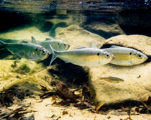
In September 2020, Annapolis endurance athlete Chris Hopkinson paddled a standup board the full length of the Chesapeake Bay (215 miles from Havre de Grace, at the mouth of the Susquehanna, to Cape Charles, outside the Chesapeake Bay Bridge-Tunnel) to raise funds for the Oyster Recovery Partnership. His inaugural Bay Paddle attracted so much attention that he organized Bay Paddle 2021 for last September. It drew multiple teams of paddlers on boards and in kayaks. This time, he broadened the beneficiary list to support not only the partnership, but also the Chesapeake Conservancy’s efforts to develop a national park for the Chesapeake.
That park may be a good idea whose time has come, but how would the National Park Service (NPS) build a Chesapeake National Park? Buy up all of the water and the land around it, then evict all of us who live here so tourists from afar can visit? Of course not, but the question is reasonable. We all tend to think of parks as specific places dedicated to public access, but the Chesapeake watershed is huge. And it turns out that quite a few people have been thinking about this question for at least thirty-five years.
Step One: A National Treasure
In 1986, the late Philip Merrill, then the publisher of the Annapolis newspaper Evening Capital, wrote an editorial calling for a national park dedicated to the Chesapeake. Yes, the editorial acknowledged, the National Park Service operates multiple valuable properties in the region, from the National Mall in the District of Columbia and Fort McHenry in Baltimore to Virginia’s Shenandoah National Park. There was, however, no unit of the Park Service dedicated specifically to the Chesapeake, which President Ronald Reagan had acknowledged as a National Treasure two years before in his State of the Union speech. Moreover, with much of the land around the Chesapeake in private ownership, there was a great need to increase public access in ways that would build a broad base of citizens who enjoy its resources, recognize its great value, and support efforts to restore and conserve it.
Merrill continued to advocate for the basic idea of a Chesapeake National Park until his death in 2006. Meanwhile, a couple of parallel concepts emerged. In the 1990s, along the tidal Rappahannock, interested local citizens joined the Chesapeake Bay Foundation’s Virginia Office and the seven counties on that part of the river to discuss the development of a National Wildlife Refuge. The idea was to conserve the river’s superb wildlife habitat and replicate the economic tourism value of the Eastern Shore’s Blackwater National Wildlife Refuge to Maryland’s Dorchester County.
The concept that emerged was “a string of pearls,” separate-but-related parcels of land, built initially around existing conserved wildlife habitat. That 80-mile portion of the lower Rappahannock already benefitted from private conservation easements such as the Beverly Marsh, nonprofit properties like The Nature Conservancy’s Horsehead Cliffs, and splendid state properties that included the Land’s End Wildlife Management Area of the Department of Wildlife Resources near Port Royal and the Belle Isle State Park downriver. Established in 1996, the Rappahannock River Valley National Wildlife Refuge has added several valuable properties that spread more than fifty miles on both sides, conserving valuable habitat while adding multiple access points for the public. All have been bought from willing sellers.
Step Two: The Chesapeake Bay Gateways Network

Also in the 1990s, Senator Paul Sarbanes (D-Md.) introduced legislation to found the Chesapeake Bay Gateways Network, based at a new National Park Service office in Annapolis. The Gateways Network is another “string of pearls” idea, pulling in the broad variety of federal (e.g., the Mount Vernon Parkway along the Potomac and the Colonial National Historical Park between Jamestown, Williamsburg, and Yorktown), state (e.g., Machicomico State Park on the York River and Shad Landing State Park on the Pocomoke), local (e.g., Patuxent River Park near Upper Marlboro and Osborne Landing on the James), and nonprofit facilities (e.g., the Calvert Marine Museum in Solomons and the Virginia Living Museum in Newport News) that tell the stories of this remarkable estuary. The Gateways Network initially offered its members a modest level of technical and financial assistance to develop their own local versions of the larger Chesapeake story. The NPS Chesapeake Bay office and the more than 120 member institutions of the Gateways Network continue to this day, though in recent years funding and support have been minimal. They do, however, hint at the potential of a Chesapeake National Park, based on a large string of pearls concept.
By the later 1990s, Virginia was beginning to plan an event to commemorate the 400th anniversary of the founding of Jamestown. Early in the 2000s, Pat Noonan, a conservationist who was then CEO of The Conservation Fund, declared, “Jamestown isn’t just a Virginia Thing. It’s a Chesapeake Thing.” He conceived a radical idea: an all-water NPS National Historic Trail, following the explorations of Captain John Smith during his time on the Chesapeake, 1607–1609. He noted that Smith not only played a key role in the early survival of the fragile Jamestown colony but also published an uncannily accurate map of the Chesapeake in 1612. That map opened the door to English colonization of the Bay during the 17th century.
Noonan was extraordinarily persuasive. In short order, he enlisted the National Geographic Society, the Chesapeake Bay Foundation, the National Park Service, and multiple U.S. senators and representatives to join the Conservation Fund in fleshing out the concept. Long story short, President George W. Bush signed the 1,800-mile Captain John Smith Chesapeake National Historic Trail into law on December 19, 2006, the 400th anniversary of the day that the three Virginia Company ships departed Plymouth, England for Virginia. Capt. Smith’s Trail did indeed contribute a strong, Chesapeake-wide context to the Jamestown 2007 commemoration, and it continues today, administered by the NPS Office at Historic Jamestowne. Many access sites around the Chesapeake, including institutions such as the Havre de Grace Maritime Museum and the Deltaville Maritime Museum, identify partly as elements of the trail.
It was interesting in those days to watch people try to get their minds around an all-water National Historic Trail. They posed questions like “Is it open yet?” [Answer: Yes, for the past 415 years] and “How do we know when we get there?” [Answer: If you are anywhere on the Chesapeake or its tidal rivers except for the Little Choptank, the Choptank, Eastern Bay, or the Chester, you’re on it. That’s how much water Capt. Smith and his crews covered in his 30′ barge Discovery during the 30 months that he was here.] The truth is, the Chesapeake watershed already has numerous local and smaller regional water trails, all of which offer great opportunities to explore their human and natural histories. Many are already part of the Gateways Network.
In 2009, President Obama issued an Executive Order that reaffirmed the Chesapeake’s standing as a National Treasure. That order led to the current, enforceable Chesapeake Bay Watershed Agreement (adopted in 2014, amended in 2020). The agreement calls for, among other things, conservation of treasured landscapes and “expand[ed] public access…through existing and new local, state, and federal parks, refuges, reserves, trails, and partner sites.”
Step Three: A Working Group for a Chesapeake National Recreation Area
In March 2021, Senator Chris Van Hollen (D-Md.) and Congressman John Sarbanes (D-Md.), son of Sen. Paul Sarbanes, drew together a group of lawmakers and representatives of more than 30 regional organizations into a Working Group to explore the designation of a Chesapeake National Recreation Area (CNRA) managed by the National Park Service. Senators Ben Cardin (D-Md.), Mark Warner (D-Va.), and Tim Kaine (D-Va.), as well as Representatives Bobby Scott (D-Va.) and Elaine Luria (D-Va.), are also participating. The Annapolis-based Chesapeake Conservancy, which has had a strong working relationship with the National Park Service Chesapeake Office for all of its fifteen-year existence, is staffing the Working Group. This is the effort that the Bay Paddle 2021 is supporting.
Van Hollen’s charge to the CNRA workgroup was, “Imagine a 21st-century park—a collection of parks and other public lands in the Chesapeake Bay watershed that bring national and international attention to the Bay’s significant natural, cultural, historical, and recreational resources. Formally connected through partnerships between the National Park Service and communities and states, these parks would become the Chesapeake National Recreation Area (CNRA) and tell a common narrative about the nation’s largest estuary and one of the world’s largest environmental restoration efforts.” The proposed Chesapeake National Recreation Area Act would permanently authorize and fund the Chesapeake Gateways program as part of the CNRA. It would also include, of course, the Captain John Smith Chesapeake National Historic Trail, as well as the Star-Spangled Banner National Historic Trail, the Potomac Heritage National Scenic Trail, and the Washington-Rochambeau Revolutionary Route.
The National Park Service currently manages eighteen National Recreation Areas, stretching coast to coast through fifteen states. As the nineteenth, the CNRA would be easily the largest, including entities stretching from the Chemung Basin River Trail in south-central New York to First Landing State Park at Cape Henry in Virginia Beach. Two examples stand out as potential models: San Francisco’s Golden Gate NRA and the Boston Harbor NRA. Each is a network of sites on both land and water, tightly integrated, supported, and assisted by a National Park Service hub. Initial ideas for the Chesapeake include hubs at Fort Monroe, at the mouth of Virginia’s James River, and on the Annapolis waterfront.
“The formal connection of these hub sites and partner parks, the expertise of the National Park Service, the additional federal resources for conservation and public access, and the influence of National Park Service designation and branding would put the Chesapeake Bay on par with other nationally significant landscapes,” said Sen. Van Hollen.
Step Four: An Expanded Mission
In recent years, the National Park Service has increasingly focused on conveying the stories of under-represented peoples and communities. A Chesapeake National Recreation Area would bring additional resources and capacity, technical assistance, and financial assistance to interpreting their stories. “Indigenous history and African American history are really important in the Chesapeake Bay region,” said Reed Perry, Manager of External Affairs at the Chesapeake Conservancy. “There are a lot of places and stories that need to be told that haven’t been.” Two recent examples are Machicomoco State Park on Virginia’s York River and the Harriet Tubman Underground Railroad National Historical Park next to the Blackwater National Wildlife Refuge in Maryland. Machicomoco is the Algonquian word for “special meeting place.” The name highlights the park’s focus as a place where people can gather and learn about Virginia’s Native American tribes. The Harriet Tubman Park has drawn a stream of appreciative visitors since its opening in 2017.
Another feature of the CNRA would be telling the ongoing stories of restoring the Chesapeake ecosystem. As Sen. Van Hollen noted, “it would boost national and international support for protection and restoration of the Bay.”
Some Words of Caution
It’s important to make clear what a Chesapeake National Recreation Area would not do. Partner facilities, such as national wildlife refuges, state and regional parks, and nonprofits, would become official partners only if they voluntarily opt-in to the CNRA and benefit from additional resources and branding provided by the National Park Service. They would retain their existing management and ownership.
It’s also important to stress that boating, fishing, hunting, and other recreational uses are part of the Chesapeake’s rich heritage. They are, in any case, managed primarily by state governments. That heritage includes commercial fishing as an important part of the Bay’s culture and economy, so the Chesapeake National Recreation Area would celebrate it. The CNRA would not impose any additional regulations on recreational or business activities, nor would National Park Service authority supersede state authority on these matters. NPS would have authority only over the few parcels under its direct ownership. As with the Rappahannock River Valley, no land would be acquired without the consent of the landowner. There would be no additional regulations governing non-participating private or public landowners, nor would designation as a National Recreation Area impact or otherwise affect statutory authority concerning navigation or regulation of commercial or recreational fishing activities in the Chesapeake Bay or its tributaries.
So is a Chesapeake National Recreation Area an idea whose time has come? You have every right to express your opinion and even participate in the process. Visit united4cnra.com to find out more and
join in the discussion.