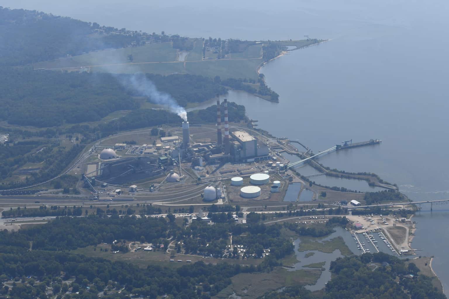
Scientists are turning to drones to seek out dangerous algae blooms in the Lower Bay.
Researchers at William & Mary’s Virginia Institute of Marine Science (VIMS) are using aerial drones to guide researchers on boats to the worst algae bloom patches.
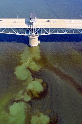
Harmful algal blooms (HABs) appear suddenly and disappear just as quickly. They also sift with tides and currents, or from a passing boat’s wake. That makes them especially difficult to sample.
With drones as their “eyes in the sky,” scientists onboard VIMS boats can collect water samples more efficiently. Then the samples can be analyzed to determine if the algal species are toxic enough to threaten marine life or human health.
VIMS has been using single-engine aircraft and satellite imagery from NASA to locate algal blooms for years. But operating a drone is more cost-effective, and VIMS professors say it flies low enough to get a much more detailed picture than a larger aircraft can.
Donglai Gong, an assistant professor at VIMS, says the drones provide a “sweet spot” in studying HABs, flying high enough to give a bird’s-eye view, but low enough to discern even small-scale streaks and patches in exquisite detail.
“The plane and satellite give you much broader spatial coverage,” says VIMS professor Kim Reece, who has been studying HABs for more than a decade. “We can fly over the entire lower Chesapeake Bay. But it’s at a higher altitude, so you don’t get the resolution that you do with the drone.”
Gong and his team use two drones for visualizing HABs. The newest, a DJI Phantom 4 Pro Quadcopter, can fly at 45 mph and for 30 minutes before its lithium-ion batteries need recharging. Its camera is equipped with a 20-megapixel sensor that can shoot both high-resolution still images and video. Gong and fellow drone pilot Lydia Bienlien, a Ph.D. student at VIMS, download and share the images in real-time via a cellular connection.
Gong, a physical oceanographer, didn’t set out to visualize algal blooms when he launched the drones earlier this summer. He obtained them in 2014 for studying shorelines and marshes.
“It happened by chance,” says Gong. “I was flying the drone for practice when I noticed there were dark streaks in the water. Being a physicist, I had no idea what biological processes could be causing them. So I took pictures and posted them to a VIMS mailing list, and that’s how we got connected.”
A recent grant from the National Science Foundation was awarded to help better understand and model how algal blooms affect the cycling of carbon through estuaries like the York River.
Gong and his team launch the drone from a high spot on VIMS’ Gloucester Point campus, fly it out over the York River, and call in what they see to Anderson, Song, Brush, and other VIMS researchers to guide them.
“Like a regular camera, the drone’s optical sensors can measure water color in red, green and blue,” says Gong. “But ocean-color sensors can measure multiple bands, into the infrared, for example. Having those additional spectral bands can potentially tell you what kind of organism is in the water.”
A collaboration is now underway with scientists at NASA and NOAA to develop algorithms that would eventually distinguish between two algal species in drone footage. And if that is possible, drones could eventually fly over the Bay and tell scientists what kind of organisms are out there.
Reece and Anderson have already begun collaborating with scientists at NASA and NOAA to develop algorithms that would use these spectral differences to distinguish between the two algal species in satellite imagery. Now they want to apply that approach to the drone.