A wave of winter storms is taking its toll on the Chesapeake Bay region, from last Wednesday’s snowfall, to the weekend’s extreme wind and rain, onward to the large southern Bay snowstorm that is now imminent.
On Sunday afternoon, winds were so strong that the Maryland Department of Transportation (MDTA) had to put a temporary hold on bridge traffic, barring drivers from the Bay Bridge and the Hatem Bridge spanning the Susquehanna River. That’s the most extreme of MDTA’s wind warnings, activated when sustained wind speeds exceed 55 miles per hour for 10 minutes or longer; or wind gusts persistently exceed 55 miles per hour over 15 minutes.
High Wind Warnings were in effect up and down the Bay. Power outages were widespread beginning on Sunday, with at least 130,000 BGE customers without power in central Maryland. More than 7,000 still had no power on Tuesday.
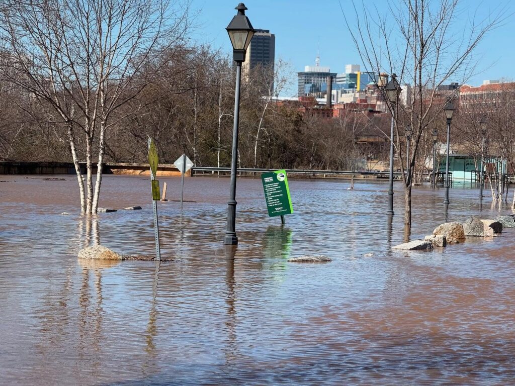
In Richmond, a swollen James River sent floodwaters up and over parks and waterfront areas. The City of Richmond Department of Public Utilities activated the Dock Street floodwall Monday, anticipating peak flood conditions. On Tuesday, NOAA’s James River (VA) at Richmond-Westham flood gauge peaked 17.2 feet, which NOAA classifies as moderate flooding. A flood warning remains in effect through Wednesday evening.
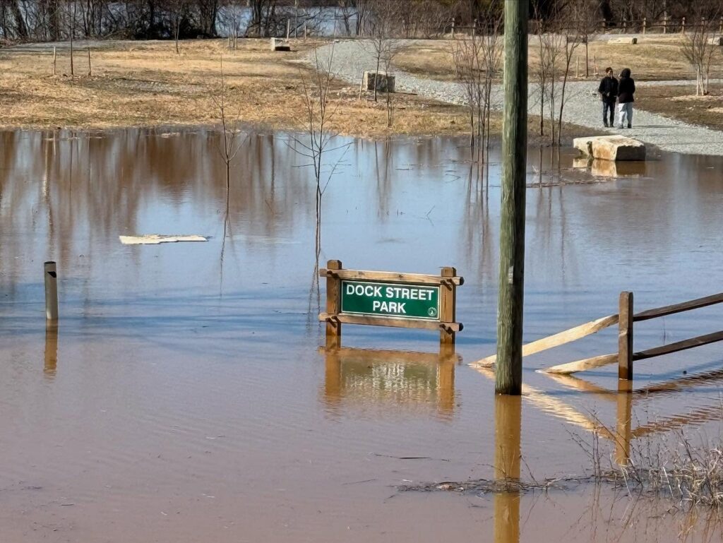
The Dock Street floodwall activation closes Dock Street between 17th and 21st Streets, which will remain closed until the water recedes. The city also closed waterfront parking lots and service roads.
The last time the floodwall was closed was in November 2020, in response to heavy rain in western parts of the James River basin. It was built in 1995, and proved essential just one year later. After the blizzard of 1996, a major rainstorm and warm, humid air caused snowmelt and rainfall to combine and create massive flooding. The James River rose to 22 feet. Just seven months later, rain from Hurricane Fran pushed the river level back up to 23.8 feet…well above this week’s 17 feet. The city floodwall gates are tested annually, and were last tested in June 2024.
At the same time, this significant flooding prompted the Virginia Department of Health announced an emergency closure of portions of the James River to shellfish harvesting due to significant river flooding. Because floodwaters can be contaminated with pollutants such as pathogenic bacteria and viruses, shellfish may not be safe (crabs and finfish would be okay). The temporary emergency closure will be effective until March 1, 2025.
NOAA forecasts that the flooding will recede throughout the day Wednesday, just in time for a significant snowstorm to arrive in the lower half of the Chesapeake Bay.
Last week, models were indicating that the central Maryland section of the Bay could haven gotten 1-2 feet of snow and blizzard conditions, but the winter storm is headed further south, from southern Maryland into North Carolina. Recent forecasts predict a potential for more than 10 inches of snow for Hampton Roads and Virginia’s Eastern Shore, with lower totals in other parts of Virginia.