The Atlantic hurricane season has already unleashed its power along the East Coast, first with the Category 5 Hurricane Beryl (the first Category 4 or 5 storm ever to arrive in June!), and now, with Tropical Storm Debby heading up the coast.
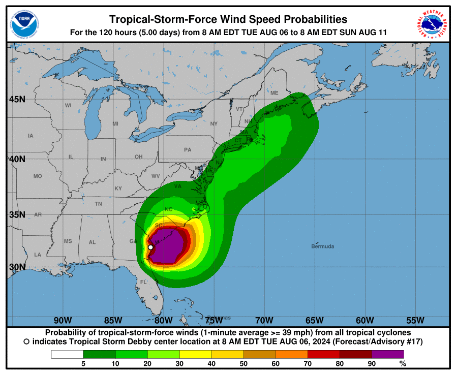
The National Oceanic and Atmospheric Administration (NOAA) National Hurricane Center gave us an 85 percent chance of having an above-average Atlantic hurricane season. The agency’s prediction is proving spot on. Debby has already taken five lives and has prompted rescues in Florida and the Carolinas.
As we wait to see what impact Debby will have on the Chesapeake region (some wind and plenty of rainfall, no doubt), researchers at the University of Maryland are using a special simulator to study hurricane effects.
The Glenn L. Martin Wind Tunnel is a facility that sits, unexpectedly, right in the middle of the University of Maryland College Park campus. Powered by a 2,000-horsepower turbine, it is about 29 feet in diameter and can generate winds over 230 miles per hour.
The wind tunnel is used for various clients like government agencies and the Department of Defense Defense Advanced Research Projects Agency (DARPA), and also as a testing ground for student experiments. Researchers can swap different sensors in and out for different tests—things like wingsuits, for example.
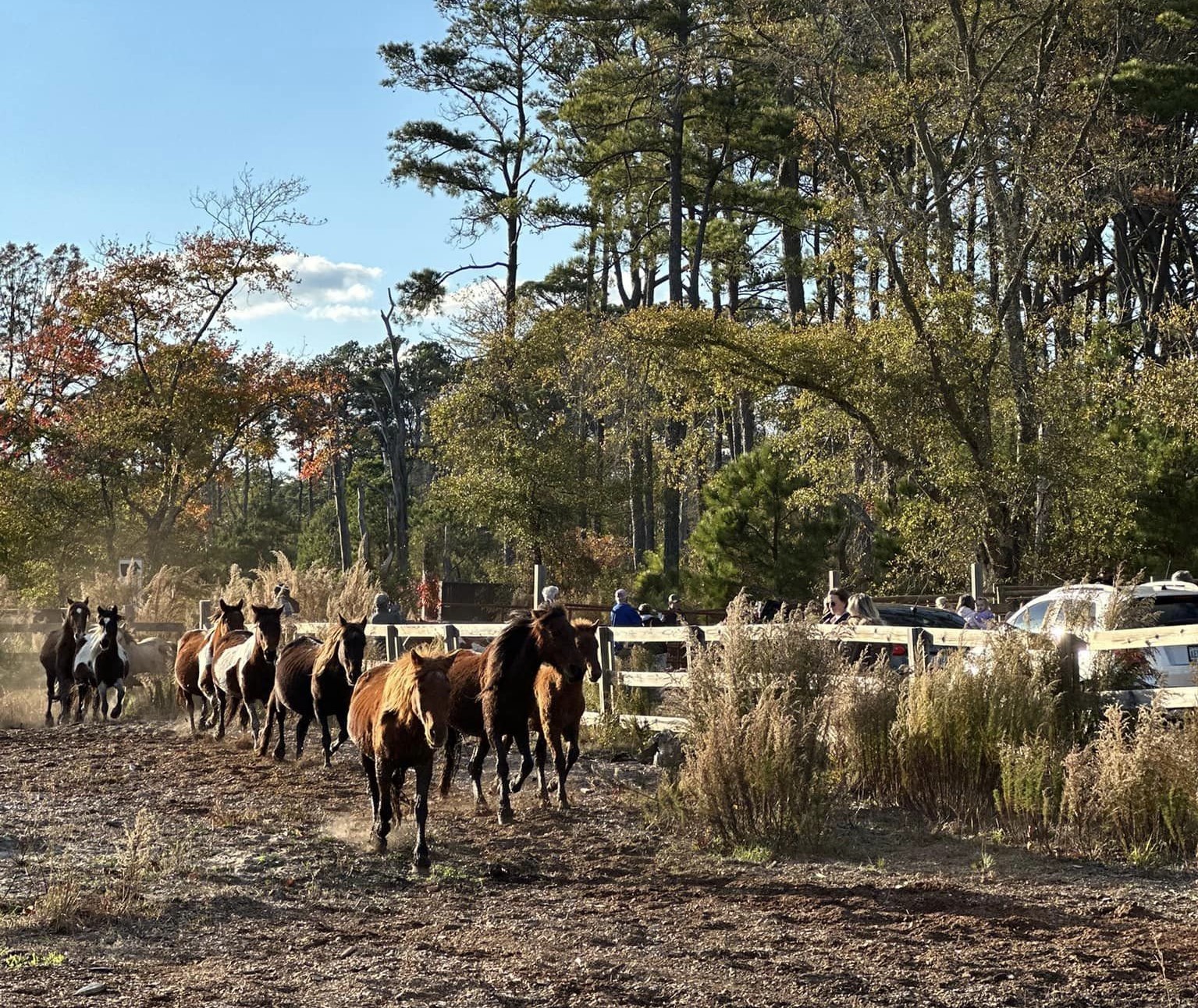
It’s also handy to have a wind tunnel when researching storm resilience on the Chesapeake Bay, as PhD student Colin Vissering, who lives in Talbot County, Maryland, is doing. Vissering is focused on storm-vulnerable spots on the Shore like Dorchester County, where much of the land is below sea level.
Vissering’s research brings him to the wind tunnel to occasionally simulate conditions during the types of storms that cause the most damage. His work focuses on hazard mitigation, disaster recovery and the environmental conditions we face here in the Chesapeake Bay region.
Chesapeake Bay Magazine got rare access to try out the wind tunnel for ourselves. No, the researchers weren’t going to subject us to the wind tunnel’s full 230-mph potential. But we quickly learned just how powerful hurricane-force winds (anything above 74 mph) are.
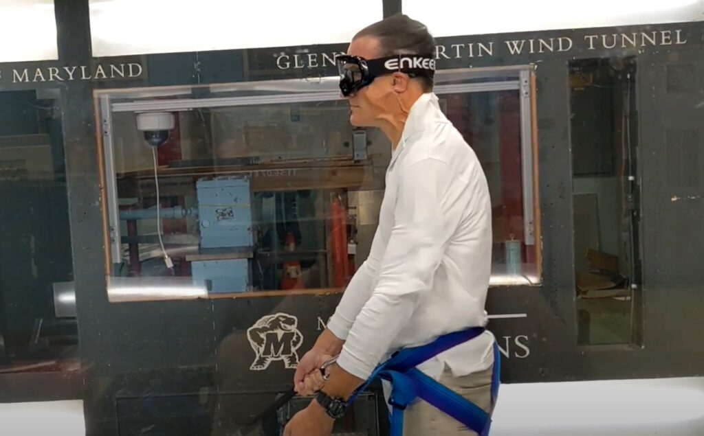
We wanted to find out what Hurricane Beryl’s 110-mph winds felt like when that storm made landfall in the Yucatán Peninsula on July 5 as a Category 3. The staff at Glenn L. Martin strapped us into a climbing harness secured to the floor with nylon straps and carabiners, then gradually raised the wind speed in the tunnel. The pressure increased significantly as we went on.
The test ended just shy of 110, at just over 108 miles per hour. It felt about the same way you’d feel during freefall in a parachute jump, short of breath!
The test was effective in showing us just how hard it is to do anything in hurricane-strength wind—which underscores the importance of preparing for storms well ahead of time. In the wind tunnel, we weren’t trying to do anything but hold on. And we didn’t have to contend with rain or storm debris pelting us. Can you imagine trying to tighten your boat lines once a storm with 75-mph (or higher) wind is already underway?
You want to prepare ahead of time when a serious storm is predicted. Many boat insurance policies offer haul-out clauses in the face of a natural disaster. Ask your agent about this option. And commit to a decision early. According to several marina owners we consulted, everyone waits until the last minute to make the call. Don’t Wait! If forecasters are saying we will see a direct impact, prepare early and move your boat to safety. Doing so will allow you to concentrate on your family and your home as the storm descends on the Chesapeake Bay.
Maryland Governor Wes Moore has declared a “State of Preparedness” ahead of Debby’s remnants. State emergency management leaders will plan for potential heavy rain and tidal flooding. Based on the National Hurricane Center’s latest forecast, these impacts would likely arrive later on Thursday into Saturday.
We’ll continue to monitor the potential impacts of Tropical Storm Debby on the Chesapeake Bay region.