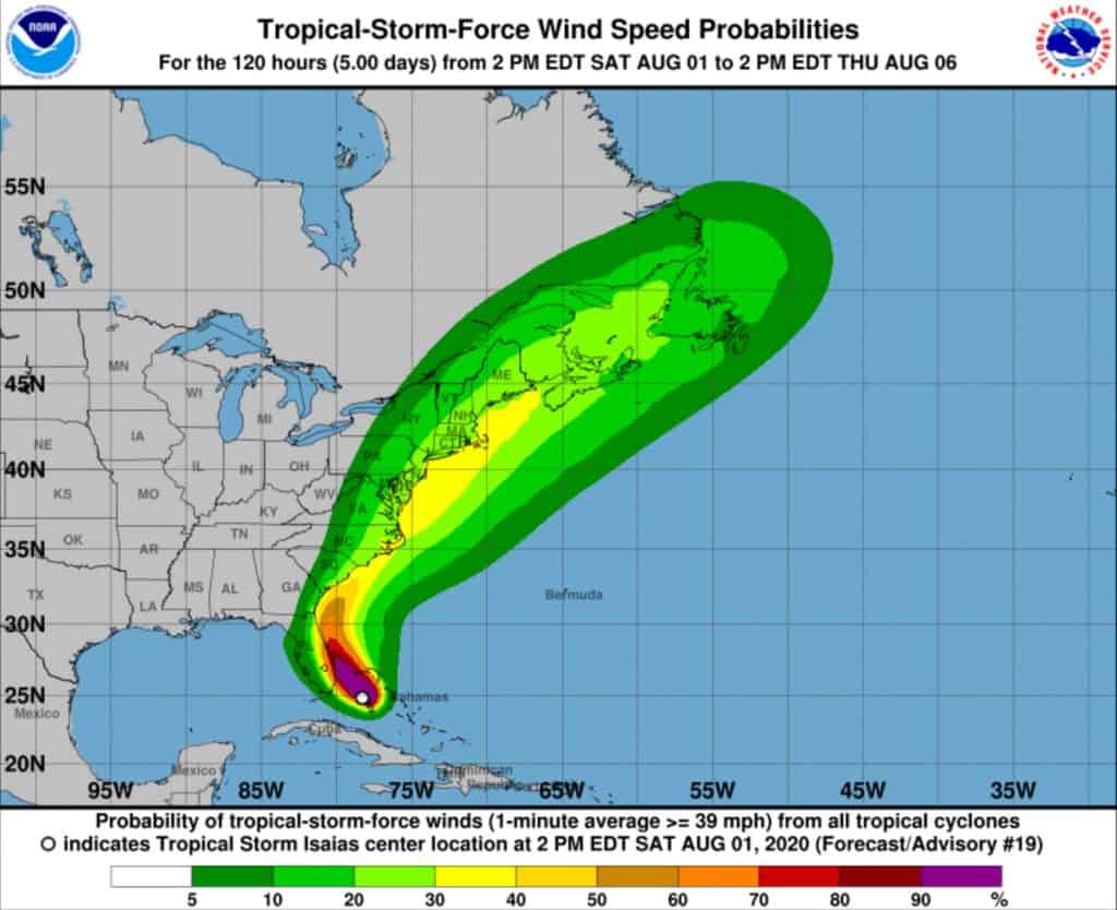
A tropical storm is threatening the East Coast with wind, heavy rainfall and storm surge. And the U.S. Coast Guard is already taking precautions in the Chesapeake Bay region.
Isaias has been downgraded to a tropical storm, but is expected to regain strength, moving up the coast and arriving in the Bay region Monday night into Tuesday.
Two to four inches of rain is expected to fall from the Carolinas into the mid-Atlantic, according to NOAA’s National Hurricane Center, with isolated maximum totals of six inches. Minor river flooding is also possible into Virginia due to storm surge.
The Maryland Emergency Management Agency urges everyone to err on the side of caution, as there is a wide range of possible scenarios:
“Forecasters remain uncertain about the exact track of the storm, but some models show it will affect parts of Maryland as soon as Monday evening of next week as it moves northward.The range of hazards that could affect Maryland is still broad – ranging from little impact, to Isaias bringing flooding rains and tropical storm force winds to central and eastern Md.”
In light of the tropical storm-force winds predicted in the next 24 hours, the ports of Virginia and Baltimore have been set to Port Condition Yankee, meaning the ports are closed to inbound vessel traffic greater than 500 gross tons.
As for pleasure boaters, the Coast Guard advises everyone to closely monitor weather conditions and seek safe harbor well before storm conditions arrive, noting that drawbridges may not be operating if sustained winds reach 25 mph or when an evacuation is in progress.
Bay Bulletin will continue to bring you updates on the potential impact of Hurricane Isaias on the Chesapeake Bay region. To see the newest information from the National Hurricane Center anytime, go to https://www.nhc.noaa.gov/
-Meg Walburn Viviano


