Chesapeake Voyages of Discovery, 21st Century Style
The August issue of Chesapeake Bay Magazine will be our annual Weekends on the Water issue. In preparation for that, let’s talk about exploring our Chesapeake in smaller boats. The Bay’s tidal system includes somewhere close to 6,000 miles (statute) of navigable water for us to discover, so what is out there to see, and what kinds of boats are appropriate? Tradition has held for too long that a large boat with overnight accommodations—preferably under sail—is necessary for proper cruising, and that only broad, open waters with proper wind are satisfactory. That tradition misses way too many of the Chesapeake’s most interesting waterways, as anyone who has explored rivers like the Nanticoke can attest.
Note the vessels of the Chesapeake’s original explorers: a millennium of Algonkian dugout canoes, then Capt. Smith’s aptly named 30-foot-long Discovery barge in the years 1607–09. Small(ish) boats allowed them to investigate not only the Bay’s mainstem but also virtually all of the rivers, creeks, and coves of this sprawling ecosystem. Note, too the degree to which such travel—by oar, paddle, sail and even power—puts even the 21st-century explorers into intimate proximity not just with immediate weather conditions but also the effects of recent conditions, especially as they have affected current, wind, tides, and salinity, as well as the flow of the seasons.
With the variations in climate and recent weather throughout the Chesapeake’s sprawling watershed from southwest Virginia north to Cooperstown, N.Y., and east to the Virginia Capes, our Bay system is never the same minute to minute, much less day to day, month to month, or year to year. When we sharpen our observation skills, both in preparation and on the water, they help us contemplate how the parts of the Chesapeake fit together or transition gradually from one to another. They also challenge us to think about how the progression of the seasons affects the system. A useful point of view combines human and natural history, the opportunities and challenges the Chesapeake ecosystem presents to us, and the way we have learned to live with it or damage it. Remember that we humans are very much creatures of the system, and dependent on it.
Your portal to observation and contemplation can be something like birding or fishing, or maritime history. It helps to focus on looking for something, whether an eagle taking off from a nearby tree, a school of white perch on an oyster reef or the pilings of an old steamboat wharf. A focused search sharpens all of the senses, but how do you begin the process? First, follow your own interests and curiosity. Researching the waterway in question ahead of time is a good way to start. Unlike Capt. Smith or the pre-1600 Indians, we have a vast array of resources available on bookshelves, online, and even aboard our boats. The list of books about the Chesapeake is vast. Just Google books about the Chesapeake Bay, and dive into a topic that piques your interest. Consider that we can literally scout a trip ahead of time with several free versions of Google Earth or the virtual tours offered by the Chesapeake Conservancy, and that even a smart phone can serve as a GPS chartplotter. Yes, it will display not just your position but also the shape of the bottom beneath your boat, if you have installed an inexpensive chart app from C-MAP or Navionics. If you opt for fishing mode, the app will even show bottom contours in one-foot increments, giving you a detailed three-dimensional sense of the waterway on which you are travelling.
Follow your own interests and curiosity. Researching the waterway in question ahead of time is a
good way to start.
Add an electronic fishfinder, even an inexpensive one, and you’ll get a real-time look at what is going on below. Yes, it will display fish, and in time you may even learn to distinguish different species from the marks on the screen, but you’ll also see features like bars, oyster reefs and holes, as well as human structures like old wharf pilings and wrecks. It’s easy to learn to distinguish hard and soft bottom. During my years running school field trips on Bay tributaries with the Chesapeake Bay Foundation’s original canoe fleet, I carried an old-style portable fishfinder that taught me a vast amount about how tidal rivers and creeks shape themselves by moving sand, gravel and mud around. It was especially useful in learning how those rivers take on their distinctive meandering pattern. Yes, I used it to catch fish, but it taught me plenty about how both the Indian tribes and the English sited their villages, towns, and commercial wharves around those meanders.
The Captain John Smith Chesapeake National Historic Trail is a reasonable starting point, looking both back to the Native communities that preceded the arrival of the English and forward to today. There are plenty of research sources to get you started. Just understand that the founding of Jamestown in 1607 marks a point in time. Consider that the map Capt. Smith published in 1612, the first accurate representation of the Bay and its tributaries, opened up the region to English colonization in the seventeenth century. As they had for the Natives, our waterways gave the English instant infrastructure in a land without roads, reaching all the way to the heads of navigation on the big rivers of both shores. Note that the Chesapeake Conservancy offers a free, book-length, online Boater’s Guide to Capt. Smith’s Trail. It’s designed to serve folks in every sort of craft from kayaks and skiffs to trawlers.
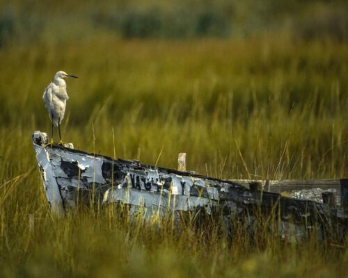
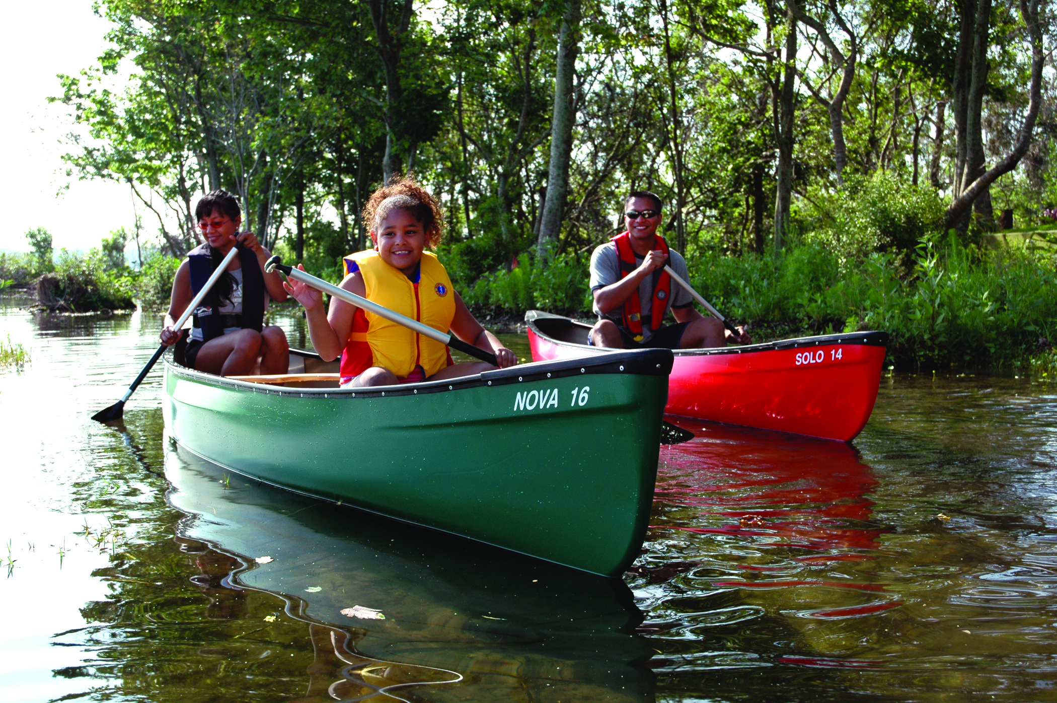
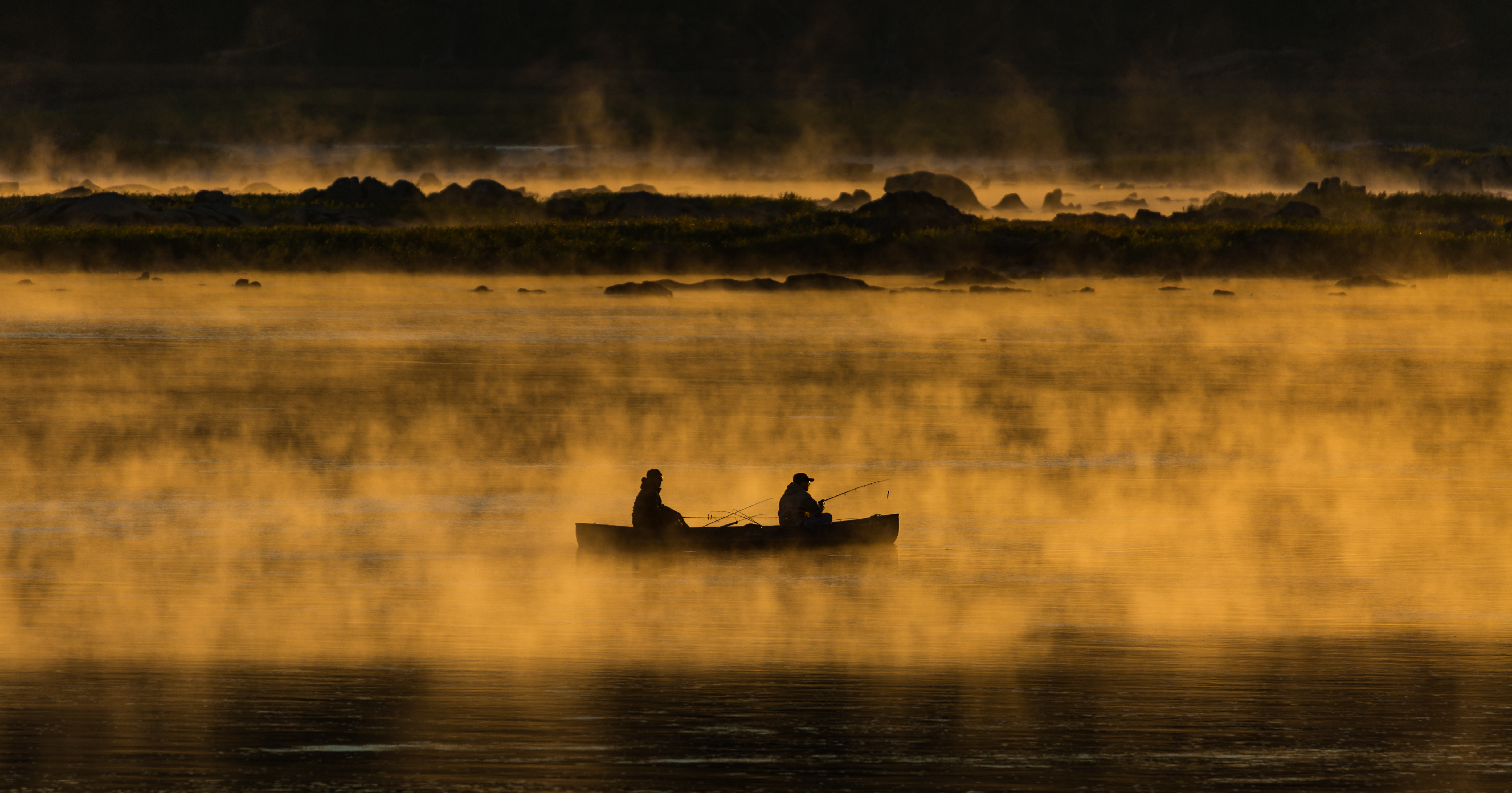
So what kinds of boats are appropriate? First, consider what is appropriate where. I believe everyone should have an opportunity to explore the Chesapeake’s small waterways while self-propelled, whether aboard a kayak, canoe, standup paddleboard, or proper rowing boat. This kind of quiet, slow, participatory travel opens the senses of sight, sound, touch, and even smell to the surroundings. There’s no better way to experience a tidal creek, whether it’s in the Big Salt Marsh of Poquoson’s Plumtree Island National Wildlife Refuge, the wild rice marshes of the Choptank’s Tuckahoe Creek, or hundreds of other waterways from Havre de Grace, Md. to Virginia Beach, Va. Areas like those are particularly interesting to paddle multiple times through the seasons of a year to watch the progression of flora and fauna. The range of launch facilities for these craft around the Chesapeake is large and growing, as is the equipment available for carrying them easily and safely on the roofs of even small vehicles.
This kind of quiet, slow, participatory travel opens the senses of sight, sound, touch, and even smell to the surroundings.
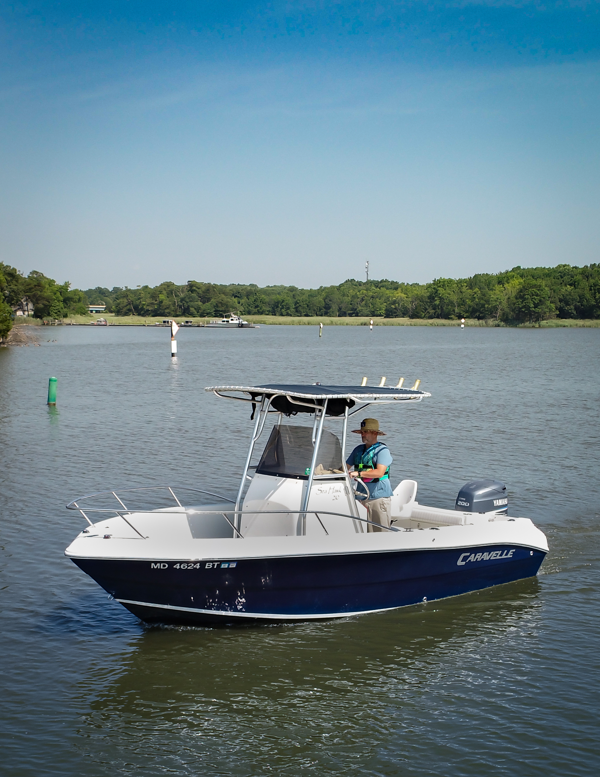
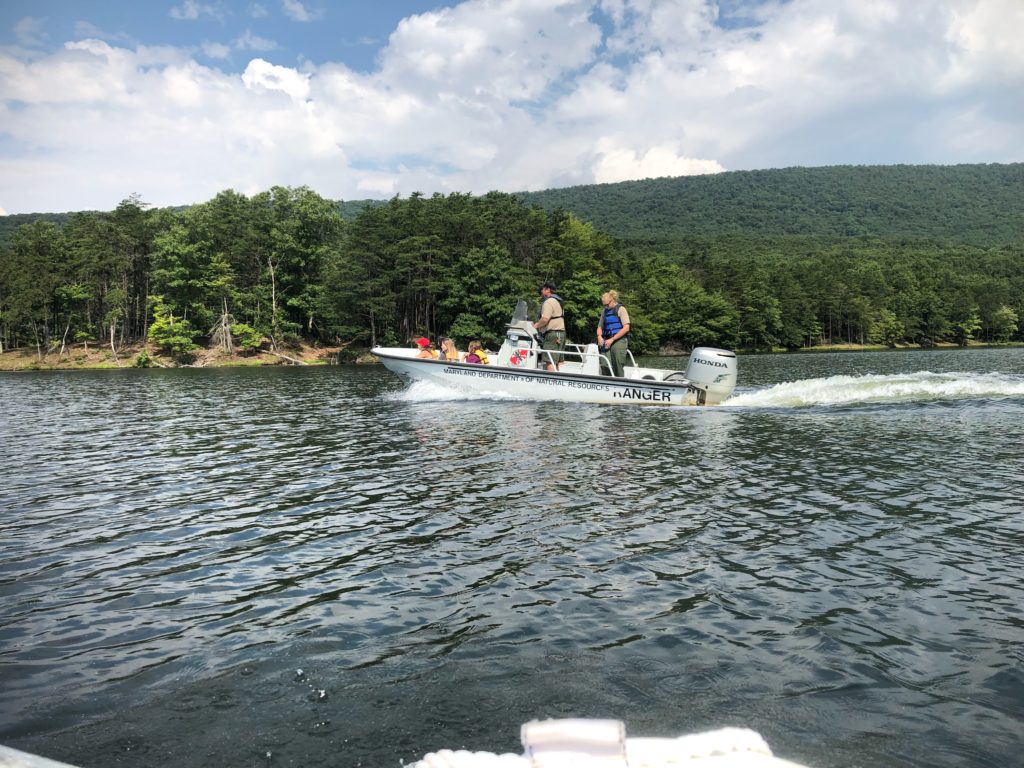
That said, there are values in moderate speed. Spend a lot of time paddling a particular section of a waterway and you’ll begin to wonder what’s around the next bend. That’s where judicious use of a powerboat is helpful in learning how the different parts of the creek or river fit together. After a lot of 2- to 4-mile trips with students on rivers like the Patuxent, Pocomoke and Rappahannock with the CBF canoe fleet, I’ve taken great delight in exploring those rivers and others aboard 14–20′ outboard skiffs, especially First Light, my faithful Boston Whaler Montauk 17. Cruising at 15 knots with her four-stroke outboard is efficient and speedy enough to explore 30–40 miles of river in a day with time for stops to idle, drift or stretch legs on shore. Often such trips are out and back to the same landing, allowing the first leg to absorb the basics of the route, with the return dedicated to absorbing the details. My skiff carries a pushpole that helps out in skinny spots.
She and her sisters are easy to tow behind a mid-size pickup or utility vehicle, and the list of launch ramps around the Chesapeake is huge. I have no idea how many different ramps First Light has been on, but it’s north of 50, stretching from the Harrisburg pool on the Susquehanna all the way down to the southern branch of the Elizabeth River, on both sides of the Bay. The realities of most of our lives mean day trips and weekends are the easiest to schedule. Even so, just as some folks have done huge chunks of the Appalachian Trail one day at a time, so can boaters explore the Chesapeake in small chunks with boats carried on cartops or trailers. At the larger end of the skiff spectrum, if well equipped and operated with prudence, these boats are perfectly capable of venturing across open waters, even to Tangier and Smith Islands.
As to spending a weekend with an open boat, our region is loaded with overnight accommodations, and county tourism offices are eager to help with information. What do you need for a day, and what for a night: regional, state, and county parks, campgrounds, local B&Bs, motels of all grades, luxury hotels? Admittedly, facilities are rustic up many of the rivers, but that’s the point for many of us. Saturday breakfast on shore, a thermos of coffee, a picnic lunch with snacks afloat, a nice supper back ashore, a comfortable bed, and the same format again on Sunday can make for a sumptuous Chesapeake weekend.
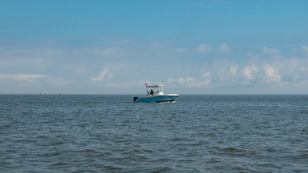
By the way, the advent of larger but still efficient four-stroke outboards makes 20–28′ center- and dual-console boats good choices for another kind of cruising. These boats are large enough to be comfortable for long trips, with stops overnight for shoreside accommodations, and their shallow draft allows them to prowl most of the rivers effectively.
Cruising sail- and powerboats have a long, proud history around the Chesapeake Bay, but you don’t have to own or charter one to experience all that this remarkable waterway has to offer. Pick your favorite small(er) boat and go discover.