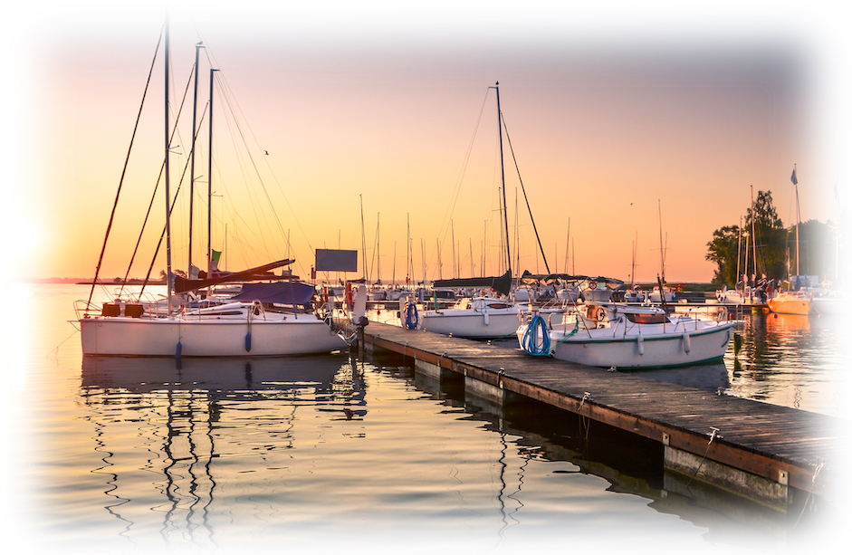
The Chester River is 90% beautiful and 10% odd.
It’s winter, and I’m sitting on my boat waiting for my water tank to leak again so I can fix it. It’s a long wait, so while I’m watching hawk-like for the first drip, I decide to re-make a boat trip in my mind, like essayist and sailor E.B. White used to do while waiting to get his hair cut.
I decide to replay the most recent trip I made up the Chester River. The Chester is beautiful, and always worth thinking about with its interesting side-trips and pleasant anchorages. But it is also a little odd. No, that’s not quite right. It isn’t odd in itself, but it has some fascinating oddities. In point of fact, I was making this latest trip to say good-bye to one of these, one that I was very happy to lose. The others, I’d just as soon keep.
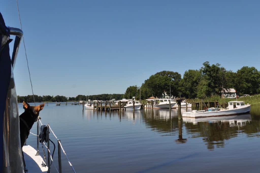
It was not good weather for a trip anywhere. I’m talking about last summer’s long heatwave, when all a sane person wanted was a spreading oak tree and a cold drink. Nevertheless, my daughter Kris was in town from St. Louis, which knows a thing or two about heat, so we took a short cruise because that’s what we always do. Over the years, we have spent a lot of time together on the Chester, though usually not on purpose. We end up there because of meteorology plus geography. If you are heading north out of Annapolis and you pop out from under the Bay Bridge and find the water particularly rough, or a storm coming, or the water full of Conowingo Dam debris, the Chester is your safe escape. It’s usually away from oncoming wind, seas, or weather, and it turns so many different directions that you are bound to find good water somewhere along the way.
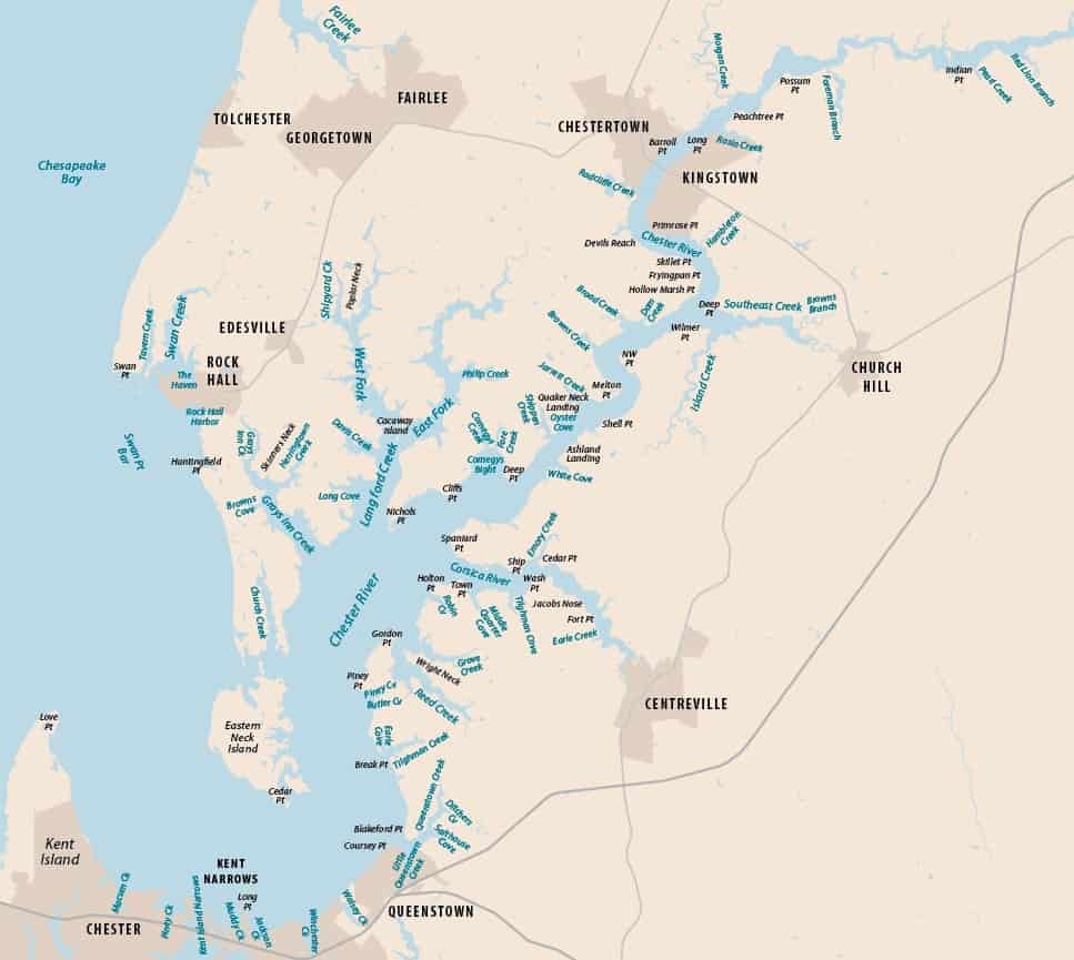
So off we went, cutting east through the haze of a breathless morning to Love Point, then south on the first five-mile leg of the river. Here we came to the first one of those oddities—Kent Narrows, which connects the Chester to Eastern Bay. I think it’s the only place on the Bay where you can cut from one body of water to another without going back out to the main stem of the Bay or to one of the big sounds like Tangier or Pocomoke. “I could be wrong, but I’m pretty sure that’s true,” I said. Kris responded, “hmm.”
It wasn’t always so. Kent Narrows began life as a broad, marshy area separating Kent Island from the mainland. Here, people variously waded across the shallowest part, took a ferry from one side to the other or, later, crossed by bridge. Eventually, (1876), a channel was dug through the marsh to create the Narrows. Fifty to a hundred years ago, the east side of the Narrows was lined with seafood processing plants; now it’s alive with seafood restaurants and dock bars, and it’s a handy waterway for watermen and recreational boaters between the Chester and Eastern Bay.
Four miles beyond the Narrows, after we had rounded the big horseshoe and begun the trek north, Kris and I came to the Chester’s first usable tributary—Queenstown Creek. This is a place we’ve anchored several times on our bail-out trips. This time, we went on by.
Five miles later, just as it jogs east, the Chester has a burst of productivity and begins to sprout tributaries like a Greek Hydra. We passed Greys Inn Creek, which appears on the north shore, Reed and Grove creeks on the south side, then Langford Creek on the north and the Corsica River on the south. Five fairly significant tributaries within a mile. A record? “Maybe,” I said. “Hmm,” Kris said.
In any case, it’s time to point out perhaps my favorite of the Chester’s anomalies because it’s so, well, old-school. You see, one of the best ways to find your way into both Queenstown and Greys Inn creeks is to use good-ole-fashioned landmarks. Really. Both creeks have narrow entrances that are tricky because of shoals encroaching on established markers. Boaters over the years have used landmarks to get them safely through. It’s a navigational technique as old as boats.
The directions for Greys Inn have probably been around since steamship days at least. I do know that they have been in the Guide to Cruising Chesapeake Bay since its first edition, about 50 years ago. When I inherited the guide’s editing job a bunch of years ago, the first thing I did was to make sure the instructions for Greys Inn still worked. They did. Here they are: “The best way to avoid the long shoals on both sides of the entrance channel is to leave green “1” close to port and head for just off the end of the wharf at Spring Point on the west side. Then keep 50 yards off the wharf and continue up the creek, staying in mid-channel.” See? Old school. Charming…In fact, the old wharf is no longer there, but the dock remains, and its owners have painted the tops of the pilings white, which makes them easier to see from out on the river.
The directions for Queenstown Creek, which has a shallower, trickier entrance, are, if anything, even duckier. Again, quoting from the Cruising Guide, “Ample water will take you to the first green “3”, but the skinniest stretch is between “3” and “5”. Stay close to “3”. Now line up the tall tree with the water tower behind it and use that as a range marker to get to green “5”. Past “5” it’s about 8 feet again.” Works like a charm. Just ask Kris.
I could spend the rest of this column describing the long history and fine anchorages on both these creeks, but then we’d never get to Chestertown. I’ll just mention that if you follow the west fork of Greys Inn Creek, you come to the lost town of New Yarmouth, which was the site of the first Kent County courthouse until it was moved to New Town, today’s Chestertown. The Yarmouth courthouse is possibly how the creek got its name: One of London’s Inns of Court is named Greys Inn. “That’s my theory,” I said. “Hmm,” said Kris.
I’m going to give Reed Creek only a short mention here. Reed also has a narrow entrance, though it does not to my knowledge benefit from landmark directions. Instead, I suggest you dial up the sonar-chart function on your Navionics app or read the directions in the Cruise Guide. Over the years, I have used both methods. Reed does have some lovely anchorages, though, whichever way you get in. Its neighbor, Grove Creek, is shallow, so avoid it unless you draw very little or are paddling a canoe.
Langford Creek is the star of Chester River tributaries, and quite rightly, Kris’s favorite. The Corsica River is pretty, but Langford Creek is beautiful. Langford has two nice marinas near its entrance with locations to die for—Long Cove is in a well-protected corner a mile upstream, and Lankford Bay sits on a lovely bay two miles up. Just beyond, lies popular Cacaway Island, where the water is deep nearly to shore on the east side, making it one busy place on summer weekends. From there you can take either the East Fork or the West Fork an additional two to three miles. At the head of the West Fork and a bit down Ricauds Branch Road that you’ll find old St. Paul’s Church and its excellent cemetery. I’m not going to tell you how to get there, because you have to dinghy up as far as you can go, then skirt a bit of private property to get there, and I of course wouldn’t recommend that. But if you do find yourself in the neighborhood, turn in at the old mill pond to find the cemetery. It is worth the trip on its own, but it is also the final resting place of Tallulah Bankhead. If you don’t know her, look her up. And if you go, don’t forget your map app, dah-ling.
Okay, we really need to move on here. The Corsica is a short but exceedingly pleasant river with some nice anchorages. If you have a fairly shallow draft (maybe three feet) you can get all the way upstream to Centreville, where there is a bit of space along the municipal watermen’s dock. From there you can walk into town. I’ve done it but not on Moment of Zen (a 36-foot Endeavor Sailcat.)
All that is very nice and interesting and worth the trip, but the Corsica has a very special peculiarity of its own: a Russian dacha. You can spot the red-brick main house through the trees from the Chester. It sits on the Corsica’s south shore at Town Point. The house and grounds were originally the estate of John Jacob Raskob, a general all-round tycoon best known for building the Empire State Building. The Soviet government bought the property in 1972 as a recreational spot for their embassy employees. Locals immediately speculated that nuclear submarines would soon be surfacing out on the Chester. The dacha was most recently in the news in December 2016 when President Obama ordered it closed after evidence came to light that Russia had meddled in the presidential election. Perhaps those submarines were real after all.
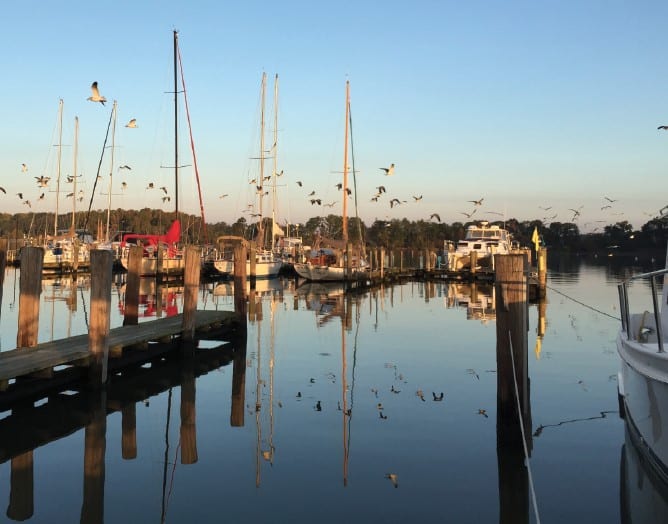
After Langford Creek and the Corsica, the Chester narrows considerably, and Kris and I followed the channel as it continued generally northeast, with zigging and zagging and making a few tight turns. At Devils Reach, we made the final turn and came at last to Chestertown. And here too we have my final anomaly. Chestertown, an important shipping port and shipbuilding center for centuries, has not had a decent marina for years. Visiting boaters have had to anchor out in the river and dinghy in. Not a good option if you didn’t have a dinghy or the weather was kicking up out on the river. It was a port city without a port. Odd, yes? But now, finally, we can cross that anomaly off the list. The city of Chestertown last year opened a revamped marina with some floating docks and nice amenities. Now it is possible to cruise upriver, dock at the city marina and walk downtown.
And that was what we did. We tied up went for a stroll, keeping to the shady side of the street, of course. We stopped for fresh bread at Evergrain Bread Company. We found a few books to read at the Bookplate. That evening, we had cold drinks overlooking the river at 98 Canon Grille, ordered crabcake dinners at the Kitchen and, in the cool of the evening, took the dogs for a good-night stroll through Wilmer Park. The next morning, we walked to Play It Again Sam’s for breakfast and a morning paper. We lunched late at Figg’s Ordinary and eventually settled down for another night. The next day, we awoke early and pulled in our docklines. We watched the sun break the horizon as we worked downriver through the dead-still early morning river. “Maybe it won’t be as hot today,” I said. “Hmm,” Kris said.