This easily navigable waterway is a treasure trove of history and natural beauty
By John Page Williams
Over the years, I’ve explored Delmarva’s Nanticoke River by canoe, skiff, and trawler. The river is lovely in spring, and communities around it cater to driving tourists, but they also offer plenty of opportunities for walking scenic trails, pedaling interesting byways, and exploring undeveloped waterways. What’s most interesting to me are the ways in which the Nanticoke’s natural resources have woven together with us humans over the past 1,000 years.
This river drains a large, heavily wooded watershed on the west side of Delaware’s Sussex County and the interior of Maryland’s Dorchester, Caroline, and Wicomico Counties. Its two big tributaries, Marshyhope and Broad creeks, drain land to the north and east of the main stem, respectively. The land is low, with the river and the two creeks flooding bottomland forests. They also grow expansive tidal freshwater marshes full of wild rice and other plants valuable for wildlife. The woods, marshes, and waters formed rich habitat for Nanticoke people for several millennia, first for nomadic hunting and fishing, but then for Late Woodland people, who began to settle along it and farm as well as fish and hunt.

Over the eighteenth and nineteenth centuries, English communities sprang up at the heads of navigation on the Nanticoke’s three branches: Federalsburg, Md., on Marshyhope Creek; Seaford, Del., on the main stem; and Laurel, Del., on Broad Creek. From the mid-eighteenth century till the early twentieth, the local forest resources encouraged shipbuilding in all three towns, as well as nearby Bethel, Del., and Vienna, Md. Forestry and farming became the region’s primary industries, along with allied industries like sawmills and, after 1865, produce canneries. Schooners (many built locally in Bethel) carried goods and people to Baltimore, Norfolk, and Washington, D.C.
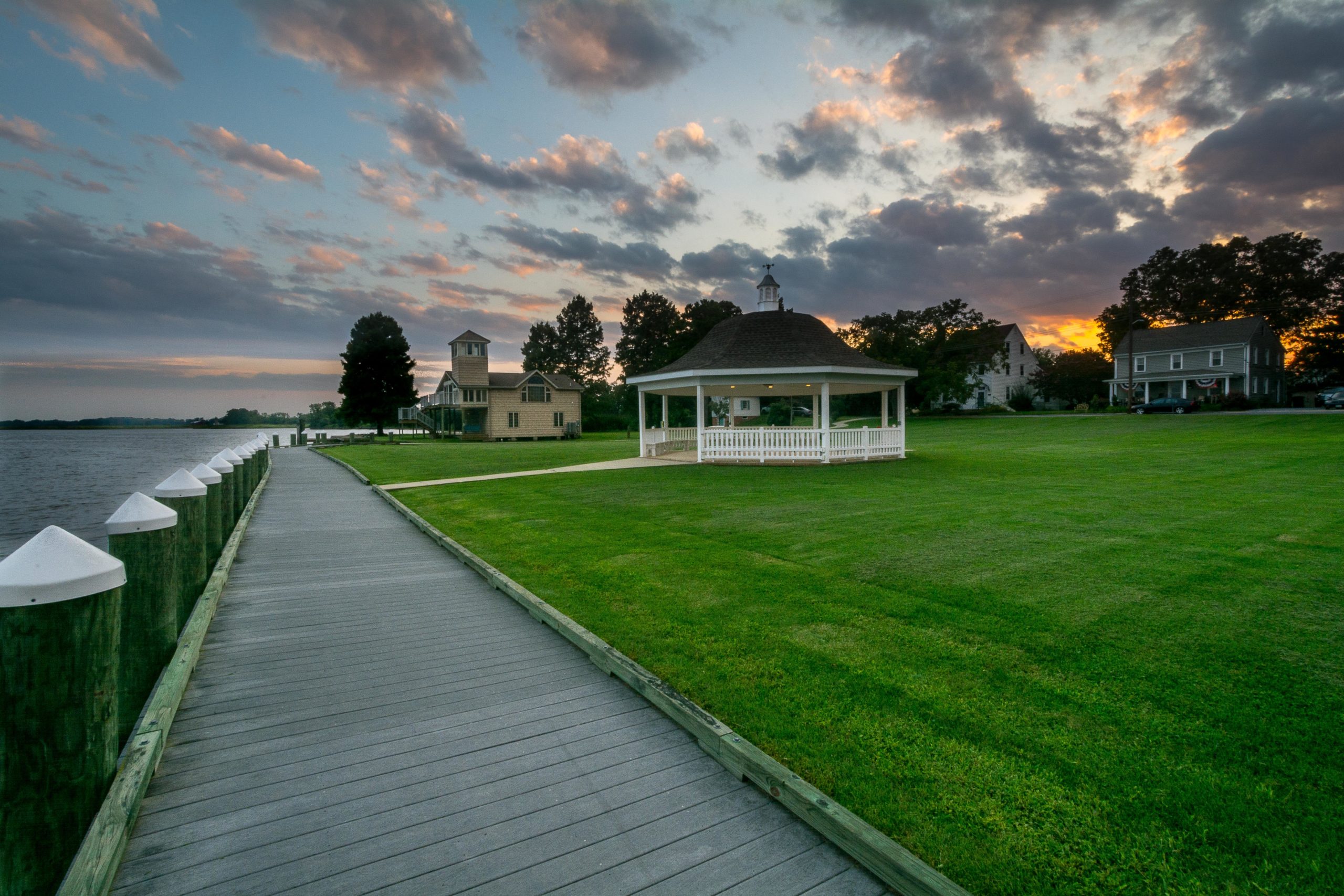
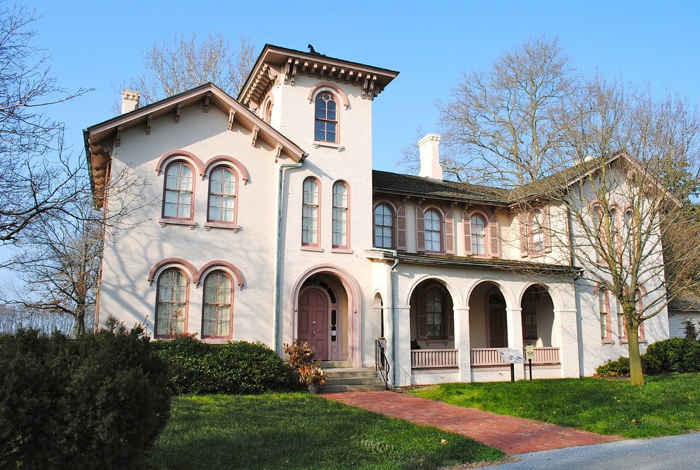
As you set off to explore the Nanticoke, use the towns as literal launch points. I like an itinerary that jumps off from Vienna, Md. This classic Chesapeake river town is situated on high land next to deep water on the outside of one of the Nanticoke’s sinuous curves, which makes it a great launch point for paddlecraft and small powerboats. The town is easy to find on Route 50, about halfway between Cambridge and Salisbury. It’s also home to Handsell, an open-air museum on the National Register of Historic Places that tells the story of the Native Tribes, English settlers, and enslaved people who all lived here over the centuries.
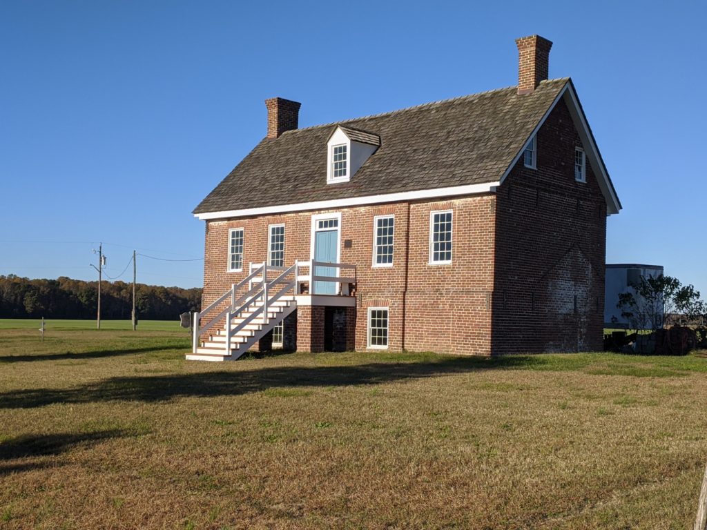
Handsell historic site
one of the oldest colonial settlements in Maryland
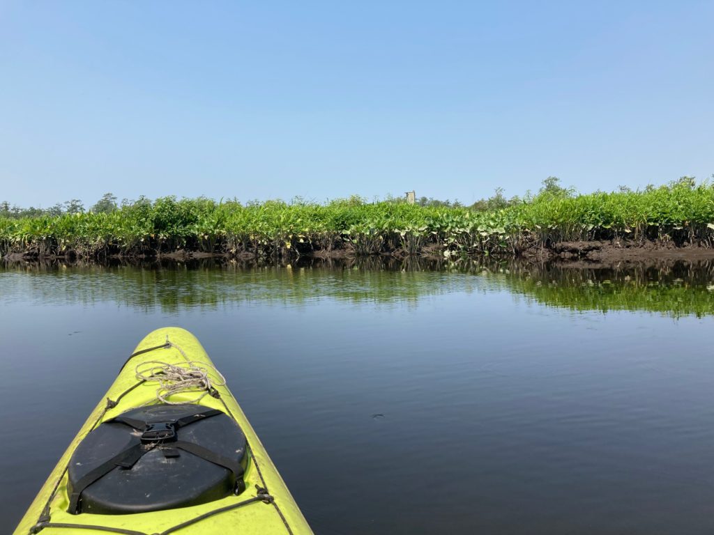
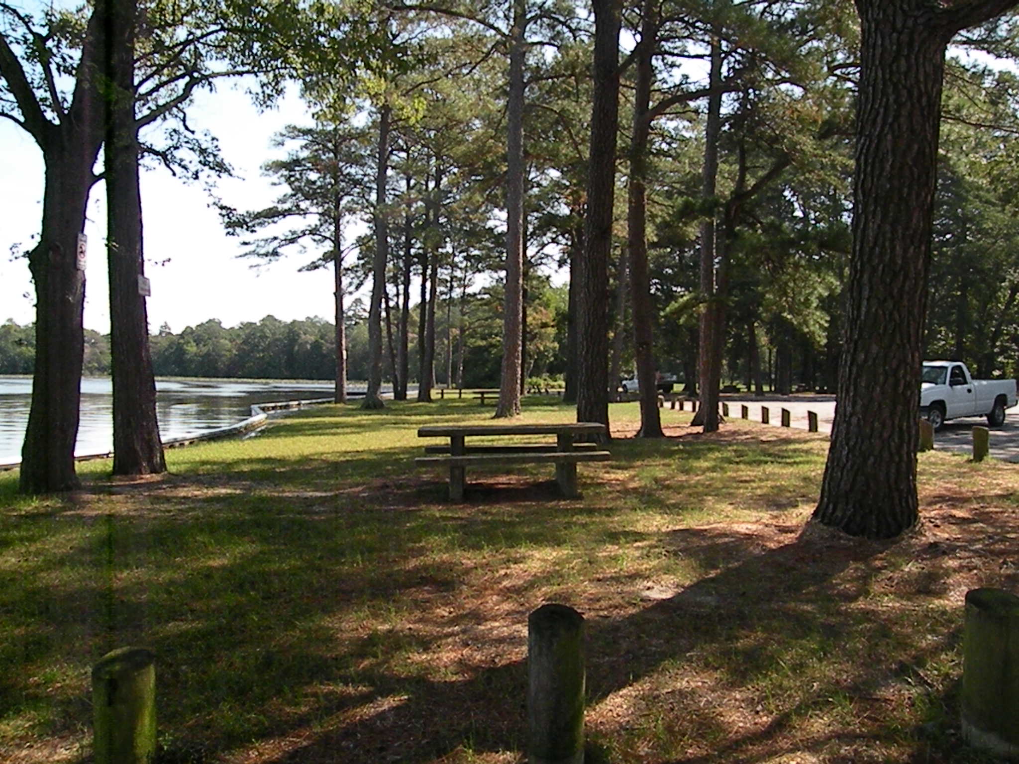
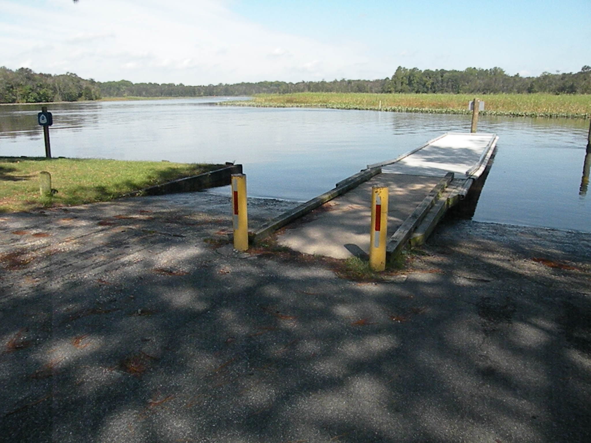
To head out on the water, launch at Emperor’s Landing Park, named for the Chief of the Nanticoke Tribe, whom Captain John Smith met near here in June 1608. Watch for the powerful current that sweeps through and look out for larger boats, especially if you’re paddling. The water is strongly tidal but just barely brackish here. Whichever way the current is running, paddle upriver under the bridge, and look to the left (north) for the mouth of Chicone Creek, flanked by broad marshes. Enter the narrow creek and follow its channel around to the right, keeping an eye out for ospreys, bald eagles, and great blue herons. The creek gets fresher upstream and enters a pristine wooded preserve owned and managed by the Maryland Department of Natural Resources.
In a powerboat, you can run up the river a couple of miles to the junction with its big northwest branch, Marshyhope Creek. It is narrow and wooded but surprisingly deep. A quarter-mile up Marshyhope, on the left, is Walnut Landing, an unassuming dock on the outside of a curve to our left. Now owned by The Nature Conservancy, it was once used by the notorious early eighteenth-century slaver Patty Cannon, who used it to ply her gruesome trade with her gang before her capture and death in prison. In an ironic nod to justice, Harriet Tubman operated part of her Underground Railroad out of here some forty years later.
Moving along through the S-curve, you’ll notice a small beach with a 20′-high sandy bank on the right. This is Redbank, another landing once favored by the Nanticoke but for the past sixty years part of the Nanticoke’s Henson Scout Reservation. Close by the shore, a depth-finder shows us 40′ of water. The Marshyhope drains a large watershed to the north, and “creek” or not, its flow is powerful. That current is part of what makes this tributary one of the Chesapeake’s few spawning grounds for endangered Atlantic sturgeon.
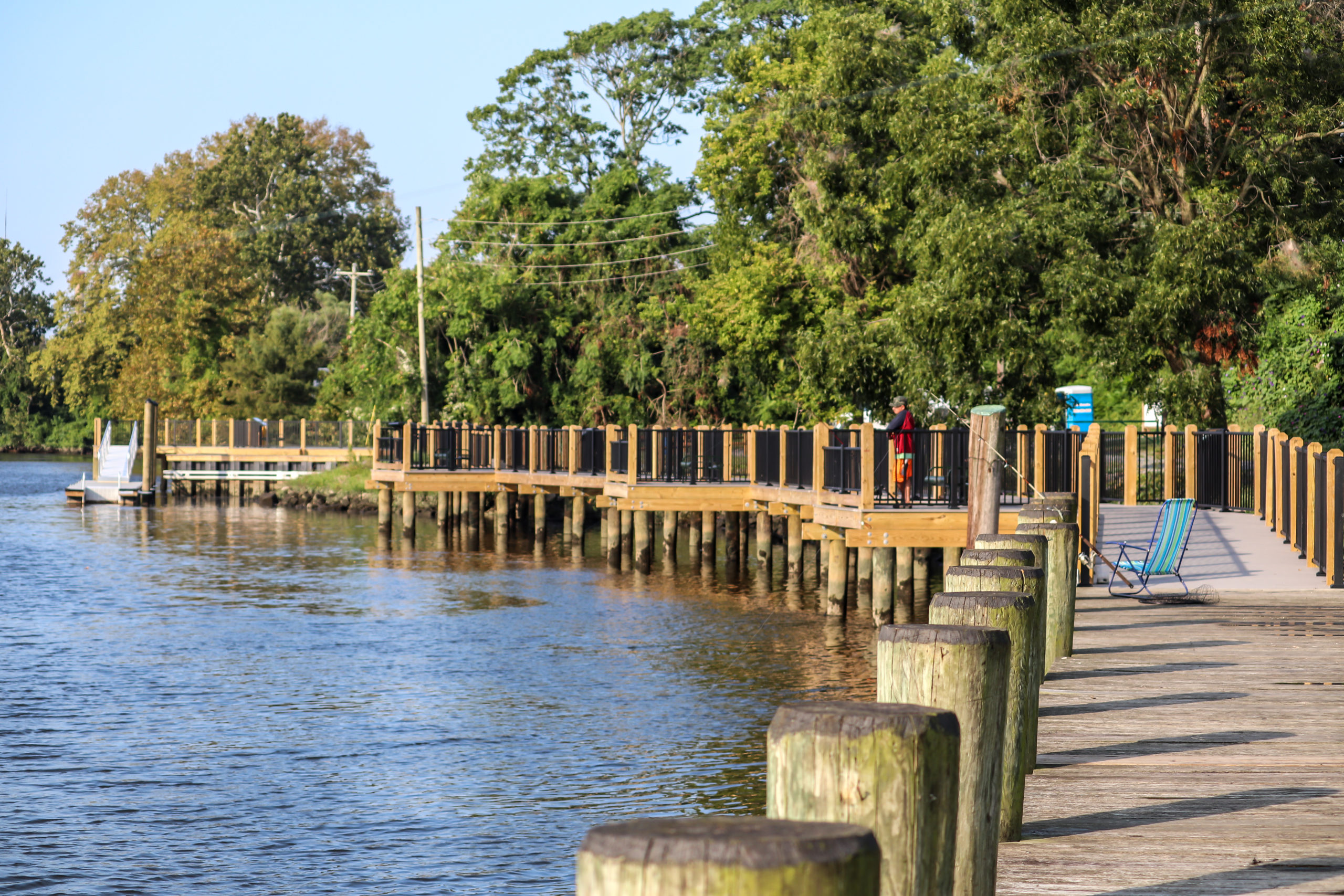
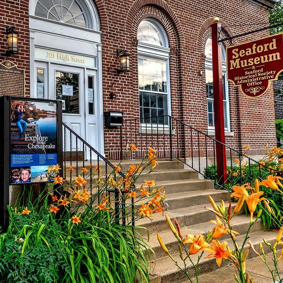
Of course, Vienna is just one option, and there are plenty of other launch points from which to explore the Nanticoke. In Seaford, Del., set out from the new Oyster House Park just by Riverview Park. Built on the site of a former oyster packing plant, it offers a kayak launch and short-term docking facilities if you want to stroll the Riverwalk or visit the Seaford Museum, set in a restored 1930s post office. Further phases will include an open-air amphitheater, art space in two reimagined oyster houses, and a Nanticoke tribal ring for riverside ceremonies.
In Bethel, you can still see the old wharf timbers in Broad Creek where so many schooners were built and launched. (The Chesapeake Ram schooner Victory Chimes was built here in 1900, and still operates out of Rockland, Maine, as part of the Maine Windjammer Association.) You can learn a bit about the shipbuilding industry at the Bethel Maritime Museum (call ahead for hours), and the nearby Bethel Store makes great sandwiches. A few miles west of town is the recently expanded Phillips Landing Boating and Fishing Access Area, which has a three-lane boat ramp, two floating docks, and a canoe/kayak launch. It opens to the mouth of Broad Creek just before it meets the Nanticoke.
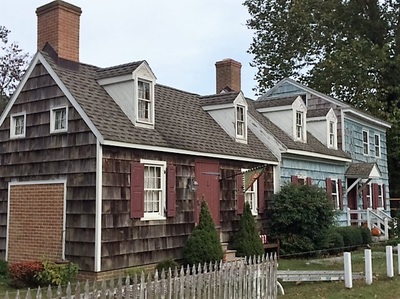
of Bethel, Del. is on the National Historic Register.
The stories along the river run the historical gamut from the Native tribes and Captain John Smith to nineteenth-century steamboats and the DuPont Company’s first nylon plant in Seaford. Please understand, though, that while this sketch offers some focal points, exploring the Nanticoke—by whatever mode you choose—is at least as much about the journey as the destination, and more about discovery than “seeing the sights.”
As you work out your plan to explore the Nanticoke, use the aforementioned towns and Seaford as focal points. Online, I particularly like Google Earth Pro for scouting trips on both land and water. Another remarkable tool is the Chesapeake Conservancy’s virtual tour of the Nanticoke, offered in partnership with videographers at terrain360.com.
The Nanticoke and its tributaries remain largely natural, thanks to major efforts over the past fifty years by the Conservation Fund, the Nature Conservancy, the Nanticoke Watershed Alliance, and the Chesapeake Conservancy. In an effort to preserve these resources, this team of partners has worked with state and federal agencies to create a corridor of protected land that retains the value of its existing resources. To date, this partnership has protected 19,300 acres of the Nanticoke watershed, ripe for exploring and enjoying.
MORE RESOURCES
For basic perspective, read about the Sentinel landscape Nanticoke Project at chesapeakeconservancy.org.
For overall on-the-water itinerary suggestions and maps, visit paddlethenanticoke.com.
For an overall view of Delaware’s Nanticoke, head to nanticokeheritagebyway.org.
For a modern, richly worded and photographed look at this waterway jewel, browse The Nanticoke: Portrait of a Chesapeake River by David W. Harp and Tom Horton.