By Jeremy Cox, Bay Journal News Service
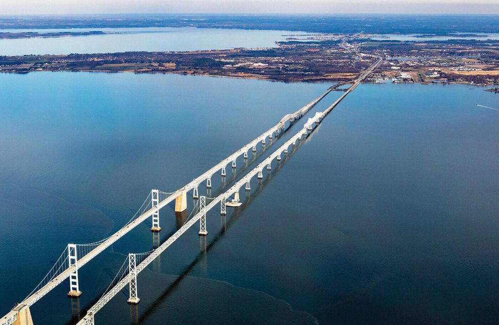
The Federal Highway Administration has given preliminary approval to Maryland’s plans to build a new Chesapeake Bay bridge near the existing two spans that cross between Annapolis and Kent Island.
The agency’s “record of decision” sides with the Maryland Transportation Authority’s preference for the crossing’s location. Before settling on the final corridor, the transportation authority, which operates the two existing bridges, evaluated 14 alternative corridors ranging nearly 100 miles from the northern tip of the Bay to the Virginia state line.
The latest move concludes the first phase in the two-phase environmental study required for large projects under the National Environmental Policy Act. The first phase was a “high-level” review that examined impacts within a 2-mile-wide corridor. More details, including an exact route, won’t be settled until a Tier 2 study is complete.
The new bridge is expected to cost $8.9 billion, according to the study. Choosing a bridge-tunnel hybrid would add $3 billion–$5 billion to that price tag.
The project’s future is up in the air. The state still hasn’t set aside funding for the second phase of the study, which would likely cost several million dollars. The first phase, begun in 2017, cost $5 million.
Politics is likely to factor into what comes next. Republican Gov. Larry Hogan, one of the project’s main advocates, is set to step down from office in January 2023 because of term limits.
A new Bay crossing faces strong opposition from many environmental groups and from one of the counties it would traverse. Anne Arundel County Executive Steuart Pittman questioned the study’s traffic-growth projections, pointing to the expansion in telecommuting amid the COVID-19 pandemic.
The study identified the existing bridge route as the “environmentally preferable alternative,” citing its shorter distance over open water (4 miles) and the other routes’ potential disruption to communities on the Eastern Shore.
The study also considered a no-build option as well as mass transit and operational alternatives. It concluded that none of the mass transit options would suffice on their own. But it suggested that three could be retained for further study “in combination” with a vehicle bridge during the Tier 2 process: traffic operation improvements, bus rapid transit and a vehicle-carrying ferry service.