Wherein the author gives you two good-enough storm anchorages and demonstrates how not to use leftovers
I’m not recommending you do this on purpose, but if you find yourself in a gale, or similar meteorological kerfuffle, anywhere south of Smith Point and north of Windmill Point you may be able to make good use of either of the two anchorages I’m about to tell you about.
The story begins, as it often does, with me headed down the Bay, in this case in early November. November is an iffy time of the year to be out on the Chesapeake because cold fronts begin to roll through with the regularity of Fast and Furious sequels. South wind, west wind, north wind. Temperatures go down; wind and seas go up. On this occasion, I was foolishly trying to beat a particularly ferocious example of a cold front down to Mobjack Bay, where I was scheduled to get some work done on Moment of Zen before making the run south to warm weather.
On the day in question, I left Annapolis at dawn and found myself off Solomons by early afternoon. I didn’t want to stop there because I knew the wind would be howling the next day and I’d still have the Potomac and Stingray Point to negotiate. I was hoping against all reason to make Deltaville before nightfall. So, on I went.
Well, I didn’t make it to Deltaville, of course. It took half a lifetime, as it sometimes does, just to get past the mouth of the Potomac, and it was late afternoon when I passed the Great Wicomico River. But the wind had clocked west by this time, so I got the sails up as I bucked the rising chop and considered my options. I would soon lose the sun. I could cross the Rappahannock in the dark, but that would leave me either negotiating Jackson Creek’s tricky channel pretty much blind or going up the Piankatank all the way up into Fishing Bay. That would be easier, but would take forever and leave me with a long miserable beam sea to get back out to the Bay the next day. Alternatively, I could just make a run for Mobjack Bay. But I didn’t fancy that option because the seas were rising, and if I needed to find shelter there was really nowhere to go after the Piankatank, except Hole-in-the-Wall, which I wouldn’t try in broad daylight on a bet.
I was still bouncing all of this around amongst my cranial synapses as I approached Windmill Point and the sun was settling deep into the pine trees that rim Virginia’sMiddle Peninsula.
“Ah, phooey,” I said finally, and wheeled Zen west into the wind and the sunset and headed for Fleets Bay. “I might as well throw in the towel and find an anchorage while I can still see it.”
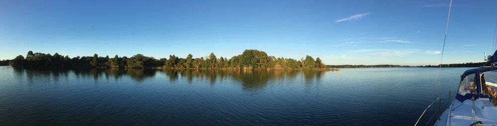
I had thought of a perfectly lovely anchorage at the south end of Fleets Bay, tucked behind the curlicue of land named Fleets Island. This part is called Little Bay, and although the charts don’t show much water there, local boaters and a significant portion of the cruising population know that there is, in fact, a nice pocket of deep water close to the sandy beach, which makes a first-rate anchorage. But when I reached it, even with a west wind and a western shore, the waves were, shall we say, uncomfortable. And with a shift to the north during the night, it would only get worse. So instead, I headed up Antipoison Creek, which is the peninsula’s southernmost creek and navigable for just shy of two miles. It is named for an event that almost certainly did not take place, which is to say that mud from the creek was given by local Indians to Captain John Smith to save him from a stingray bite. Stingray bites, while immediately painful in the extreme, are not lethal. Smith could have slathered his bite with peanut butter and had the same effect as applying the creek mud he almost certainly was not given by local Indians—who doubtless knew better in the first place and thought he was being silly. Still, it’s a good story.
The Antipoison channel is marked from the north end of Little Bay and continues a half-mile into the creek. After that, there are a few private markers for about a mile. As soon as I eased past green “5” at the creek entrance, which is only about 500 feet wide, things looked considerably cheerier. Yes, it was still windy and a bit choppy, but on a friendlier scale.
“Good enough,” I told ship’s dogs Sammy and Bindi, who were by now taking a keen interest in the proceedings and occasionally warning off some imagined enemy. The real enemy, if they had asked my opinion, was that it was by now nearly dark. Time to find a nice mole hole.
And just like that, there it was, opposite the final official marker, green “7”: a small, irregularly shaped cove scooped out of Antipoison Neck. Slowing nearly to a stop, I drifted in and circled to sound a spot in about 6 feet of water. “Good enough,” I said, and we all went forward to attend to the anchor.
Half an hour later, satisfied with the set, and thoroughly chilled, I went below to start the generator. It turned over but wouldn’t start. “Grrr,” I said, or words to that effect.
Eventually I gave up, and instead made a big pot of chicken vegetable soup over the propane stove. This warmed the cabin up nicely, if fleetingly, but also caused rain to fall gently from the ceiling. “Oh well,” I thought, “it’s a warm rain.”
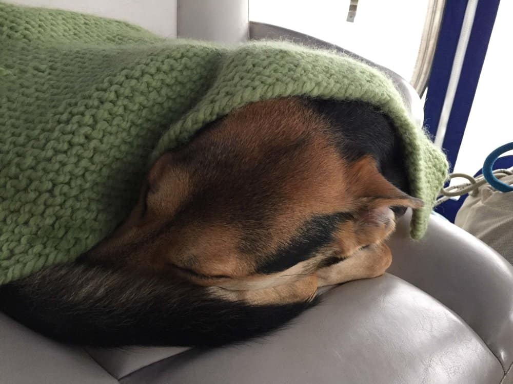
It was a cold and fairly miserable night, with the temperature inside the cabin falling into the 40s and the wind outside keening through the rigging and shoving the boat about. I alternated between checking the anchor alarm and popping my head out to check our position. At 8 p.m. I hustled the pleasantly surprised ship’s dogs into the forward bunk and piled on five or six pounds of covers and crawled in.
Dawn was barely distinguishable from dark, except that the wind was stronger. It was doing a fine job now. I used my phone to check the smart buoy off Stingray Point. Thirty-three knots and a significant wave height of 4.5 feet. Over my limit. I heated water to make coffee and then tried to talk the crew into taking the air and what not on the front deck. Security Chief Bindi gave me a withering look and resettled herself on my pillows. I got the hint. “Grrr,” I said and put on more clothes.
I sat down and calculated my go-no-go time for reaching my Mobjack destination: 1:30 p.m. At 11:30 a.m. the current should start its ebb, which meant that with the north wind, the waves should drop a bit and be on my stern most of the way . . . in theory. I kept checking the smart buoy app, and the current kept flooding.
At half-past 12, I decided to give it a try. We’d up anchor and take a look. Maybe it wouldn’t be as bad as it seemed. We’d have to take it on the beam for a good bit to get around the long Windmill Point shoal before turning south, but if we could just manage that, the rest might be exciting but doable.
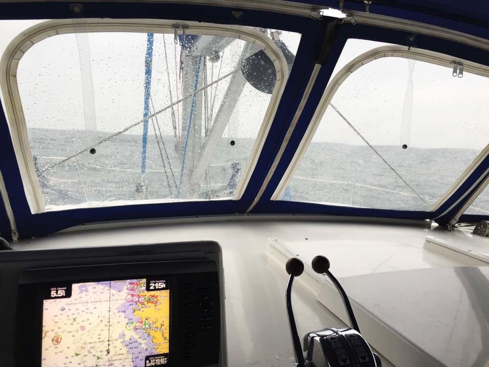
It was certainly exciting, but it wasn’t doable. Before we got to the beam-sea part of the trip, we had to head northeast up Fleets Bay for two miles to round North Point Light “1,” which marks the nearly 1-mile shoal off Fleets Island. Wild galloping bucking broncos does not begin to describe it. Even Zen’s stout-hearted navigator trainee, Sammy, abandoned his post and dove for the cabin. Past North Point “1,” I held the course to get a better angle on our assault on Windmill Point, but, with shoals north and south, there wasn’t much room to maneuver. As we came out from behind Bluff Point to our north, we caught the full brunt of the storm.
“Holy Moly!” I said to myself, as we climbed up the first wave then dropped into the trough to be caught halfway down by the second, which sent a torrent of water sweeping up the front deck and into the helm station. “I think we can safely say this is a bad idea.”
At the first pause between significant waves, I spun Zen back around to the west. This time, though, I headed for Indian Creek, which lies near the top of Fleets Bay, and was the closest thing to where we happened to be. I knew that Indian Creek contains several nice little side creeks as well as the excellent Chesapeake Boat Basin—though that was unfortunately full at the moment. I had checked earlier when thinking longingly of plugging in to run the heater.
“Oh well, what’s another night shivering under the covers?” I asked myself rhetorically and headed for Indian Creek 2. It was not until we had reached red “6” and were halfway to green “7” that things began to calm down appreciably. Just beyond “7”, I took a starboard turn to enter Bells Creek, a short north-south creek with enough water for navigating. It also boasts a small cove just inside its entrance, and this is where I dropped the anchor and breathed a very big sigh of relief.
Bells Creek, on this occasion anyway, proved to be an even better choice than Antipoison. Both were quiet and relatively calm, but Bells Creek felt more protected and managed to muffle the incessant caterwauling of the wind. Later that evening, resigned to another cold night, I went to the refrigerator to retrieve the big pot of leftover chicken vegetable soup. “This is going to taste even better tonight,” I thought, imagining it steaming merrily away on the stove. I pulled open the door and after the usual items had fallen out onto the floor I saw that in the higgledy-piggledy of trying to get out of Fleets Bay, the pot had turned turtle and released contents among the yogurt cups and the hummus, its excellent tasty broth filtering down into the vegetable drawer where they had created a lake deep enough to float the carrots and the celery. It was a bitter moment. And a messy one. I ate cold cheese and crackers that night in silence.
The following morning, however, dawned bright and clear. The north wind was still sharp but had dropped to 15 to 20 knots. The seas would soon follow. It would be a bumpy trip, but nothing out of the ordinary, especially once I got the sails up to steady the ride. “Good enough,” I said, starting the engines.
And so it was. By the time I got to Mobjack Bay and headed for the Severn River, the wind had dropped to a whisper, and the storm was only a future good story. I started the engines and then rolled in the jib and dropped the main. It was a little sad, because this would be the last time they would be up for at least a year. I was on my way to Mobjack Bay to become a powercat. But that is a tale for another day.
Cruising Editor Jody Argo Schroath, with the help and not infrequent hindrance of ship’s dogs Bindi and Sammy, goes up and down Bay’s rivers and creeks in search of adventure and good stories.
Cruising Editor Jody Argo Schroath, with the help and not infrequent hindrance of ship’s dogs Bindi and Sammy, goes up and down Bay’s rivers and creeks in search of adventure and good stories.