Kayaking the ghost fleet of Mallows Bay
Being a Baltimore boy and a sea-kayaker, I’ve grown accustomed to navigating hazards that lurk just beneath the surface of the Patapsco River’s post-industrial coastline. Sweet spots can be found, often where bulkheads of abandoned maritime infrastructure create protected, quiet waters, but getting to them sometimes involves avoiding barely-submerged rebar or other pointy hunks of hull-battering metal. The trick: go slowly and wear polarized shades.
The resulting scrapes and gouges notched on my kayaks have been few, with no impalements, wet exits, or watery-rescue stories, and the payoffs have been memorable. The windy winter days I paddled around in Curtis Bay in the 90s were the stuff of meditation, nosing my craft into placid micro-climates afforded by the open remains of wooden ships, still-standing reminders of bygone human toils, where birds rested and nested in the oases of shrubby marshland inside. But, time, tide, and waterfront development have reduced opportunities for such outings.
Not so in Mallows Bay, where the Potomac’s celebrated ghost fleet is sunk into the muck of the river-bottom, a little downriver and across wide tidal waters from Quantico, Virginia. As an eco-historical paddling destination, Mallows Bay has the Patapsco River’s urban shores beat by far. Unlike the Patapsco, where working vessels and other larger craft at times regard kayaks as nuisances, and even gaining access to the water can prove hazardous, Mallows Bay is set up for paddlers. While its designation as a national marine sanctuary, proposed in 2015, is pending, Charles County, with broad support from institutions interested in preserving nature and historical sites, has set the place up very nicely for paddling.
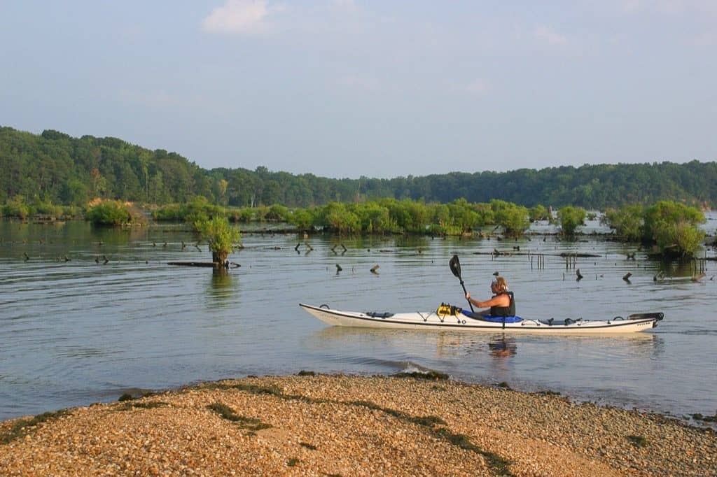
Mallows Bay is one of many sites in the world where retired merchant and naval fleets have ceded their utility to more modern vessels and had their still-valuable parts stripped, are put out of use. These ghosts add useful ecological structure to the local habitat, drawing all kinds of shelter-seeking flora and fauna. When their final resting place is in the shallows, they fall to pieces in place over time, with loose parts ending up ashore to add to the riverbank’s nearby rack-line of tree trunks and other beached flotsam and jetsam. What remains with the mother ships eventually becomes a jumble of partially submerged ribs and planks—a terrarium in situ.
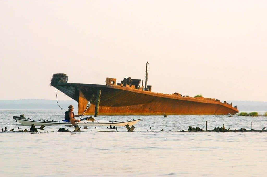
Shafts of rusty metal abound in Mallows Bay’s water column, as exposed or submerged as the river’s level dictates at any given hour. They serve as perches for birds where they protrude. So many ship remains have congregated here that dodging immobile metal is a paddler’s regular preoccupation. The deterioration of many of the skeletal, vegetated vessels has advanced nearly past the point of recognition; they look more like estuarine knolls than derelict structures, until one gets close enough to notice the metal parts embedded in the substrate.
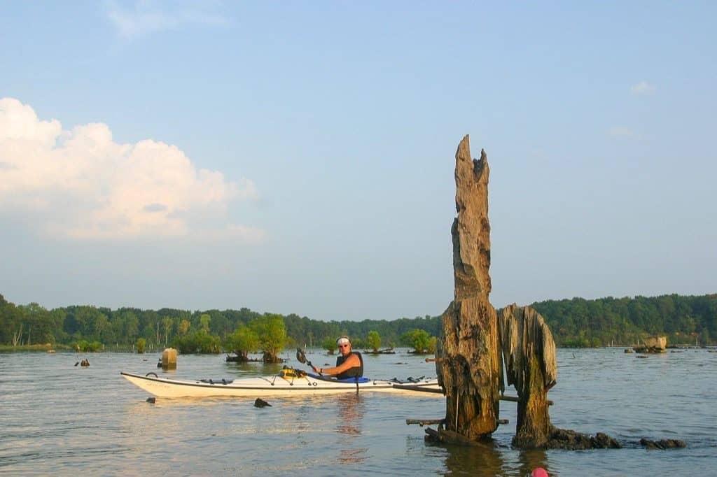
The hazards are clearly spelled out in A Paddler’s Guide to Mallows Bay, the pamphlet available at the launch site. “BEWARE OF HIDDEN WRECKS. It is dangerous to travel through the central shipwreck cluster,” the pamphlet explains, “especially during high tide when ship remains lie just below the waterline and are invisible to the paddler.” More sage advice: “Not recommended for inflatable kayaks or stand up paddleboards.”
This slightly fraught aspect of paddling Mallows Bay forces a go-slow approach, good for letting the mind soak up the site’s historical and ecological assets. It’s simple enough for a savvy, weather-wise paddler to avoid hull damage in a low-draft, super-maneuverable kayak, and other worthy preoccupations abound. Try to silently approach the surrounding bird life perched atop spikes or inside shrubs to get a good snapshot. Visually comb the rack line for items of interest and look up to the top of riverside trees to check for eagle and osprey, or gaze ahead at the scattered canopies reaching across downed trunks into the river from the actively eroding bluffs behind them.
A high-quality kayak launch pier and the aforementioned pamphlet, which doubles as a self-guided tour map, make paddling Mallows Bay a cinch. If you lack a kayak, or want company, the county parks department offers an outfitted, guided tour on Sundays, May through October, for a fee, and local outfitters are also available. The facility, near the tiny town of Nanjemoy, is used as a put-in point for trailered boats, and it’s also a draw for shoreline anglers, but its paddler-friendliness is unimpeachable.
My visits to Mallows Bay bracketed this past winter. The first time, in November, I did nearly everything wrong. I saw that there was a self-guided tour map available next to the kayak pier, but forgot to even look at it, much less bring it with me on my outing. Instead, I did what I always do when I arrive to embark—unload my kayak and gear from the truck, park it, don my neoprene skirt and personal floatation device, grab my wooden Greenland paddle, tap my phone for the GPS, and get right into the water.
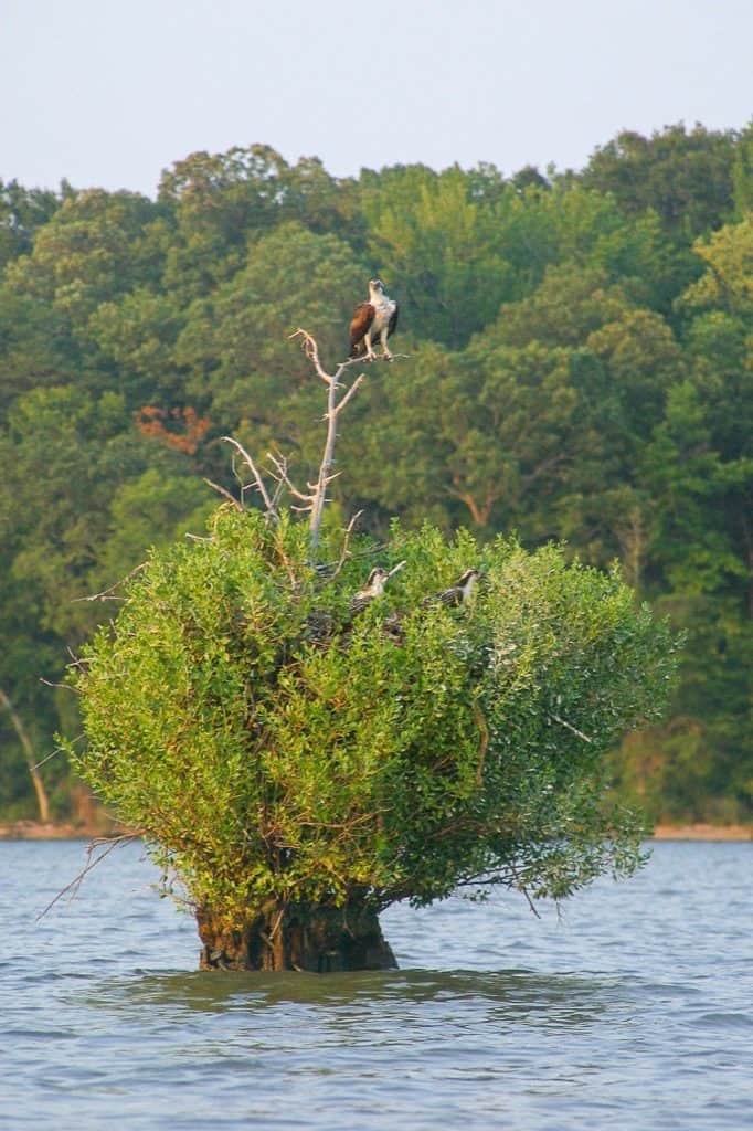
My first move was to head straight to the most obvious ship out there, which I later learned is the Accomac, a steel-hulled ferry abandoned here in 1973. It was the only thing I did that followed the pamphlet’s recommended tour path. I went astern of it to get a close look and surmised its use by a generation or two of disaffected youth and weekend warriors.
Then I pointed my bow for the nearby Benzonia, a 1919 product of a Columbia River, Washington shipyard. I soon realized I was in treacherous waters with seemingly random submerged and other hazards. I slowed to a drift, occasionally dipping my paddle to make directional adjustments, and started a staring contest with the gathered gulls and cormorants that stood sentry on the spikes and other structures. They eventually flew off. I managed not to knock into anything.
In the mid-November chill, I wanted to open up a bit and get the heart rate going. I headed for open water, free to speed in my favorite kayak, a 1998 Dagger Meridian with a Kevlar hull, which I’d just spent good money to have refurbished with new gelcoat. As I played in the river’s main stem, I gazed at my GPS and thought of the possibilities: Mallows Bay could be a great put-in spot for more ambitious paddling outings, up or down the river. Given the river’s width here, the fetch on windy days could make for exciting, bow-plunging challenges. I headed back toward Liverpool Point, Mallows Bay’s downstream boundary, and decided to return another day with a more impact-forgiving kayak, like my polyethylene-hulled Necky Looksha Sport, before trying to navigate the graveyard any further.
To cap off my first visit, I headed into what is essentially Mallows Creek’s tiny delta, dubbed the Burning Basin on the map. After gaining the 48-foot-wide gateway, I found a few wrecks amid the marsh-tinged waters. Bethlehem Steel once used the site for salvaging metal from the ships, but today nature wins out. A few anglers were trying their luck, perhaps hoping my quiet, gliding craft wouldn’t spook the fish.
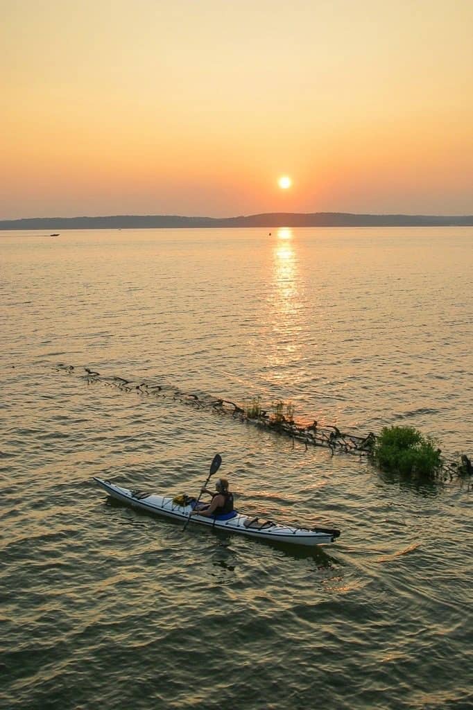
I picked another still day for my return in March, this time better prepared to paddle the area. In the meantime, I brushed up on some history. Turns out, Mallows Bay and the Patapsco are linked on this score. Both graveyards received poorly designed, barely used ships built hastily during a $1 billion U.S. Navy boondoggle after the start of World War I. While examples from this effort remain at Mallows Bay—Casmalia, Mono, Bayou Teche among others—and a few are believed to be moldering still in Curtis Bay and Curtis Creek in Baltimore, most of those put out by Baltimore shipyards joined the others who met their fate in the Burning Basin at the foot of Mallows Creek. A Baltimore local told a Baltimore Sun reporter in 1995 that construction defects were obvious once he’d compared the shipbuilding plans to his measurements of the remaining wrecks. No wonder that many saw little use before they were scrapped and burned.
Elsewhere in Mallows Bay, there are unmarked and unmapped remains dating as far back as the Revolutionary War. During the Civil War, this stretch of the Potomac shoreline was heavily fortified to face the possibility of a cross-river confederate attack. Native American artifacts dating as far back 12,000 years have been found in the area. It’s nice to have these facts in pocket while perusing the watery landscape, giving fuel to imagine how Mallows Bay’s history over time has accumulated cultural layers.
This time, I followed the self-guided tour map’s instructions, heading out to the Accomac, then turned upriver across open water toward the Georgia-built Casmalia. Rounding her, I pointed toward Grady’s Spit, a small protuberance of shoreline festooned with what the storms have brought in—Igloo coolers and deck chairs tangled up with large tree limbs. The return trip along the coastline, put me up close and personal with the wrecks. Some vessels are grouped together, such as the Three Sisters Wrecks, lined up next to one another, and the Flowerpot Wrecks, so named because of their profusions of vegetation. Others are named individually, like the SS Afraina, known to have made at least one trans-Atlantic voyage, and the SS Boone, christened by First Lady Edith Wilson before a crowd of thousands.
As I glided, I encountered a floating piece of waterlogged lumber, maybe ten feet long and eight-inches square, too heavy to for one man to pick up. It looked like old-growth timber, and probably broke loose from one of ghost fleet’s roster. It was encrusted with small mollusks and insect larvae, a reminder of how alive Mallows Bay is thanks to the wrecks. As spring arrives, the damselflies and dragonflies hatch, and the bass will rise to the occasion. The wildlife must be accustomed to the substantial engine noise emanating from Quantico’s many military fly-overs.
The entire route is a mere 2.5 miles, and any navigational confusion can be easily cleared up by heading for marked buoys, which bear numbers for corresponding points of interest on the map. It’s slow-going, so schedule about two hours to enjoy it. Just make sure to grab the map and bring it with you, and remember to leave the fancy kayak at home.


