The Maryland Transportation Authority (MDTA) is inviting the public to learn more about a study intended to identify a location for another Bay crossing.
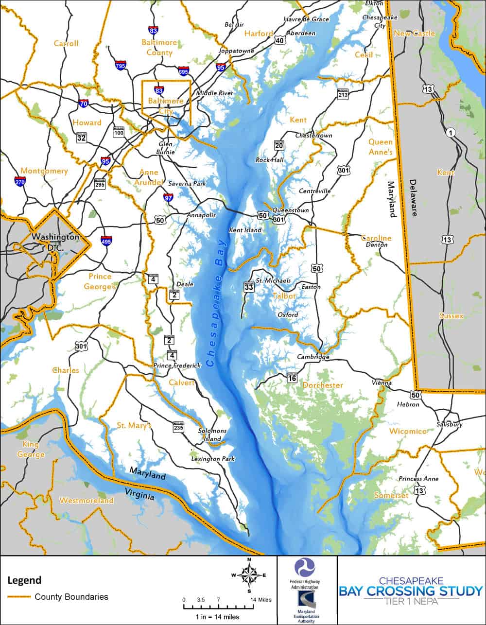
As Bay Bulletin reported in December, the purpose of the MDTA’s Chesapeake Bay Crossing Study: Tier 1 NEPA (National Environmental Policy Act) is to consider current and future traffic demand and identify the location for an alternative Chesapeake crossing that would alleviate congestion at the Bay Bridge. The study will also take into account the financial and environmental impacts of an additional bridge or tunnel.
MDTA Bay Crossing Study Map.The MDTA, which owns and operates the Chesapeake Bay Bridge, will consider the corridors throughout the Bay’s 100-mile stretch through Maryland. The study will cost $5 million and is expected to be completed in the winter of 2020.
Late last year, the MDTA invited the public to comment on the study via email, letter, or online form. To view public comments, click here.
In May, the MDTA will host a series of meetings throughout Maryland so that the public can learn more about “the project’s purpose and need; scoping activities and public comments received to date; the environmental review process; and the alternative corridor development and screening process.” The MDTA notes that the range of corridors will not be discussed at the meetings.
The meetings, each of which will provide the same information, will be held in the evenings in the following cities: May 8 in Prince Frederick; May 9 in Arnold; May 10 in Chestertown; May 16 in Middle River; May 17 in Cambridge; and May 22 in Wye Mills.
The MDTA will welcome comments at the meetings, by email or regular mail, and online.
For meeting information and materials and to learn more about the Bay Crossing Study, click here.
-Laura Boycourt


