
For the first time, Maryland scientists have given the state a grade for how well-adapted it is to climate change impacts. And with an overall grade of B-, things could be worse. But there’s room for improvement.
The University of Maryland Center for Environmental Science (UMCES) says in its assessment, “The State of Maryland is fairly well-adapted to handle continuing threats of climate change.” While some goals were already met or are close to being met, but others will require “significant investment,” the report says.
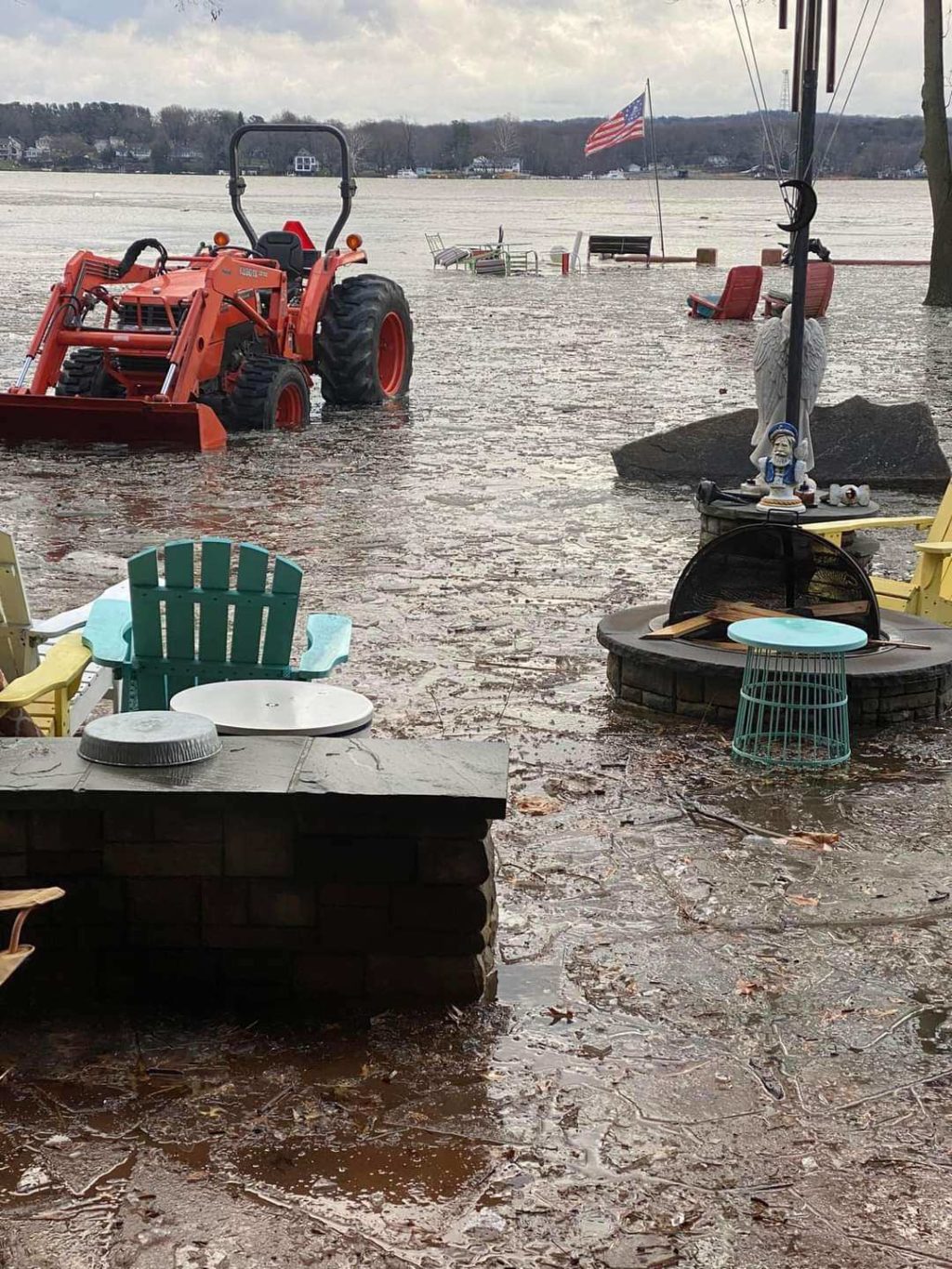
According to UMCES, 72 percent of the state’s population lives and works along its 3,000 miles of shoreline, making coastal communities especially vulnerable to climate change. As we begin to see “increasingly frequent and severe storms, hotter summers, warmer winters, sea level rise, and changes in precipitation patterns,” UMCES explains, coastal adaptation actions like shoreline protection projects and green infrastructure that prevents runoff will make our coast more resistant to these impacts.
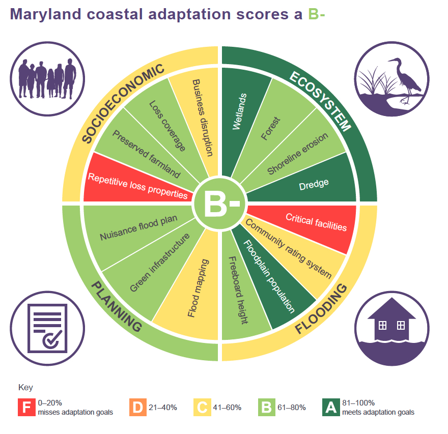
The highest marks on the new report card come in the “ecosystem” and “planning” categories with an A and B+, to include successful maintaining of wetland acreage and the use of dredged materials for restoration. And the population of people living in floodplains has been reduced, leaving fewer people at risk for coastal emergencies.
UMCES says the worst grades, two big fat Fs, come in the number of critical facilities that must remain operational in emergencies, which lie in flood hazard areas, and properties that have previously flooded but haven’t been adapted to withstand future climate events.
Researchers say building this report card underscores the importance of having useful data at hand, so the state can plan better coastal adaptation in the future. “The biggest challenge in developing the report card was finding adequate data … Filling these gaps is important to inform planning and management decisions to improve Maryland’s adaptation status,” says Science Integrator Katie May Lauman.
This first report card also allows indicators to be established as future benchmarks. Chesapeake Bay Foundation Senior Scientist Doug Myers says in a statement, “This report represents an important first step toward helping citizens and government leaders understand the significant risks we face from climate change in Maryland. Establishing indicators, collecting data about them, and evaluating them honestly is necessary as Maryland works to adapt its thousands of miles of coastline to increasing sea levels and stronger storms.”
Myers points out that the data gap researchers found point to a need for more public outreach, so ersidents can understand their flood risks. He also calls for adequate funding to actually carry out the plans state and local governments have in place.
-Meg Walburn Viviano

