New speed limit proposals are on the table following the last round of changes. Make sure you have your say!
The Maryland Department of Natural Resources (DNR) is considering new regulations affecting five bodies of water, from the Magothy and Severn rivers on the Western Shore to the Chester and Little Choptank on the Eastern Shore. DNR depends on comment from boaters actively using the waterways, so be sure to voice your opinion before the March 14 deadline. To view the full list of regulations and provide feedback, please click here.
The areas under consideration are:
GRAYS CREEK, Magothy River, Anne Arundel County
Currently, two separate 6-knot speed limit zones exist in Grays Creek and Sillery Bay. The two zones lie within close proximity, and the DNR is concerned that this creates confusion as well as wake problems. The new proposal would combine the two areas and expand the zone further into the Magothy, leading from Grays Creek to Little Island and extending out to Hickory Point. The new zone would have 6-knot speed limit in the area year-round.
YANTZ CREEK, Severn River, Anne Arundel County.
Yantz Creek already has a speed limit of 6 knots at all times, but a sandbar has formed directly on the current regulatory line. The sandbar has become a popular spot for recreation and raftups, creating a hazard for boaters operating on the waterway. The proposal would push the line roughly 700 feet further outside the mouth of the creek and create a larger boundary.
SLAUGHTER CREEK, Little Choptank River, Dorchester County.
The DNR has received complaints about unsafe boating activities in the area between the Taylors Island Bridge and Slaughter Creek Marina. One request was that the entirety of Slaughter Creek be put under speed restriction, but the DNR believes that an established 6-knot zone between the Marina and the bridge only will address the majority of concerns. The proposed changes would be in effect on weekends and holidays throughout the boating season.
QUEENSTOWN CREEK and LITTLE QUEENSTOWN CREEK, Chester River, Queen Anne’s County
The narrowness of the entrance channel to Queenstown Creek and the shallowness of the adjacent waters both pose a risk for boaters operating above 6 knots. The regulation zone would allow safer transit in an area where boaters risk running aground, and also assist in stabilizing wake on the entirety of the creek. The DNR is evaluating the size and span of the area, considering “too small of an area would have created further hazardous conditions due to the up and down motions of acceleration and deceleration in the small area.” The proposal looks to establish a 6-knot zone enforced at all times.
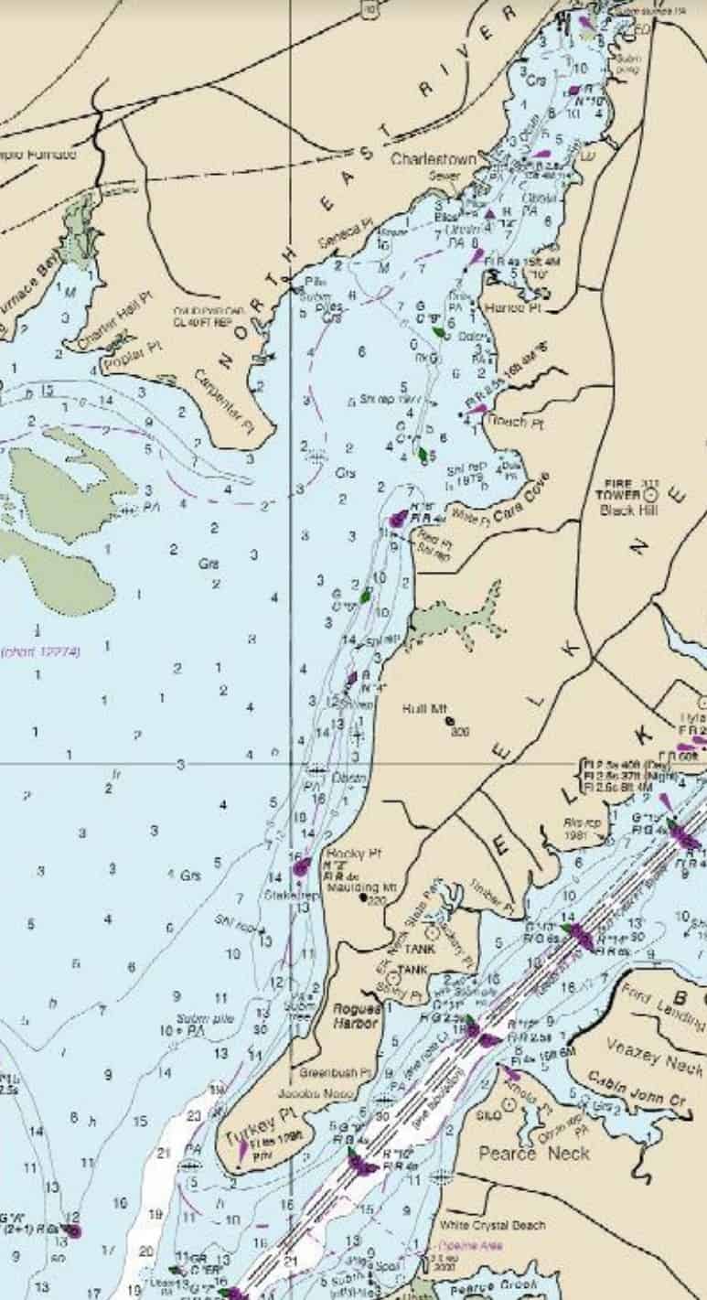
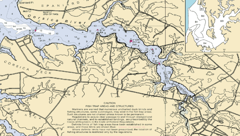
UPPER CORSICA RIVER, Chester River, Queen Anne’s County
Currently, the area surrounding the Centreville Wharf near the Route 304 bridge has no speed regulation in place. Boaters using the wharf to load and unload their vessels have reported concerns over the impact of wake coming from other boaters using the waterway. The proposed regulation zone would span between the Route 304 bridge to the split in the river, and have an enforced speed limit of 6 knots on weekends and state holidays.
The last round of speed limit changes proposed were on the South River, Mill Creek off Whitehall Bay, and the South Magothy, as Bay Bulletin reported on last September. The new regulations went into effect in November.
-Duffy Perkins