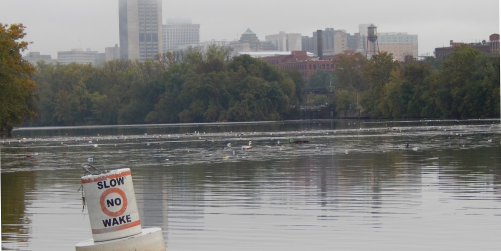
Nine years ago, Outside Magazine’s readers declared Richmond our country’s most livable river town. It was a clear sign of how far the James River’s health has come, reinforced two years ago when Our Nation’s Founding River won a prestigious international prize for restoration.
But, as usual in waterway cleanups, there is still a great deal of work to do. The James has for a century suffered from Richmond’s combined sewer overflows. They come from a late 19th/early 20th-century urban plumbing system in an older third of the city that routes both stormwater runoff and household wastewater through common underground pipes to a treatment plant. The problem comes when rain overwhelms the system’s capacity, causing overflows at 25 marked outfalls along the river. An inch over several hours is usually enough, but the system may be able to hold a longer-term, gentle rain. Yes, that means raw sewage flowing into the James, now several dozen times of year because of increased rainfall and more pavement.
The problem is hardly unique to Richmond. Most older cities’ systems along the Atlantic seaboard were planned and built this way a century ago, including Lancaster, Penn., Washington, D.C., Baltimore, and Virginia’s Alexandria and Lynchburg in addition to Richmond. All are working to rectify their situations, and they have made progress, including in Richmond a large retention basin and a recent increase in capacity at the treatment plant, but it is a horribly expensive and frustratingly slow process to rebuild the plumbing beneath an active city. Richmond is making incremental improvements, with a deadline of 2035 to eliminate all overflows.
One of the improvements is a new system to manage the overflows more efficiently through better information about where and when overflows occur. Ever watch a radar map during a summer rainstorm? Notice how cells pop up and then wither? Rainfall is often spotty, rather than coating a city, town, or county uniformly. Thus, some parts of the city receive enough to cause an overflow while others nearby do not.
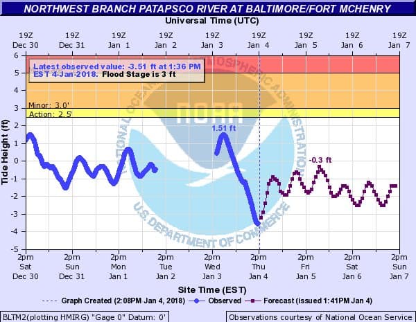
The city’s Department of Public Utilities recently released a new online mapping system to determine in real time whether and where any pipes have overflowed. The system includes dozens of rain gauges, meters to measure flow in each pipe, and level sensors to determine their capacity for more water. The system can help managers predict how likely a pipe is to overflow and how long the overflow lasts. With such information, they can manage the system more effectively by closing outfalls with capacity, creating additional storage space.
The map indicates if any of the outfall points along the James has overflowed recently, important information not only for utilities managers but also for the many local citizens who paddle, tube, fish, run, bike, and walk along the river. The city’s health department advises that people avoid direct contact with river water below an outfall for two to three days after an overflow, but water upstream of the outfall remains safe. Yes, Richmond remains a great river town, even as the city works to remedy its antiquated plumbing. The mapping system is one more tool to help James River people stay safe as we celebrate its sustained return to health.
-John Page Williams