Ever heard about the original three-dimensional, hydraulic Chesapeake Bay Model built in the early 1970s? Built of concrete over precision-cut forms, it covered the area of seven football fields inside a large steel building on Kent Island. Walking around it was a fascinating exercise in seeing how all of the waterways of the Chesapeake system flow together.
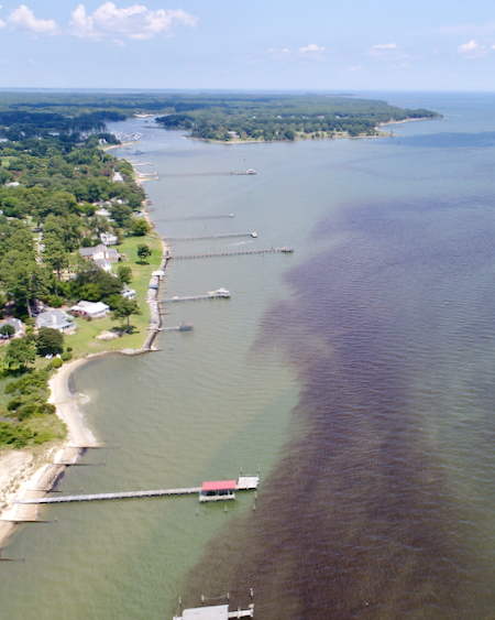
Unfortunately, it proved to be obsolete shortly after completion. One big problem was that there was no way to simulate the many effects of winds, which exercise enormous influence on how the shallow water in the Bay and its rivers “behave”. After the first Chesapeake Bay agreement in 1983 established the EPA’s Chesapeake Bay Program partnership (CBP), an early order of business was building a digital Bay model that could simulate all of the many forces that affect the health and ecological workings of the Chesapeake and its watershed.
That proved to be a huge undertaking, but almost 30 years later, evolving computer technology, increasingly sophisticated data science, and a dedicated, talented team from multiple agencies have created what is arguably the finest ecosystem model in the world. Now, though, as we draw ever nearer to the 2025 deadline established by the most recent Chesapeake Bay Watershed Agreement (2020), even that model is becoming obsolete, due especially to its limited capacity to simulate climate change.
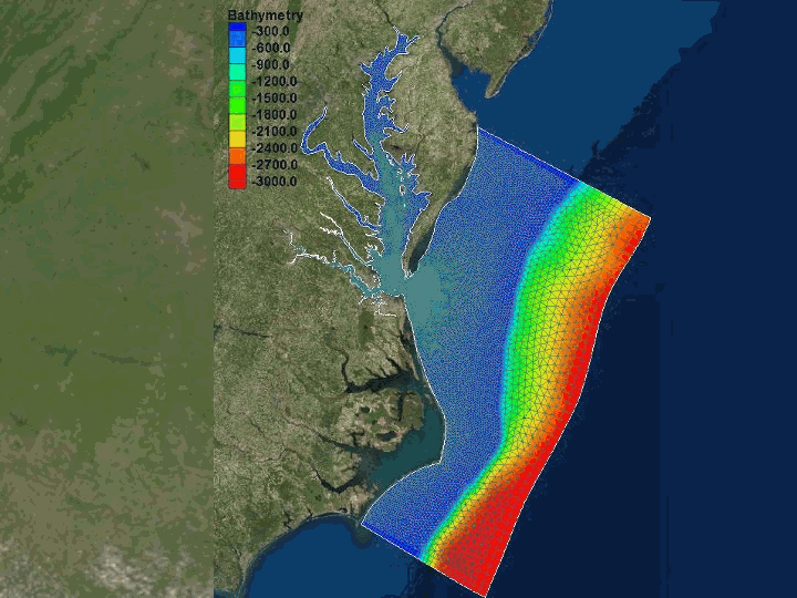
Just in time, an interdisciplinary team led by Dr. Joseph Zhang, research professor in the Center for Coastal Resources Management at the Virginia Institute of Marine Science (VIMS), has developed a new Semi-implicit Cross-scale Hydroscience Integrated System Model (SCHISM). The team has designed it to incorporate increasing climate-change impacts and help assess all Chesapeake Bay water-quality standards, two key requirements of the Bay Program’s search for a new modeling platform. The Bay Program has selected the SCHISM model as the first step in a 6-year, $1.65M cooperative agreement with VIMS, in collaboration with the many other federal, state, and tribal partners that make up the Chesapeake Bay Program, as well as the Office of Coast Survey and the Office of Water Prediction at the National Oceanic and Atmospheric Administration (NOAA).
It’s not easy for us average citizens to get our minds around how computer models can help clean up the Chesapeake. The team at the Bay Program has constantly tested the model’s predictions against actual in-the-water and on-land field monitoring data, correcting (calibrating) it accordingly to make it more accurately show the effects of river flow, weather, and human activities.
“All models are wrong, but some models are useful” is a favorite saying of Dr. Beth McGee, the Chesapeake Bay Foundation’s Director of Science and Agricultural Policy. Watch this informative five-minute Bay Program video to get more insight into the thinking around the model. Lee Lutz, the Mayor of Columbia, Pennsylvania, whose town sits on the Susquehanna River, calls the model “a guide to ask where do we want to be in the future, and how are we going to get there?” As a local official, he notes clearly that he wants to see the river cleaned up, but he also wants to make sure his citizens’ hard-earned tax dollars that go to the cleanup get spent wisely and efficiently. One of the most important functions of the Bay model is to keep that focus sharp.
We’re on the home stretch for the Chesapeake Bay Watershed Agreement, a time that calls for a final sprint to the 2025 deadline. SCHISM may help us get there and keeps us sustaining the Chesapeake’s health in the years beyond.
-John Page Williams