
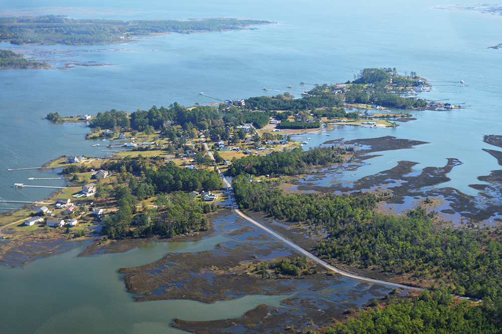
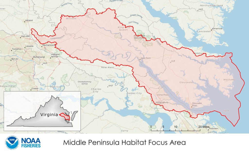
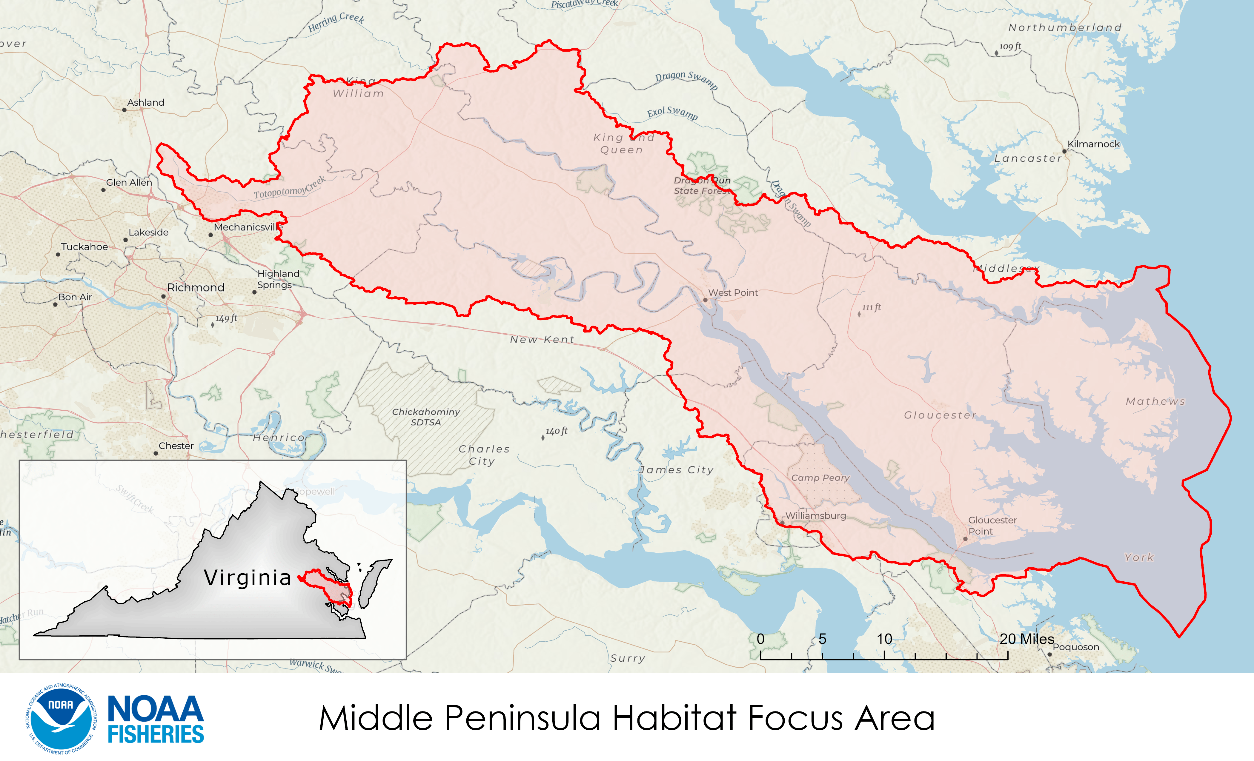
The National Oceanic and Oceanographic Administration (NOAA) recently chose Virginia‘s Middle Peninsula as its newest Habitat Focus Area, because it faces significant challenges from coastal flooding and erosion. At the same time, the Middle Peninsula also presents major opportunities to enhance habitat for fisheries.
The project has three long-term goals, to enhance fish and shellfish productivity, restore resilient shorelines, and build local capacity for restoration.
“This area provides a great opportunity to bring diverse partners together, within and outside NOAA,” Lauren Taneyhill of NOAA’s Chesapeake Bay Office tells Bay Bulletin. “NOAA and our partners know that nature-based infrastructure can help the Middle Peninsula become more economically and ecologically resilient. These projects will restore habitats for important fish and shellfish while improving the environmental and economic resilience of its rural communities.”
The lower York River and the Piankatank are two of Virginia’s targeted tributaries for oyster restoration. NOAA has worked with partners and funded their work in both, including most recently The Nature Conservancy in the Piankatank and the Shellfish Replenishment Division of Virginia’s Marine Resources Commission on the lower York, which expects to complete work on the last 150 acres there this spring.
Oysters will figure in living shoreline projects as well, set on concrete structures designed for wave attenuation (damping), backed up with marsh restoration. NOAA’s partner here is the Middle Peninsula Public Access Authority (MP-PAA), concentrating first on eroding Hog Island, at the mouth of the York, in the southeast corner of the Guinea Marshes. NOAA funded development of the design. MP-PAA will begin work in the new year, with monitoring and evaluation after construction. NOAA has also supported design of a living shoreline at the base of a bluff at the Mattaponi Indian Reservation, up in the Mattaponi River.
To build local capacity for restoration, NOAA is supporting a yearlong Morgan State University study of the socioeconomic values of Middle Peninsula oyster reefs, underwater grass meadows, and living shorelines.The study will focus on fish habitat and its value to the local fisheries economy. The Coastal Resources Management Center at the Virginia Institute of Marine Science (VIMS) with provide input.
To increase school students’ understanding of their local waterways—and their commitment to keeping those waterways healthy—NOAA’s Chesapeake Bay Watershed Education and Training Program (B-WET) has made awards to the York County School Division (three years, $150,000) and the Hanover-Caroline Soil and Water Conservation District (two years, $159,000). The grants support meaningful watershed educational experiences for students and teachers in Caroline, Essex, and Middlesex counties.
Finally, NOAA’s Habitat Focus Area will support the York and Small Basins Roundtable, under the leadership of the Chesapeake Bay National Estuarine Research Reserve at VIMS. It aims to build a long-term sustainable partnership for strategic planning, coalition building, and communications, including planning for habitat conservation and restoration, developing a regional wetlands plan, and issuing an annual State of the York Report. Stay tuned to Bay Bulletin for details as these projects develop.
-John Page Williams

