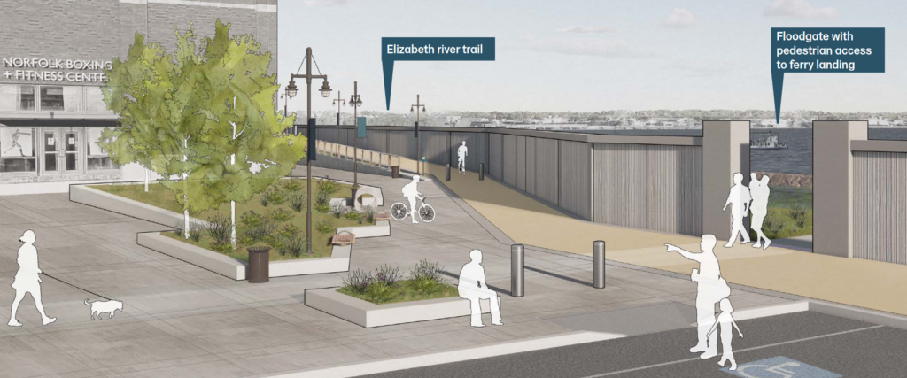
We are getting our first look at the city of Norfolk’s flood protection plan—a plan that includes a 16.5-foot-elevation wall along the waterfront at a cost of a couple of billion dollars.
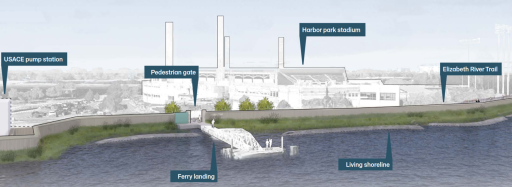
Norfolk officials released updated designs for the first section of the city’s Coastal Storm Risk Management Project. The project aims to protect Norfolk from major flooding events such as hurricanes. The new designs shows how a combination of walls and levees and floodgates will protect areas around Harbor Park and Waterside from high water. The entire project is expected to cost $2.6 billion.

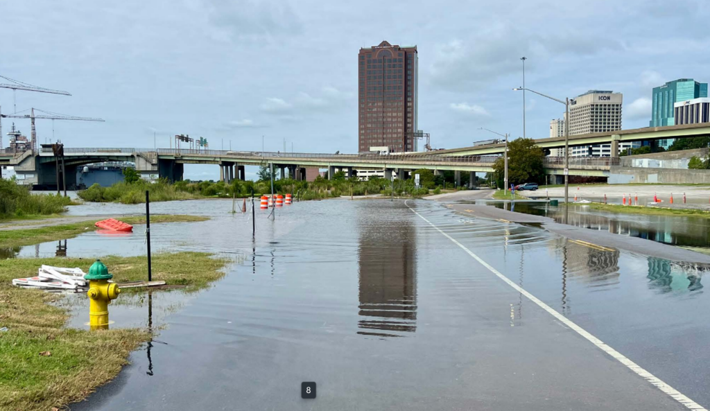
Norfolk was established along the Elizabeth River for its commerce routes. But being so close to the river put the city in the path of floods, too. According to Norfolk leaders, a hurricane in 1749 pushed waters up to 15 or 16 feet above normal. This storm, and another in 1806, created Willoughby Spit. Two hurricanes in 1933 provided enough flooding for children to swim in the downtown streets. (We don’t recommend swimming in floodwaters!) Hurricane Isabel, in 2003, brought a storm surge of about 5 feet, which was still high enough to flood large parts of the city.
Norfolk has taken the lead in preparing for coastal flooding, especially compared to other large East Coast cities like New York and Charleston, South Carolina. But designing flood protection is complicated. In addition to the engineering and cost challenges, there is the character of the waterfront itself. Businesses and people inhabit the shorelines for access to the water or to enjoy its views. Flood barriers can cut the city off from the very river that gives it life.
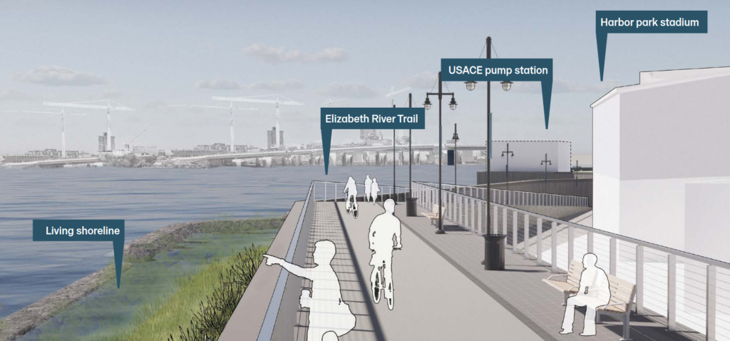
The new plan offers a variety of components to address the flooding while maintaining access and views as much as possible. It shows structures such as T-walls, Bin-walls, gates, and pump stations, along with natural components such as living shorelines and oyster restoration projects. The system is designed to be a constant 16.5 feet above mean seal level, which designers believe will protect Norfolk from a 70-year storm surge in the year 2076. Based on the varying ground elevation along the waterfront, the height of the wall itself varies from 4-7 feet to 16.5 feet above the ground.
The Elizabeth River Trail, which follows Norfolk’s shoreline downtown, will be elevated to the top of the wall in some areas, so trail visitors will still be able to enjoy the views and breezes. However, in some areas raising the trail is not practical, and there will be sections where hikers will walk along a wall that restricts their views. While some residents have complained, there may not be much choice.


According to Norfolk’s Lori Couch, “During the feasibility study that was completed in 2019, we evaluated various alternatives for the project and the floodwall for this part of the city scored the highest Benefit/Cost Ratio. For example, we evaluated a do-nothing option, a non-structural option, and a combination of both for all the watersheds in the city.”
Since the newly released designs only apply to the first phase of the project, allowances for views and access and other concerns can be considered for other parts of the project at a later date. The Army Corps of Engineers will design and construction the floodwall and will approve or modify it. Ultimately, the City of Norfolk has the final decision whether to build.
You can see the full presentation here.


