Meandering along the Chesapeake
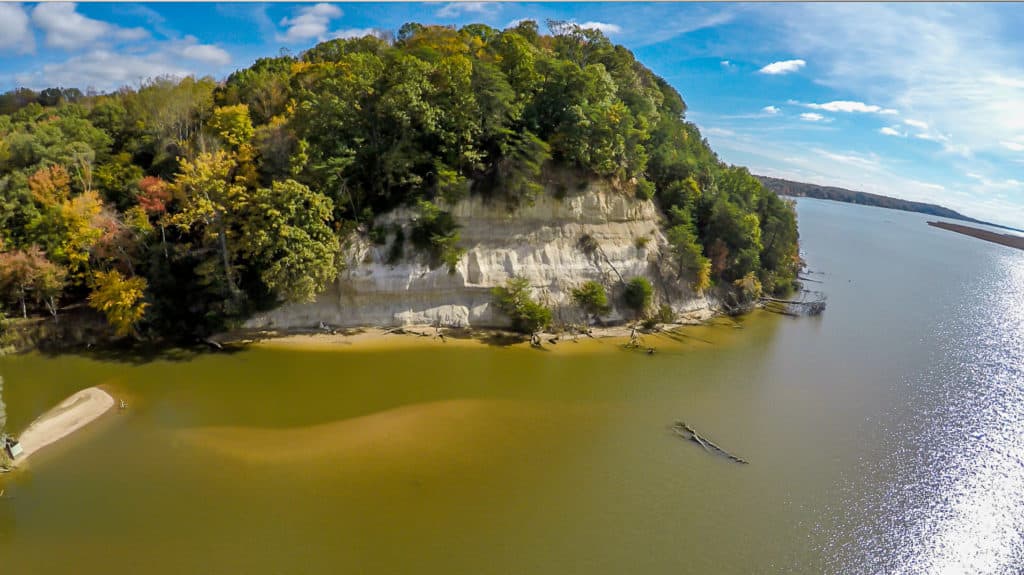
On August 18, 1608 (according to the calculations of historian Edward Wright Haile), archers of the Rappahannock Tribe began shooting at Captain John Smith and his crew aboard their discovery barge as they made their way up the river. The archers positioned themselves along the towering Fones Cliffs, a long curve in the south bank above today’s town of Tappahannock.
According to his own written account, Smith anticipated an attack somewhere along the river and had prepared the boat with shields set along its gunwales, and he steered the boat away from the cliffs toward the marsh on the inside of the curve only to find that several dozen Rappahannock warriors were hiding there to attack.
That strategy sounds like a recipe for a Rappahannock victory, but, due to the shields and the width of the river, the arrows fell harmlessly into the water while the assailants jeered at the English for fleeing. Smith and his crew stopped that evening at the friendly town of Pissaseck a few miles upriver on the outside of a curve on the north bank before continuing their exploration upstream to the head of navigation at the site of today’s Fredericksburg. He made peace with the Rappahannock on his return, and the rest, as they say, is history. You can read about the incident in Smith’s The Generall Historie of Virginia, New-England, and the Summer Isles, published in 1624.
This skirmish tells a story about how the Chesapeake’s rivers have served humans and the resources that we have depended upon for centuries. Those two looping turns in the Rappahannock are meanders, which are characteristic features of river sections flowing through gently sloping land where gravity’s inexorable force is tempered by obstructions in the river’s bed.
Water seeks the path of least resistance, so it will try to flow around any obstruction, which creates a dynamic struggle between flow and resistance from the mud, sand, gravel, rock, natural debris, and man-made structures such as wharves in the river’s bed. This dynamic tends to form repeating curves in which accelerated flow along the outside erodes the waterway’s bed and bank while the slower flow on the inside allows sediment to settle. The result tends to be deeper water and fast (solid) land on the outside of the curve, with shallow water and soggy, lowland marsh or swamp on the inside. At the next obstruction, the process repeats.
For the Native people of the Chesapeake, the meanders offered advantages for settlement. On the outsides of the curves they found good soil for growing squash, beans, and corn. Woodlands provided wild game to hunt, nuts to gather, and material to build canoes and houses. Bluffs offered vantage points where lookouts could observe river travelers, and the ravines between ridges often exposed fresh-water springs. The rivers also offered a wide range of seasonal and resident fish, while the opposing marshes and swamps attracted waterfowl furbearers, and edible wild plants. The Native people saw their rivers as uniting, not separating, the two shores. Captain Smith marked many of these towns in his map of 1612 along the outside of the river meanders on the James and Chickahominy to the Patuxent on the Western Shore and the Pocomoke and Nanticoke to the Sassafras on the Eastern Shore.
Transitions came to those meanders through the second half of the seventeenth century. It’s not entirely a pretty story. Those town sites proved useful to the English especially as the tobacco trade flourished. In the 1650s, some of the immigrants had settled around Pissaseck, and by 1678, all of the town’s Indians had moved away, not necessarily voluntarily. In that year, Edward Bray built a brick church there along with an ordinary, a ferry, and a wharf for shipping products to England. The site became Leedstown, and it still has a wharf, which serves the tour boat Captain Thomas (Chesapeake & Tangier Cruises) and the nearby Ingleside Plantation Winery. Similar stories played out up and down the Chesapeake’s rivers, and many town sites retained their native names.
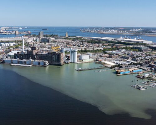
Some of those meander towns flourished as their rivers formed infrastructure for regional and international commerce. The nineteenth century brought steamboats, which provided regular service for freight and passengers connecting rural communities with urban markets such as Baltimore, Washington, Richmond, and Hampton Roads. The skill of the steamboat captains was marvelous as they negotiated the winding channels and powerful currents. Their navigation skills were only surpassed by those of the schooner, bugeye, and pungy skippers who negotiated the rivers under sail.
One of my most treasured Bay friendships was with the late Clyde Watson, a farmer, riverman, and community leader whose life spanned the twentieth century at Magruder’s Landing on the Patuxent River near Brandywine, Maryland. His father was the steamboat agent for that wharf, and Clyde worked there as a boy. Like the Native Patuxent people before him, he saw the river as the essential connection between the wharf where he moored his workboat to the marsh on the inside of the curve where he hunted, trapped, and fished. It even allowed him to court his eventual wife with that workboat where she lived at Lower Marlboro on the opposite shore.
Over centuries of flow, this dynamic system continues to cause curves to grow sharper and extend deeper into the land in water’s constant attempt to find its way to the Chesapeake. In time, the curves may grow so sharp that the necks of land between them become very narrow. Native people on the James were mystified in April of 1607 to see captains Newport and Smith and their crews struggle up the James River meanders under sail and oar when all the Indians had to do to keep up with the strangers was to walk the trail through the woods on say, Curles Neck.
Sometimes, the force of a sudden flood from a major storm will cause a river to jump a neck and cut a shortcut through the base of the meander, creating an oxbow in the channel. Shortcuts also come from industrious humans. The James has three dredged cutoffs that shorten a ship’s run to Richmond’s Intermediate Terminal. The first (Dutch Gap) was cut in 1862.
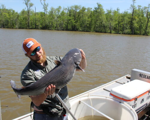
Today, Chesapeake’s river meanders provide deep channels for tugs pushing barges with everything from feed corn and soybeans to fuel-oil, sand, and gravel. The skills of the tug skippers are amazing as they negotiate tortuous bends such as the one under the Nanticoke’s Route-50 bridge at Vienna. A few watermen still work fyke and pound nets in the upper rivers for crabs, perch, and catfish. And then, there are folks like us who have developed a fondness for these meandering waterways for birding (especially great blue herons, bald eagles, ospreys, waterfowl, and prothonotary warblers), fishing (white perch, largemouth bass, crappie, catfish, and shad), hunting (waterfowl), and recreation aboard canoes, kayaks, skiffs, bass boats, and pontoon boats. Marinas are scarce in these sections of the Bay’s rivers, but Maryland and Virginia have done a good job of providing boat ramps and other access points; you guessed it— mostly on the outsides of the meanders at sites where ancient towns appear on Smith’s map.


