Little-Known Meteotsunami Strikes Upper Bay
Charter boat guide Tom Weaver was confident he’d be able to dodge the forecasted storms during his scheduled roundtrip from Annapolis to Tolchester on the afternoon of July 6. Instead, his course took him right into the path of a common but largely unknown weather phenomenon.
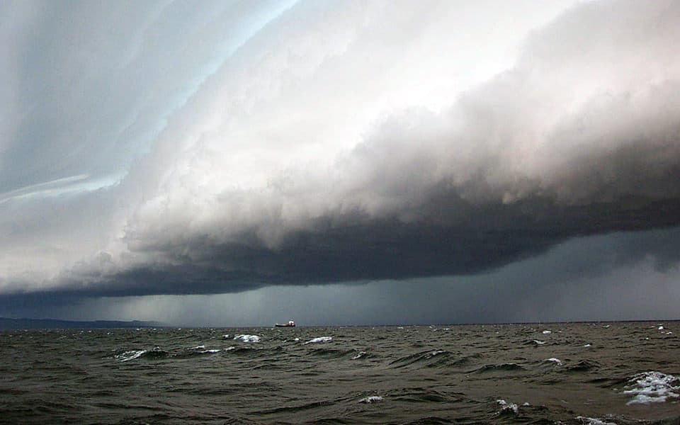
Two massive storms converged over the Chesapeake Bay, leaving Weaver and his clients trapped between them. Among them were John Chiochetti; his son, Ryan Scales; and their friend, Brian Robinson. “We just start motoring south a little bit, just to get in this lane between the two storms and we’re watching, watching, watching and then they start to merge,” Weaver recalled. “Sometimes, I can get away without even getting wet. This one just closed in on us and we didn’t have anywhere to hide.”
Though the storm to the north, near Tolchester, was the smaller of the two, the lightning there was far worse so Weaver determined it would be best to head towards Annapolis. He could see the shipping channel markers on the GPS, but he couldn’t make out the markers in the water in front of him due to the horizontal rain and blinding wind.
As the storms closed in, they were hammered with waves, starting mildly at about four feet. As they punched over the first round, Weaver and company were met with a bout of churning waves nearing 10 feet. “I’ve raced around the world, I’ve made my living as a professional sailor for the past 25 years,” Weaver said. “I mean, I’ve seen big waves, but in the Chesapeake I’ve never seen waves that size.”
Hurtling through a series of lesser waves, the four were soon out of the storm. In the end, they managed to stay clear of the storms for all but 15 to 20 minutes of their trip. “By the time we got to the Gibson Island area, the rain stopped, wind stopped, and it was kind of a pleasant ride home,” Weaver said. While no one onboard panicked, they did each note their ears popped with a sudden drop in pressure, and they felt alternating waves of warm and cold air during the storm.

Credit: NOAA
What Weaver did not know at the time was that the atmospheric conditions of that event had created a meteotsunami wave. Chesapeake Bay Media covered the phenomena the next day in Bay Bulletin, and before long it had been shared through our Facebook more than 1,500 times.
According to Gregory Dusek, senior scientist with the National Oceanic and Atmospheric Administration, this wave was about 14 and a half inches from peak to trough, which is considered a small to moderate meteotsunami. It turns out, meteotsunami events are quite frequent in the Chesapeake Bay, averaging about 25 each year. Last year, Dusek published a study detailing meteotsunami events along the East Coast ranging from 1996 to 2017. So why haven’t we heard of them before?
“The catch with that is that the vast majority of them are really small,” Dusek said “Out of those 25 per year or so, only on average about one a year is over two feet.”
Dusek described the characteristics of a meteotsunami, a form of tidal wave, as similar in frequency to seismic tsunamis. They are often caused during the warmer months of the year when fast-moving summer storms (like the one that rocked Weaver’s boat) meet a sudden drop in pressure. “When you have this fast-moving storm system, it can move at just the right speed to align itself with this wave, so you end up feeding energy into the wave over a period of time,” Dusek said.
The effects of meteotsunamis are recorded through water level gauges stationed on land. NOAA collects data from hundreds of stations, including 16 gauges throughout the Chesapeake Bay. A meteotsunami event this far north is somewhat rare; they are much more common in the southern regions of the Bay. With far less water for the wave to gain traction over, the Tolchester gauge only observed 10 events over course of Dusek’s study, while some southern Bay gauges had recorded as many as 50.
Michael Angove, tsunami program branch director for NOAA and the National Weather Service, explained that some meteotsunami waves can dissociate from the storms that formed them. Though meteotsunamis are the offspring of violent summer storms which can be destructive to the immediate area, the tidal wave itself is often harmless and inert, lumbering in to shore an hour later.
While they are often relatively small and localized compared to their seismic counterparts, some meteotsunamis have caused damage along the East Coast. A large event on June 13, 2013 was recorded on gauges from Massachusetts to North Carolina. Its waves grew to over two feet, becoming a public safety concern. When these events are detected, especially large ones, they are reported to the National Weather Service, who issue warnings. Some of the larger meteotsunami events can also trigger deep-water sensors designed to pick up seismic tsunami activity, providing researchers with further data on a given wave.
Though you may not have heard of them, they are common occurrences in coastal areas and rarely a threat in the Chesapeake. “You won’t sense the wave the way the weather and rain is sensed when you’re out in it,” Angove said.
People should remain aware of the possibility of hazardous meteotsunamis without living in fear of them, said Angove. “No one wants to go around screaming ‘Tsunami!’ and ‘Run for the hills!”


