by Gary Reich
Despite avialable warning and accurate forecasting, Bay boaters were caught off guard by major weather events at least three times last winter—some with deadly effect. We talk to a pro to find out what happened and to learn how to be more weather-aware on the water.
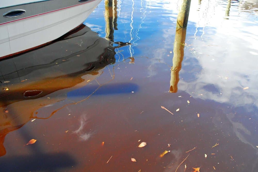
ANDREW COLEIt was unusually mild and tranquil in mid-December as a fleet of Laser sailboats scattered across the Severn River for an afternoon of frostbite racing from the Severn Sailing Association (SSA). It felt more like late April than winter as thermometers ashore approached 70 degrees. A shifty, five-knot, east wind made maneuvering the small boats a challenge.
Around 2:15 p.m., a shelf of swirled, angry clouds bore down on the fleet from the northwest. Stuck in the proverbial calm before the storm, the small sailboats were sitting ducks. Within minutes, a wall of 30-knot winds with 50-knot gusts flattened every boat in the fleet, tossing 22 people into the water. Eleven sailors were able to right their boats and make it to shore. The others were rescued and brought ashore by the Annapolis Fire Department, United States Coast Guard, and race committee boats.
Sounds like a freak, unusual weather anomaly, right?
About a month earlier, three men lost their lives on the tidal Potomac River in a similar weather event, and in late February a comparable blast of howling winds claimed another man’s life on the Patuxent River. All three events have at least one thing in common—gale-force winds were forecast at least 24 hours in advance by the National Weather Service (NWS).
So, what went wrong? How can events like these happen in today’s seemingly complete smartphone connectedness? To find out, I visited the NWSin Sterling, Va. and interviewed a chief meteorologist. I also spoke with people who were on the ground during at least one of the events. And, I got some key information on how we can avoid getting in trouble out on the water.
Weather Nerd Heaven
Forecaster Bryan Jackson was wrapping up after a midnight shift when I met him at the NWS Baltimore/Washington headquarters. A weather nerd’s dream, the NWS office stands in a shadow cast by the center’s towering weather radar. Inside, meteorologists huddled around banks of huge flat-screen monitors, keeping an eye on developing weather around the region. Jackson has been with the NWS for 10 years, and for three years, he has led the Baltimore/Washington Marine Program.
Earlier that day, Jackson held a conference with the Marine Users Committee, a panel made up of leaders from boating organizations from around the 14 NWS Baltimore/Washington zones, which includes the USCG Auxiliary, U.S. Power Squadron, Severn Sailing Association (SSA), and Chesapeake Area Professional Captains Association. The focus of the conference was to dissect NWS’s forecast and performance leading up to the aforementioned weather incidents of November 19, December 18 and February 25, which NWS describes as “sudden-onset events.” The group would also discuss how to better alert the boating public about these weather phenomena.
Data Mining
Jackson started with a slide that recounted the weather specifics of those three days:
“On November 19, a boat with four anglers aboard capsized in the Potomac River when a sudden-onset event with winds of 34 to 38 knots occurred. One angler was able to survive by clinging to the overturned vessel overnight while the other three anglers perished,” Jackson said. “On December 18 there were multiple water rescues when 34- to 40-knot winds capsized 22 sailboats off of SSA in Annapolis. Everyone survived, but half the fleet had to be rescued by local emergency agencies. Lastly, on February 25, a lone boater on the Patuxent river died when his 16-foot skiff capsized during a frontal passage that contained 35- to 40-knot winds, with higher gusts.”
Next, Jackson drilled down through each event and showed slides of the forecasts the NWS issued for those dates. “If you look at each event, gale warnings were posted at least 24 hours in advance for all three. In the case of the SSA event, the possibility of gale-force winds had been a part of the weather discussion up to five days before the event,” Jackson says. “For the November 19 event on the Potomac, we issued a gale warning at 3:29 a.m. the day before. A gale warning was issued at 2:29 a.m. on December 17, the day before the SSA event. And on February 25, a similar scenario on the Patuxent River, a gale warning was issued at 2:42 a.m. on February 24.”
Gale warnings were issued and Marine Weather Statements were published, yet people still went out on the water.
Possible Reasons
Jackson has a hypothesis or two about why folks went out on the water despite gale warnings being in effect. “The weather conditions before each of these events were pleasant and relatively benign. It’s easy enough to hypothesize that the enjoyable weather lured folks out onto the water and gave a false sense of security. The events also occurred on weekends. If people have no other days to get out on the water than on the weekend, and the weather is nice, there’s a perceived pressure to make the most of that day versus postponing a trip for an entire week. This mindset is particularly acute in the sailing community around Annapolis. Each sailing group is only allowed one day or night on the water to accommodate every group in the area, so if they cancel a regatta or race they’re off the water for another week.”
While it’s easy enough to point the blame at the folks on the water, there was a tool the NWS had in its box that wasn’t deployed on the days with sudden-onset events—a Special Marine Warning (SMW). When an SMW is issued, the NWS system essentially throws everything and the kitchen sink at notifying mariners on the water. “That’s when you’ll hear those tones on NOAA Weather Radio,” Jackson says. “That’s when we’ll broadcast a warning for a very specific area that can be picked up on marine VHF radios.” Jackson tells me SMWs were not issued for these events because they didn’t match the NWS criteria. He also allowed that the NWS is changing this policy partly as a reaction to this winter’s gust fronts. “Going forward we will issue an SMW when a gale warning is in effect and a short-duration wind event with 48-knot or higher gusts will occur,” Jackson says. “Additionally, if the gale will have a sudden onset—meaning winds will go from calm to gale force in less than 15 minutes—we will issue an SMW, and folks tuned into NOAA Weather Radio will get that alert. Our goal is to provide 45 minutes of advance warning.”
There are factors other than the lack of an SMW to consider. An interesting phenomenon that caught the SSA race committee off guard on December 18 was the fact that the front did not show up well on radar. “It wasn’t very impressive looking on radar, as you might expect with a front like that,” Jackson said. “Only when you look at radar velocity, which isn’t commonly available to mariners, could you see the intensity of what was bearing down on them. You can’t always rely on radar to predict these types of events.”
Kim Couranz, SSA’s commodore, echoes Jackson’s comments. “We knew that bad weather was forecast and we were keeping an eye on it. Unfortunately, it wasn’t evident from the radar that the types of winds the fleet encountered were coming. Also, we didn’t receive any warning over NOAA marine weather radio, which we religiously monitor. Lastly, it was almost dead calm before the winds came. The Lasers had virtually no chance to sail to safety before they were slammed by the winds.”
Tools for Boaters
I asked Jackson why there’s no official NOAA weather app. “We’re not permitted to develop products that might compete with the private sector. Private entities can tap into our data—it’s free—but we can’t make our own app.”
“The best thing you can do is check the NWS marine forecast (www.weather.gov/lwx/marine) before you head out, and keep your VHF radio on when you’re out on the water,” Jackson says. “That way you get any alerts and are up to speed on what sort of weather is expected for your area. It’s also not a bad idea to have a smartphone or connected tablet with you so you can keep an eye on the radar and get special alerts, especially if it’s a day when severe weather is forecast. If you’re looking for a quick link to get to our marine weather forecasts, you can do a Google search for CWF LWX to go straight to area marine weather forecasts.”
Experts from the USCG Auxiliary and U.S. Power Squadrons asked me to remind readers that it’s easy to be complacent when you’re enjoying yourself. Anglers are especially prone to losing touch with what’s happening on the horizon. One panel member says, “Check your forecast, keep your weather radio on, and keep a constant watch when bad weather is forecast. Use all the tools at your disposal including your eyes, your ears, weather radio, and any weather apps you may have at your disposal. It’s easy and it can save your life.”
Suggested Marine Weather Apps
Most weather apps don’t relay Special Marine Warnings, although we found a few worth trying.
WINDY: NOAA Wind Forecast Map (Android, iOS; Free)
Overlays wind, temperature, pressure and tide information on an interactive map. Provides access to interactive wind forecast maps.
MyRadar (Android, iOS; Free)
Comprehensive weather radar app with severe weather warning, wind and satellite overlays.
Dark Sky (Android, iOS; Free)
A popular and comprehensive general weather app that provides radar imagery, precipitation forecasts with time of onset estimates, and an overall weather forecast.
Weather Underground, AccuWeather, The Weather Channel
(Android, iOS; Free)
Well-liked, general-purpose weather apps that have everything you might expect: radar and satellite imagery, detailed forecasts, and links to marine weather forecasts.
Storm Shield (Android, iOS; $2.99)
Provides weather radar with severe weather overlays, local forecasts and links to NWS forecasts. Most notably, this is one of the few apps we could find that actively pushes Special Marine Warning and Marine Weather Statements to your smartphone or tablet.
NOAA Weather Radio (Android, iOS; $2.99)
Allows users to tune into NOAA weather radio stations around the country. App provides access to Special Marine Warnings and other severe weather alerts.
NOAA Smart Buoys (Android, iOS; Free)
Accesses live data from 10 Chesapeake Bay Interpretive Buoy System buoys. Buoys provide data such as wind strength and direction, air and water temperatures. App provides links to latest NWS marine forecasts.
FishWeather (Android,iOS; Free)
Provides current wind direction and strengths via interactive map with radar overlays. Includes wind forecast maps and access to NWS marine forecasts. Special Marine Warning and Marine Weather Statement alerts available with $3.99 per month in-app subscription.
Gary Reich is a Chesapeake Bay-based freelance writer and photojournalist, living in Annapolis. He is an avid birdwatcher, angler, oyster connoisseur and self-affirmed weather nerd.