With Baltimore’s Key Bridge collapse still fresh in our minds (the green highway signs directing drivers to the Key Bridge have finally been covered up), it’s clear how large a toll an infrastructure disaster can take on a busy port city like Baltimore.
The U.S. Army Corps of Engineers (USACE) released a three-year study this month warning of flood risks at the entrances to Baltimore’s two tunnels, and the thought of more threats to the city’s remaining transportation arteries is alarming.
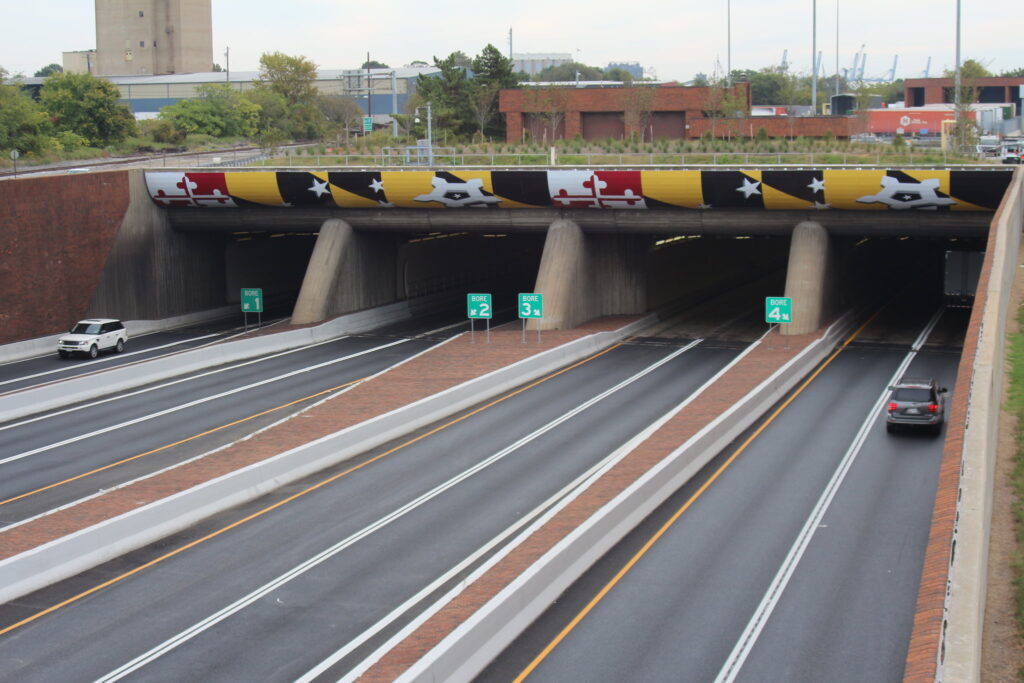
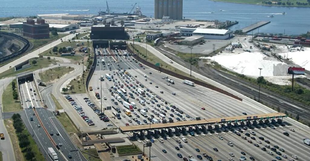
The Baltimore Coastal Storm Risk Management Study recommends about $77 million in structural floodwalls to protect the entrances to the I-95 and I-895 tunnels along with their associated facilities.
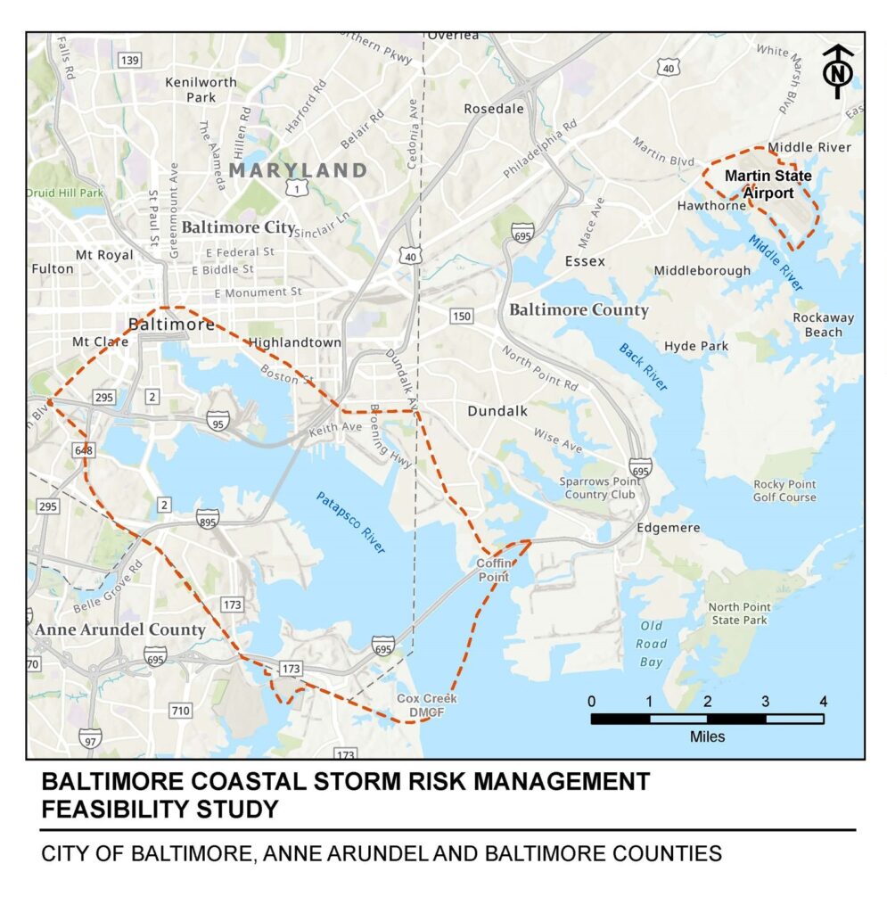
The three-year, $3 million study was cost-shared between USACE’s Baltimore District and the Maryland Department of Transportation. It looked at needs and potential solutions for several key locations in Baltimore’s coastal area. The area it zeroed in on is indicated within the red dotted line on the map below:
This study is a spin-off from a broader one completed in January 2015 that was commissioned by Congress as part of the response to Hurricane Sandy recovery. The Baltimore metropolitan region was one of nine high-risk areas it identified as needing more analysis.
The project to protect the tunnels would include about 9,500 feet of fixed floodwalls along the southern approach tunnel entrances and ventilation buildings. The floodwalls would tie to higher ground, USACE says, reducing flood risk in the tunnels to a 1 percent probability. In other words, it would take a 100-year flood to possibly send floodwaters into the tunnels.
“The Fort McHenry Tunnel is used by approximately 45 million vehicles per year and the Baltimore Harbor Tunnel sees nearly 27 million vehicles per year,” said Joe Bieberich, USACE Baltimore District Coastal Storm Risk Management Study Project Manager. “It is very important to make sure these critical transportation routes remain open during a coastal storm event, maintaining access to jobs, commercial transportation routes and emergency services.”
Baltimore is no stranger to flooding, as drivers who have parked a car at the foot of certain Fells Point streets during coastal flood events can attest. Between 1971 and 2011, seven flood-related disasters prompted Presidential disaster declarations in the Baltimore metro region. Within the city, yearly damage due to coastal flooding is estimated at $2.2 million.
“The people of Baltimore know all too well the impact caused when vital transportation infrastructure is lost. This project would improve the resiliency of the tunnels, which are critical routes for the transportation of goods and services in the state of Maryland and along the Eastern seaboard,” said Spellmon.
The study team also looked at port terminals, highways, evacuation routes, hospitals, public utilities and airport facilities that may be susceptible to flooding. They focused on areas of flat or low-lying elevation and streams and rivers in the Chesapeake Bay drainage area.
The Maryland Transportation Authority (MDTA) will work with USACE to design the floodwall solution later this year. If the project receives Congressional Authorization and funds, construction would begin in 2027.
You can read the full report can be found on the Baltimore District website at nab.usace.army.mil/missions/civil-works/baltimore-coastal-study/.