We live in a world dominated by documenting our lives for social media, so why not use our phone cameras to document nature, too? That’s the thinking behind a new scientific program.
21st-century life tends to distance us from observing the details of seasonal changes around us—from water temperature and plant metabolism to migrations of fish, crabs, birds, and wildlife. Sure, we notice fall colors on trees and put on a fleece when the first October cold fronts come through. However, details like the late-July blooming of wild rice and other seed-bearing marsh plants evades most of us, as do the first waves of bobolinks, sora rails, and blue-winged teal that stop off in migration around Labor Day to feed on marsh riches.
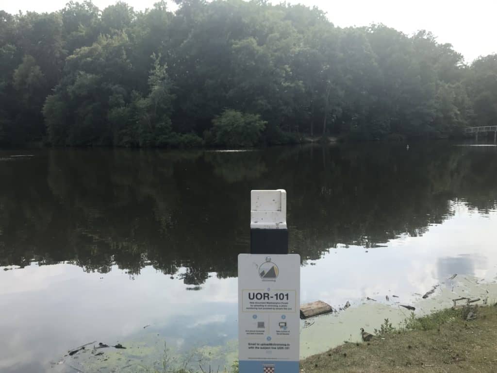
Now, with our climate changing, scientists want to document when seasonal events like these occur, to get better data on the specifics of the changes. Better data, though, means lots of data needed over long periods of time. Now comes Chronolog, a web-based system for recording change with photographs you, as a citizen scientist, take yourself. Just place your smartphone on one of the rigid brackets installed at one of two dozen stations around the Bay. Then email the images to Chronolog, along with the name of the specific station and bracket. The company stitches the images for that station together into a visual log that records changes over time.
Chronolog says its mission is twofold: “First, to engage people with nature in an interactive new way. Second, to keep a record of change for scientific use. By making environmental conservation a collaborative activity, people become interested in participating and compelled by the findings. There are no limits to where you can put a chronolog or what you can monitor. You choose what story to tell.” Examples include restoration projects, water levels, invasive and native species, storm recovery, and education. Any person or organization can install a Chronolog for a cost of $200 per year.
So who offers Chronologs around the Chesapeake? A look on the company’s website turned up a couple of dozen sites nearby, sponsored by county and state parks, the Shenandoah National Park, the Blackwater National Wildlife Refuge, and the Chesapeake Bay National Estuarine Research Reserve in Virginia. The latter’s site, numbered CBV-101, is anchored at the York River State Park’s beautiful overlook of Taskinas Creek. Another longtime favorite is PRP-101, looking downstream over Maryland’s Mattaponi Creek from the bridge between the Patuxent River Park and the state’s Merkle Wildlife Sanctuary. The Blackwater NWR observation platform site, BWR-101, is particularly interesting because it helps to document sea level change and marsh loss in that critical site. Close to home for this correspondent are three sites at the University of Richmond along Westhampton Lake (UOR-101) and the Gambles Mill Eco-Corridor restored floodplain (UOR-102, UOR-103) that carries the lake’s outflow to Little Westham Creek and the James River.
Check Chronolog’s map to find a site near you and start contributing to its log. It’s providing valuable observations, and now you have a good excuse for a visit.
-John Page Williams


