By Tom Hale
One late August years ago and nearing the end of a week’s cruise, we departed Oxford, Md., aboard our Tartan 30, Sunday’s Child, heading for a mooring in Annapolis. We could already taste the crabcakes at Buddy’s. As we left we realized that we would exit Knapps Narrows at dead low water. Sunday’s Child drew 5 feet. Not wanting to chance running aground on the shoals off Tilghman Island, we opted for the longer route around the tip of Blackwalnut Point.
We had a moderate northwesterly breeze, and by the time we cleared the point it would be low tide. We figured that with the tide coming in, a favorable current would push us northward, and it would be a one-tack beat to Annapolis. When we hit Blackwalnut Point about a half-hour shy of dead low, we weren’t surprised to see that there was still a slight ebb current as we flopped over onto port tack and headed for Poplar Island. We assumed the current would soon go slack and then start to push us on our way north.
An hour later we were still up against more than half a knot of current. Even after two hours it had dropped only to half a knot. For a 5-knot boat like ours, there’s a big difference in speed over ground (SOG) between bucking half a knot of current and carrying it. Instead of making 5.5 knots we were only making 4.5 knots. To make matters worse, the wind was dropping, slowing us down even more. Disappointed, we headed for the Rhode River. Buddy’s crabcakes would have to wait.
A tide table is handy if you want to know the depth of water in an anchorage. For planning a cruise, though, it’s more important to know when to expect slack water and a favorable current. In most coastal locations, the current turns at the change of the tide. On the Bay, not so much. As we discovered on that August afternoon, often the current is still ebbing long after the tide tables indicate low water. Now, why is that?

Tide has two components, the most obvious being its vertical movement: how much it rises and falls. The movement up is caused by the moon’s gravitational pull as the ocean’s surface passes below it. On the opposite side of the earth where the gravitational force is less, inertia from the earth’s spin causes the water to bulge outward. These tidal bulges are about two and a half feet high in the open oceans. They represent our two daily high tides.
As the earth turns, these high tide “bulges” move westward across the sea at 900 knots or 1,040 miles per hour. This adds a horizontal component. The bulge translates into a 2.5-foot wave (very low amplitude) and a 5,000-mile wave length (very long). In a low amplitude wave the water molecules only move up and down; although the wave is moving laterally across the ocean’s surface the water molecules remain in the same place. (Imagine dropping a small stone in the water next to a floating stick; the resulting surface ripples pass under the stick, lifting and dropping the stick but they don’t move it sideways. The same follows for a ship at sea. The tidal bulge raises and lowers the ship but doesn’t change its speed.)
As this wave reaches the continental shelf its velocity slows dramatically. The shape and depth of the shoreline significantly influences the height of the tide at any given point. In the bight of Georgia the wave is concentrated, resulting in 8-foot tides; on other shorelines the tide height could be less than a foot. In this context, “tide” refers only to the height of the water. There is high tide and low tide; the change of the tide only refers to whether the water level is rising or falling.
“Current” is the horizontal movement of the water. When we speak of a flood tide we are really talking about current flowing into the Bay and should say “flood current.” Ebb current is when the water is flowing out of the Bay.
As the ocean bulge reaches the continental shelf, friction in the shallow water begins to slow it down. Looking at a tide chart of the Chesapeake, you will see that when it is high tide at the mouth of the Bay, it is low tide near Solomons and high tide near Baltimore. The tidal crest moves up the Bay on a six-hour cycle, the continuation of the ocean’s low amplitude wave now slowed to 15 miles an hour.
If you leave Hampton Roads at mean low tide and head up the Bay at 5 knots, the high tide crest will eventually catch up with you. The tide is just starting to rise as you head north. Six hours later back at Hampton Roads the water will start to fall—down there, at Hampton Roads. But, remember that the tide crest has been moving north too. If you were cruising at 5 knots for six hours, you would have traveled 30 miles up the Bay. Meanwhile the tide wave was moving north at 15 miles an hour, so being 30 miles up the Bay, you would still have two more hours of rising tide; essentially you are in the six-hour rising tidal cycle for a total of eight hours.
When you head south on the Bay the opposite happens, and the tide cycle appears to be shorter. If you leave Solomons at low tide heading south at 5 miles an hour, you will be headed towards the incoming tide crest and will only experience four hours of rising water before the water starts falling again. This is important to understand as it also explains how the currents on the Bay will affect your boat.

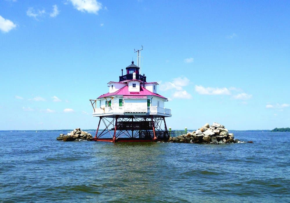
The vertical tidal period at any location on the Bay is approximately six hours up and six hours down. The horizontal current period is far less predictable, because more river water is continually flowing downstream into the Bay’s main stem than the ocean tide is pushing up the Bay. At any place on the Bay, Thomas Point for example, there is a time when the water has been flooding up the Bay and it goes slack. We call this “flood slack.” It then starts to go the other way and the current ebbs. Three hours after flood slack, the ebbing current reaches its “maximum ebb” and the current slows for the next three hours until it goes slack at the time of “ebb slack.”
Here on the Chesapeake Bay currents change direction a few hours after high tide and low. Slack current does not occur at high and low tide, but three hours after the vertical maximum and minimum. In other words, at the low tide end of the cycle even as the water level is rising, the current is still ebbing, and vice versa.
On the opposite page are the NOAA tide (top) and current (bottom) charts at Thomas Point. The graph at the top shows low water (measured in feet) at approximately 2 a.m. At the same time, the current graph on the bottom shows current ebbing at a little more than 1 knot (the negative speed indicates the reverse direction). Note that the dark horizontal midline on the current graph shows 0 speed, when the current is slack. Slack current (where the time line crosses the 0 speed line) is at 5:30 a.m., more than three hours after low water, when the tidal height has already begun to rise by nearly half a foot. While a casual glance at the two graphs would lead you to think they are synchronized, they are really telling you that the peak currents occur at the time of highest and lowest water, just when you might expect the current to be least.
What is going on?
The water flowing out of the Chesapeake Bay on the ebb meets the ocean between the two Capes. When the ocean is at low tide at the Capes, the water flows out of the Bay at maximum current. As the tidal height in the ocean begins to increase, it acts like a slowly rising dam, causing the Bay’s ebb current to slow down. When the water level in the Bay and at the ocean “dam” are the same elevation, the current goes slack. This is at mid-tide, about three hours after low water. The ocean water level (the dam) continues to rise for another three hours. When the ocean height at the Virginia Capes exceeds that of the Bay, the current floods into the Bay. The maximum flood current into the Bay occurs when the tide is highest at the Virginia capes. Even as the water level in the ocean begins to recede (the dam begins to lower), the ocean is still higher than the Bay so the Bay currents continue to flood and the water level continues to rise in the Bay for another three hours.
If you leave Hampton Roads at “ebb slack” (not mean low water as in the previous example) and you head up the Bay at 5 knots, the time of maximum flood current will eventually catch up with you. The current was starting to accelerate as you headed north. Six hours later it will be slack current back at Hampton Road again, but you’ll still be riding the current north. If you were cruising at
5 knots for six hours, you would have traveled 30 miles up the Bay. Meanwhile the point of “maximum flood” current was moving north at 15 miles an hour, so being 30 miles up the Bay, you would still have two more hours of flood tide; you’ll manage to ride the six-hour flood current cycle for a total of eight hours.
Any time you are moving up the Bay you want to time your passage so you can carry the current with you longer. Unfortunately on that late August afternoon as I rounded the tip of Blackwalnut Point, I was headed into the ebb current portion of the cycle, which was also moving up the Bay at 15 knots with its current running against me. Now I understand why.
Oceanographers will tell you that while it’s possible to predict the time of high and low water with precision, accurately predicting currents is far more difficult. On the Chesapeake, it’s nearly impossible. After a big rainy nor’easter, for example, the tides could be running a foot and a half above normal. The front will pass, the wind will shift, the pressure will build and the water will drop. It is not at all unusual for this to cause an ebb current that runs for more than 18 hours as the Bay drains all that excess water. High tide may only slow it down rather than completely reverse it.
There are other idiosyncrasies related to Bay currents. For instance in the lower Bay the flood tide starts earlier and runs stronger along the Eastern Shore, which may be due to the Coriolis Effect. Currents in the major rivers behave similarly to the main stem of the Bay, but in the mid-Bay region near the mouth of the Potomac the currents are hard to predict. As a general rule if you enter the Potomac at the start of the flood, you will carry a favorable current upstream for more than six hours.
Understanding the basics of the tidal currents on the Bay, you can study the local effects in your own cruising ground. Knowing what to expect and how to use the information on the charts will allow you to go further on a cruise (and use less fuel getting there), and will help you know whether or not to make dinner reservations.
Special thanks to Kim Couranz, Chesapeake Bay Office of NOAA, and Dr. Richard Hale, PhD, Old Dominion University Department of Ocean, Earth & Atmospheric Sciences.


