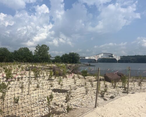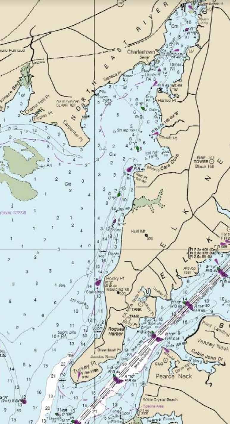
The U.S. Coast Guard has just finished permanently removing several Aids to Navigation on the North East and Elk rivers because the agency says shoaling makes the markers misleading and difficult to maintain. But marinas and other business owners say having no markers at all leaves them high and dry.
As of August 26, the Coast Guard has discontinued six markers, converted five from floating to fixed markers, and relocated two.
PAC Seth Johnson tells Bay Bulletin, “by removing the aids, we no longer endorse the waterway as safe passage. To put it another way, the aids could mislead a mariner into thinking the area was safe to pass through, but in reality we would be endorsing their transit, one that could cause damage or harm to themselves or their vessel.”
Johnson also says the shoaling makes the markers too difficult to maintain. He explains that the Coast Guard needs at least six feet of water depth for its workers and boats, and for the sinker, chain and buoy to function properly.
But Capt. Craig Desimone, who pilots the North East River daily, says removing markers isn’t a good solution. “There’s no guidance at all now for boaters to navigate the water. Without any channel markers, there’s more likelihood of a boater to run aground or boaters to hit objects that have been submerged in the northern part of the river.”
Desimone says there are a lot of submerged logs that aren’t always noticeable during high tide. Tom Brittingham, owner of Lee’s Marina, agrees. He thinks a marker-less waterway is especially dangerous for boaters who visit the river infrequently.
“If you don’t know the river like a lot of the bass fishers, it’s a hazard. Right now, there’s three big trees that have washed down. If you have the marker, it gives you a better feeling of knowing where deeper water is,” says Brittingham.
The Coast Guard proposed changes to the Aids to Navigation last winter, and a public comment period opened in March. They tell us the only comment they received was from a member of the U.S. Power Squadron, a non-profit boating education group, supporting the changes. But other local boaters say they were never aware of the opportunity for public comment, timed as the COVID-19 pandemic hit.
Matthew Trainer, co-owner of Anchor Marina, says that with the Aids to Navigation gone, the closest marker is now down at Charlestown Marina, about 1/2 mile away.
Trainer believes that the North East River should be a priority for federal maintenance, as it is the closest access to the Bay for Pennsylvania, New Jersey, and Delaware boaters.
Trainer says, “I just feel like they have abandoned the upper part of this river and shedded the responsibility of maintaining the river for such projects as dredging. The river is in current need of dredging.”
The Coast Guard says it did consult the U.S. Army Corps of Engineers about the possibility of dredging this section of river to remedy the shoaling before removing the markers, but the Corps determined they were unable to dredge there.
Capt. Desimone is taking matters into his own hands. He plans to apply to put in private, USCG-sanctioned buoys to re-mark the channel. He just created a GoFundMe page to raise money for the five buoys he wants to replace, which he believes will cost about $500 per buoy.
Johnson says private aids must be permitted within federal guidelines, maintained by the permit-holder and USCG verifies them every one, three, or five years after.
-Meg Walburn Viviano & Cheryl Costello