Day 4 & 5—Washington Channel
Story and photos by Jody Argo Schroath
At first light, it is the job of some metaphysical employee to hit the pause button, and for a few minutes—maybe half an hour—the wind holds its breath, darkness melts away and the familiar world reestablishes itself before getting on with business. This is the best time in the world to be out on the water. This is why watermen would rather be watermen than kings or orthodontists.
I’m out on the water too. It’s first light on a late September day, and I’m on the fourth day of a Potomac cruise aboard my 36-foot cat Moment of Zen, in the company of Ship’s Dogs Nos. 1 and 2. I have spent the first two nights at anchorages, one at the top of the St. Marys River and the other in Wades Bay, before stopping at National Harbor, especially to see the new MGM Grand Casino. That was the subject of part one of this story. In part two, my last stop heading north will be Washington D.C., where I’m hoping to get a first look at The Wharf, the huge new development that is reshaping the Southwest waterfront. I say I hoping because I don’t yet know how much I’ll be able to see since the Wharf’s grand opening is still a couple of weeks away. But there is always plenty to do there anyway, so I’m not worried. After Washington,
I’ll come down the Virginia side of the Potomac, stopping at Colonial Beach to see how the former Stanford Marine Railway is doing, and then make a final anchorage somewhere I haven’t decided on yet. The Potomac is so full of great places to visit, it’s hard to choose only a few, so I’m pointing out a few extra stops along the way in case your Potomac cruise is longer. I sure hope so!
I’ve also spent the last few days preoccupied with staying out in front of the remnants of Hurricane Maria, which has come up from ravaging Puerto Rico to harry the coast of North Carolina and up the southern Bay as far as the lower Potomac. There are gale warnings on the river today as far as Indian Head, with small craft warnings filling in the rest up to DC.
But at the moment I’m skimming across the still water like cold butter on a hot skillet, retracing the channel out of Smoots Bay and into the Potomac. I look down mechanically to check the instruments and am stunned to see the depth suddenly drop from 6 feet to 1 foot beneath my keel.
“What the . . . ?!” I say, reaching up quickly to throttle back to neutral. I look at the Garmin chartplotter. It says I should have 8 to 9 feet under me. The Navionics chart on my iPad at the helm says the same.
“Here’s a lesson, Navigator Trainee,” I say to No. 2 Ship’s Dog Sammy, who is watching for alligators. “It doesn’t matter how many charts say you’ve got water under you, if you stop moving you’ve run aground.”
We haven’t actually grounded yet, so I slip into reverse and cautiously back out the way we came. It seems to take forever for the depth to start coming back, but finally it does and I slip into neutral again to see where I went wrong.
I see at once that in my preoccupation with the pleasures of sliding through still water, I have skipped the last three markers, a bone-headed mistake. Happily, the bottom here is the consistency of space dust, so I’ve gotten off scot free. Chastened, I wind through the remaining markers and return to the Potomac channel.
I am out in the middle of the river when a Delta flight into National Airport roars by not very far overhead. Then the wind picks up and ruffles the picture-perfect reflections. Traffic crawls across the Woodrow Wilson Bridge. The pause in the day’s occupations is over.
I follow the channel across the river, where it passes under the Woodrow Wilson Bridge very near the Virginia shore. This is the location of Alexandria’s Jones Point Park and the Jones Point Lighthouse, which was built in 1855 and is really a little one-story house with a bright light on top. On the seawall nearby is the old survey stone that marks the southern boundary of the District of Columbia. As laid out by George Washington, its boundary included the city of Alexandria, but in 1847, that land was retroceded to Virginia and the line was reset at the high-water mark, though that in itself has changed plenty over the years.
Coming up a narrowing river has a special charm, and coming up the Potomac to D.C. is especially exciting because there is a lot going on. For example, at the same time I am passing Reagan National Airport on the Virginia side, on the Maryland side I am passing the Anacostia Flats, site of the Army’s old Bolling Field and the Navy’s old Air Station Anacostia, now combined into Joint Base Anacostia Bolling. Both date to the earliest days of aviation and have long and interesting histories of their own.
But my favorite spot here, which I pass now, is the wholly unremarkable looking Giesboro Point, now part of the Anacostia Bolling base. It began its colonial life, unsurprisingly, as a tobacco plantation. During the Civil War, it became the Union Army’s principal staging area for its cavalry, processing more than 200,000 horses over the course of the war with roughly 20,000 in residence at any one time, producing 500 aromatic tons of manure a day. It has also been a summer resort and the site of a large steel mill. I’ll bet you didn’t know that.
Giesboro Point also marks the junction of the Potomac and Anacostia rivers and Washington Channel. Here, I stay to starboard of the junction marker and look for the Anacostia first markers, “1” and “2”. Immediately afterward, I leave a second junction marker to starboard and head up the Washington Channel. To port, I pass Hains Point, which marks the southern end of East Potomac Park, an artificial island that includes the Jefferson Memorial.
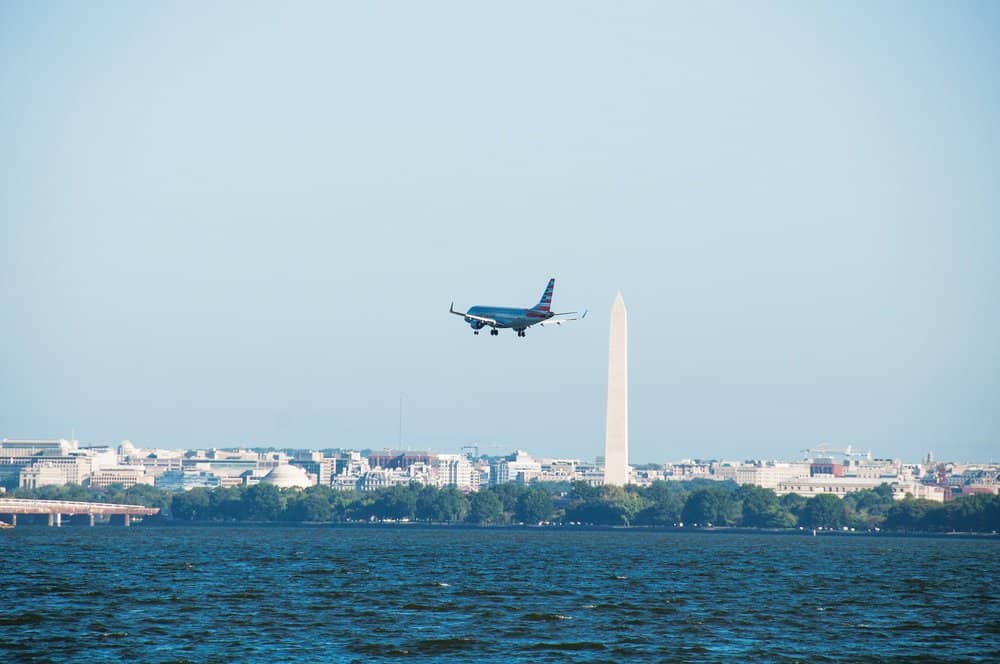
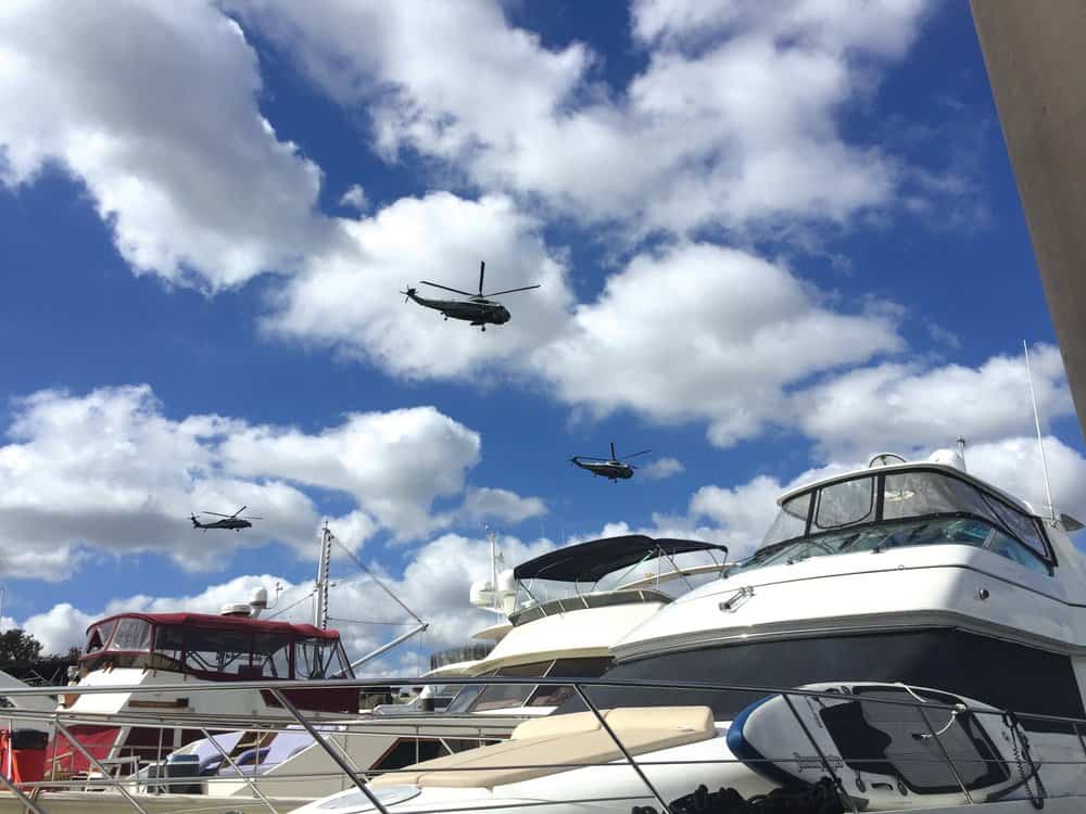
Working my way up Washington Channel, I dodge first a tour boat and then a paddleboarder, followed by four small sailboats, as one military helicopter after another roars by overhead. I am so busy dodging traffic and looking at the Washington Monument, which dominates the skyline, that I almost forget to watch for the new buildings of The Wharf. Just before I reach Gangplank Marina’s new long transient dock, I catch a glimpse, but they are hidden before I get a good look, out of view beyond Gangplank and Capital Yacht Club’s piers and boats.
An hour later, all tied up and walking Sammy and Bindi, I try again to get a good look at the new Wharf. I’m stymied again. Everything is behind chain-link fences. There are piles of construction material everywhere, and the sound of cranes and hammering nearly succeeds in drowning out the helicopters. I can’t make heads or tailsof it, so I pick my way back through the construction and head back to the boat. But just before I reach it, I stop to buy a big juicy barbecue sandwich from King’s irresistibly aromatic stand at the edge of one of the old, slightly desolate little parks behind the marina. I sure hope Kings survives the change. The next day, I walk over to the National Mall and wander through the Sackler Museum, returning by way of the Tidal Basin and Jefferson Memorial. Yes, always lots to do here.
Now I don’t want to leave without giving you a little idea of the Wharf. About two weeks after its grand opening, I return by car, in company with a couple of friends and relatives. We have a fine time, and I am immediately impressed with the access it gives people to the Southwest waterfront that they’ve never had before. We do have a hard time finding anywhere to eat because almost none of the 20-some restaurants in the works is open yet. When they do open (and some have by now) they will feature local rock-star chefs like Mike Isabella’s Requin and Fabio Trabocchi’s Del Mar. Rappahannock Oyster Company will have a new restaurant at the thoroughly wonderful Maine Street Fish Market.
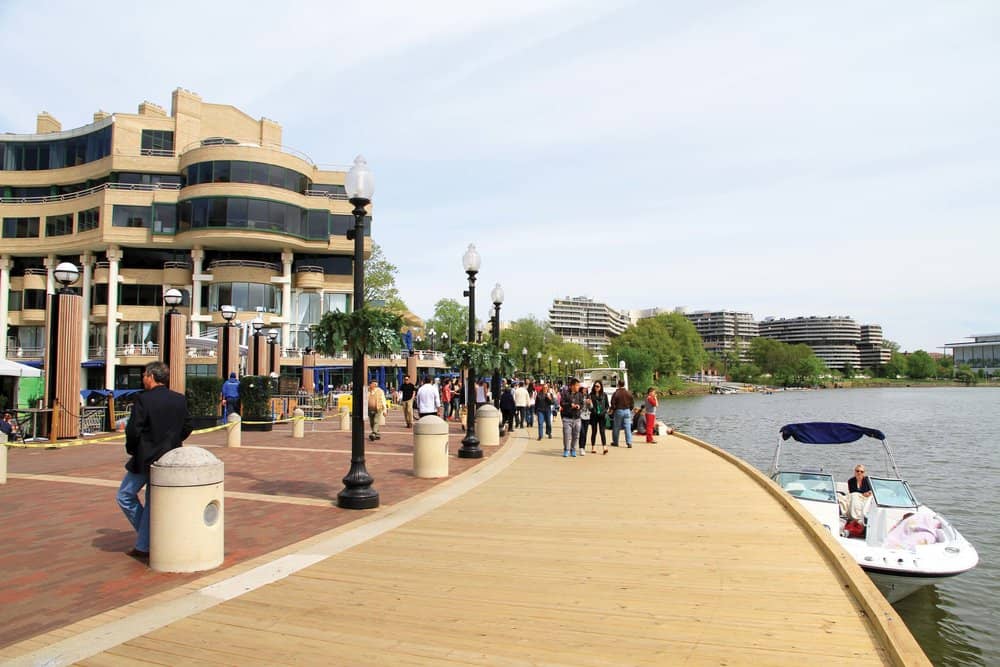
First, there is not a chain-linked fence in sight. I don’t know where they were hiding all this stuff when I was there, but wow! It’s a beautiful Sunday, and, in the company of about half the population of Washington, we stroll down the broad walk that runs between the water and the restaurants, shops, lots of other stuff and Anthem, a 6,000-seat concert hall. Foo-Fighters headlined the grand opening there.
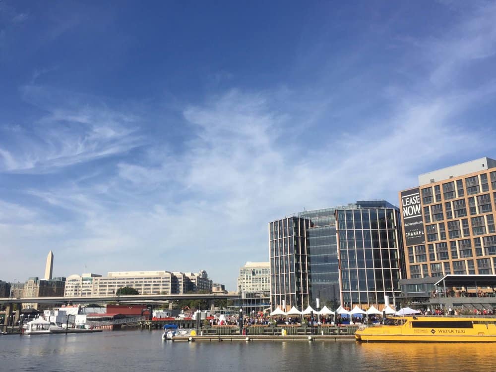
Then we walk out on the top tier of the pier that juts far out into the Washington Channel. Along the pier, people are playing giant-sized games like Battleship, taking pictures of themselves and each other in front of the water, and generally having a fine time. Below us on the lower deck of the pier, other people are renting watercraft of various kinds, taking little yellow water taxis across to East Potomac Park and also having a fine time.
Day 6 & 7—Colonial Beach
Sigh, it’s time to start home. Early the next morning, I begin my trip back downriver. The wind has let up and the gale warnings for the lower river have come down, though the small craft warnings for the river south of Indian Head remain. But I make good progress and late that afternoon, as I make the final bend past Tobacco River, I put up the sails and coast under the Harry W. Nice bridge.
It is nearly dark when I reach Colonial Beach, my destination for the night. I drop the sails off Gum Bar Point and turn up Monroe Bay, passing Colonial Beach Yacht Center then head for the northern shore where the channel runs just off the docks. Ten minutes later, I’m tied down nice and tidy at Boatyard Marina.
Boathouse Marina is the former Stanford Marine Railway, where, for more years than you can comfortably count, Clarence Stanford built, repaired and generally looked after what seemed like half the boats on this part of the Potomac. Stanford died in 2006. Clarence’s widow Mary Virginia operated the yard until 2013 when she sold it to Bill Bowman of Richmond.
Unlike a lot of great old boatyards, this one fell into good hands. Bowman, who has thousands of miles and hours of boating experience, knows what makes a good marina—good facilities and good customer service. He has fixed up the docks, dressed up the facilities and is on-hand to help boaters when they come in.
I tidy up the boat for the evening, then amble down to the office in the old ship’s store where I sit and chat a bit with Bowman. He spends part of the week at the marina, living on his 50-some foot Burger and the rest at his home in Richmond, where he operates a construction company. He is also a dedicated boat collector. How many boats does he have? Maybe 75 right now, he thinks, and shows me a couple of small antique racers in the workshop. He also invites me to the weekly potluck, but I inadvertently sleep through it when I sit down after giving the dogs their evening walk.
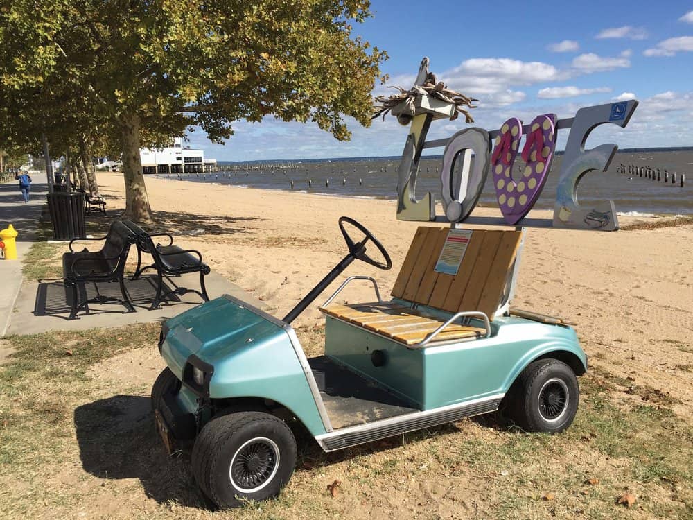
Colonial Beach is a great place for walking, built as it is on a peninsula and laid out in an easy-to-use grid pattern. So north and south, you can pretty much see from Potomac River to Monroe Bay. East and west, you can wander from Gum Bar Point to the highway. Most of the homes are cottages, lovingly but simply tended, built from the 1920s to the 1970s. It has become a popular place for people to retire.
When I walk over to Denson’s Grocery the next day for lunch, Rocky Denson is there to greet everyone, asking after one man’s family and another’s business. He knows them all and they know him. Denson’s is a nice story. Rocky’s family operated Denson’s Grocery in Colonial Beach for many years, but it closed years ago as most of them did with the advent of supermarkets. A few years ago, Rocky came back to Colonial Beach and opened Denson’s Grocery, which serves fresh local food and oysters. And Denson is a busy as can be.
Day 8: Cornfield Harbor
Early the next morning, the Potomac is as still as a watercolor, so I pull in the lines and head out Monroe Bay and onto the Potomac. I have only one more night before I make the trek back up the Bay to Annapolis. Where shall it be? I consider Nomini Bay, remembering a lovely night there behind Sharks Tooth Island. Or the Yeocomico River. I know a nearly perfect anchorage in a deep cove just beyond Kinsale. Finally, I settle on the Coan, the last river on the Virginia side, and consider the possibilities. I’ve anchored on the main branch and also at the top of Kingscote Creek. The leaves Glebe. Yes, just the ticket, I decide, and settle back to enjoy the ride.
I arrive at the entrance to the Coan in early afternoon. There is a soft breeze, and the sun is warm without heat. I start up the Glebe and around the first bend come to a large bay. I sound it out and find plenty of water. Very nice. But no, I decide. Instead, I go to the top of the river, which makes a final dogleg before shallowing out. Yes, there are one or two places here as well that would make good anchorages. Still, I can’t get myself to drop the anchor.
Finally, I understand the problem: I’m thinking of positioning myself for tomorrow’s trip up the Bay, which I’d like to do in one hop. Mentally,
I’ve already left the Potomac. So, I recheck the night’s forecast: Five knots from the north. Okay, I know where I’m headed.
I come out of the Glebe then out of the Coan and make a beeline across the Potomac. I am going to drop anchor in Cornfield Harbor. I’ve passed the anchorage as many times as I’ve been in and out of the Potomac and as many times have thought, “That would make the ideal quick anchorage in the right weather.”
Cornfield Harbor is a small indentation in the shoreline behind Point Lookout at the Maryland mouth of the river, and over the centuries it has doubtless served as a passable haven for vessels from galleys to day-sailors. It’s not a good anchorage, but it’s convenient.
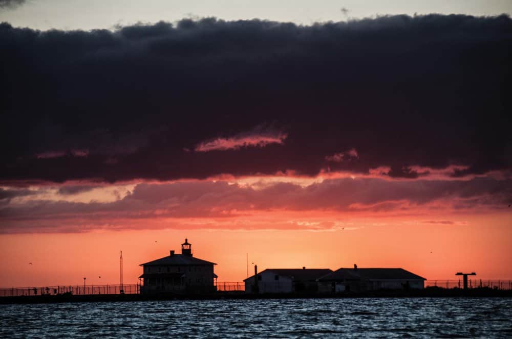
The project starts just fine. I sound an area of six to eight feet, well off the beach, but in the lee of the night’s predicted north breeze. The anchor catches at once, and I let out a good bit of scope. The river is like a mill pond. The sunset is dazzling.
“Ah, this is going to be great,” I tell the Ship’s Dogs and settle down for the night.
Almost immediately, the predicted light north wind springs up out of the south and immediately pipes up to 10 knots. Great, now we have a lee shore. Soon after, the ebb gets down to business and produces a smart cross chop. About midnight, the predicted light north wind from the south rises to 15 knots. At 3 o’clock, the flood tide clocks in and sets up a cross chop in the other direction. Zen bounces.
Zen rolls. Zen sails restlessly at her anchor. Who can sleep? An hour before first light, even before I make coffee, I pull up the anchor and leave
the Potomac.
Day 9: Up the Bay, a short summing up
“All in all, it was a very fine cruise,” I tell the navigator trainee a bit sleepily as I watch the sun rise out of the Eastern Shore. We’re off Point No Point Light and I’ve made coffee by now, so I feel I can begin to think deeper thoughts.
No, it was not at all the cruise I meant to make. But then it never is. Even if you manage to keep to your itinerary, the weather, the company, the sea conditions, the people you meet and the things you do are never the same as they were in your head.
Allain de Botton in his book The Art of Travel tells of a fictional 19th century Frenchman the Duc des Esseintes, who was obsessed with
the idea of travel and foreign places, but never left his house. The trip, he believed, could never live up to his expectation of it.
I had meant to make a long, meandering trip up on the Potomac, but I ended up with a quick week, chased by weather and obligations. Yet, unlike the Duc, I wouldn’t trade any of those days or any of those stops, even the last one. My feeling about that one is that if you survive it, it wasn’t that bad at all, and you end up with better story.
So, here’s my final Cruise note:
Colonial Beach is full of stories like this, I just don’t have time here to tell them. It would be a better idea to come and hear them for yourself. It also has not one but two very good Vietnamese/French restaurants. You may be sure that’s a good story too.
Cruising Editor Jody Argo Schroath, with the help and not infrequent hindrance of ship’s dogs Bindi and Sammy, goes up and down Bay’s rivers and creeks in search of adventure and good stories.

